State Line, Vigo County, Indiana facts for kids
Quick facts for kids
State Line
|
|
|---|---|

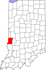
Vigo County's location in Indiana
|
|
| Country | United States |
| State | Indiana |
| County | Vigo |
| Township | Sugar Creek |
| Elevation | 561 ft (171 m) |
| Time zone | UTC-5 (Eastern (EST)) |
| • Summer (DST) | UTC-4 (EDT) |
| ZIP code |
47885
|
| Area code(s) | 812, 930 |
| GNIS feature ID | 444087 |
State Line is a small, quiet community in Vigo County, Indiana. It's not a city or a town with its own government. Instead, it's known as an "unincorporated community." This means it's a group of homes and businesses that are part of a larger area, like a township, rather than having its own separate rules. State Line gets its name because it's very close to the border between Indiana and Illinois. It's also part of the bigger Terre Haute metropolitan area, which is a region around the city of Terre Haute.
Contents
Discovering State Line
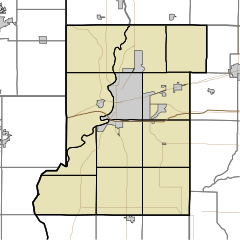
State Line is a unique place in western Sugar Creek Township. It's a community that doesn't have its own official city government or mayor. Instead, it's managed by the county or township it's located within. This is why it's called an "unincorporated community."
Why the Name "State Line"?
The name "State Line" is quite simple to understand! This community is named for its location right next to the border, or "state line," between Indiana and Illinois. Imagine living so close to another state that you could easily walk or bike across the border! This makes State Line a special place, sitting right on the edge of two different states.
Where is State Line Located?
State Line is found in the western part of Vigo County, Indiana. It sits at a specific spot on the map, which scientists and geographers describe using coordinates. These coordinates are like an address for a place on Earth. State Line is located at 39°26′13″N 87°31′46″W / 39.43694°N 87.52944°W. This means it's 39 degrees, 26 minutes, and 13 seconds north of the equator, and 87 degrees, 31 minutes, and 46 seconds west of the Prime Meridian.
The community is also at an elevation of about 561 feet (which is about 171 meters) above sea level. This tells us how high up it is compared to the ocean.
Part of a Bigger Area
Even though State Line is a small community, it's connected to a larger region. It's considered part of the Terre Haute metropolitan area. A "metropolitan area" is a big region that includes a main city (like Terre Haute) and all the smaller towns and communities around it that are closely linked. People in State Line might work, shop, or go to school in Terre Haute, making it an important hub for the community.
 | William Lucy |
 | Charles Hayes |
 | Cleveland Robinson |


