Steffenville, Missouri facts for kids
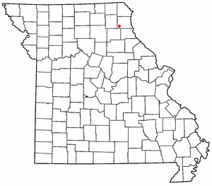
Steffenville is a small, unincorporated community located in the southwestern part of Lewis County, Missouri, in the United States. An unincorporated community means it's a place where people live, but it doesn't have its own local government like a city or town. It's found along Missouri Supplemental Route D, about 22 miles southwest of a town called Canton. Steffenville is also part of the larger Quincy, Illinois–Missouri area, which is a group of towns and cities that are connected economically.
The community of Steffenville got its start in 1872 when a post office was opened there. This post office served the area for many years, finally closing down in 1988. The name "Steffenville" comes from Henry Steffens, who was one of the first settlers in the area. His family originally owned the land where the community was built.
Understanding Steffenville's Weather
Steffenville experiences a type of weather known as a humid subtropical climate. This means it has hot, humid summers and mild winters. On climate maps, this kind of weather is often shown as "Cfa."
The weather in Steffenville can have some big ups and downs! The hottest temperature ever recorded there was a scorching 115 °F (46.1 °C) degrees on July 15, 1936. On the other hand, the coldest day ever was February 13, 1905, when the temperature dropped to a freezing −28 °F (−33.3 °C) degrees.
| Climate data for Steffenville, Missouri, 1991–2020 normals, extremes 1897–present | |||||||||||||
|---|---|---|---|---|---|---|---|---|---|---|---|---|---|
| Month | Jan | Feb | Mar | Apr | May | Jun | Jul | Aug | Sep | Oct | Nov | Dec | Year |
| Record high °F (°C) | 74 (23) |
80 (27) |
90 (32) |
94 (34) |
102 (39) |
107 (42) |
115 (46) |
113 (45) |
109 (43) |
98 (37) |
85 (29) |
74 (23) |
115 (46) |
| Mean maximum °F (°C) | 58.2 (14.6) |
64.3 (17.9) |
75.3 (24.1) |
82.7 (28.2) |
87.7 (30.9) |
92.4 (33.6) |
96.1 (35.6) |
96.1 (35.6) |
91.8 (33.2) |
84.9 (29.4) |
72.0 (22.2) |
61.9 (16.6) |
97.9 (36.6) |
| Mean daily maximum °F (°C) | 34.5 (1.4) |
39.5 (4.2) |
52.1 (11.2) |
64.1 (17.8) |
73.2 (22.9) |
81.9 (27.7) |
85.7 (29.8) |
84.3 (29.1) |
77.7 (25.4) |
65.6 (18.7) |
50.9 (10.5) |
38.6 (3.7) |
62.3 (16.9) |
| Daily mean °F (°C) | 26.1 (−3.3) |
30.5 (−0.8) |
41.8 (5.4) |
53.0 (11.7) |
63.0 (17.2) |
72.1 (22.3) |
75.6 (24.2) |
73.9 (23.3) |
66.3 (19.1) |
54.9 (12.7) |
41.8 (5.4) |
30.9 (−0.6) |
52.5 (11.4) |
| Mean daily minimum °F (°C) | 17.8 (−7.9) |
21.5 (−5.8) |
31.5 (−0.3) |
42.0 (5.6) |
52.8 (11.6) |
62.2 (16.8) |
65.5 (18.6) |
63.5 (17.5) |
55.0 (12.8) |
44.1 (6.7) |
32.6 (0.3) |
23.3 (−4.8) |
42.7 (5.9) |
| Mean minimum °F (°C) | −4.1 (−20.1) |
0.8 (−17.3) |
11.5 (−11.4) |
26.2 (−3.2) |
38.1 (3.4) |
50.7 (10.4) |
55.9 (13.3) |
53.9 (12.2) |
39.8 (4.3) |
27.8 (−2.3) |
15.6 (−9.1) |
2.9 (−16.2) |
−7.8 (−22.1) |
| Record low °F (°C) | −24 (−31) |
−28 (−33) |
−11 (−24) |
5 (−15) |
26 (−3) |
38 (3) |
42 (6) |
38 (3) |
24 (−4) |
7 (−14) |
−10 (−23) |
−26 (−32) |
−28 (−33) |
| Average precipitation inches (mm) | 1.70 (43) |
1.85 (47) |
2.49 (63) |
4.01 (102) |
5.06 (129) |
4.84 (123) |
3.98 (101) |
3.88 (99) |
3.73 (95) |
3.41 (87) |
2.61 (66) |
1.91 (49) |
39.47 (1,004) |
| Average snowfall inches (cm) | 5.8 (15) |
4.1 (10) |
2.1 (5.3) |
0.7 (1.8) |
0.0 (0.0) |
0.0 (0.0) |
0.0 (0.0) |
0.0 (0.0) |
0.0 (0.0) |
0.1 (0.25) |
1.0 (2.5) |
4.0 (10) |
17.8 (44.85) |
| Average precipitation days (≥ 0.01 in) | 6.6 | 6.6 | 8.0 | 10.7 | 11.5 | 9.9 | 9.0 | 8.3 | 6.6 | 7.7 | 6.9 | 6.9 | 98.7 |
| Average snowy days (≥ 0.1 in) | 3.9 | 3.0 | 1.5 | 0.4 | 0.0 | 0.0 | 0.0 | 0.0 | 0.0 | 0.1 | 0.6 | 2.9 | 12.4 |
| Source 1: NOAA | |||||||||||||
| Source 2: National Weather Service | |||||||||||||
 | Selma Burke |
 | Pauline Powell Burns |
 | Frederick J. Brown |
 | Robert Blackburn |


