Steinhatchee River facts for kids
The Steinhatchee River is a short river located in the Big Bend area of Florida in the United States. It starts in a swamp called Mallory Swamp, which is just south of Mayo in Lafayette County. From there, the river flows for about 34.5 miles (55.5 km).
As it flows, the Steinhatchee River forms the border between Dixie County and Taylor County. Finally, it empties into the Gulf of Mexico. The river collects water from a large area of about 586 square miles (1,518 sq km). In the past, this river was also known by other names like Hittenhatchee, Esteenhatchee, and Isteenhatchee.
Contents
Where is the Steinhatchee River?
The Steinhatchee River is found in the northern part of Florida. It begins in a swampy area and flows west towards the coast.
The only towns located right along the river are Steinhatchee and Jena. Both of these small communities are near where the river meets the Gulf of Mexico.
What Makes the River Special?
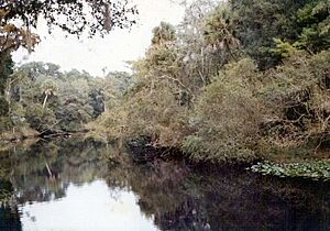
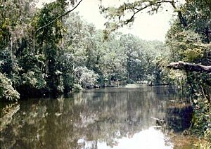
The Steinhatchee River is quite unique because it is mostly undeveloped. This means there aren't many buildings or big changes made by people along its banks.
River Activities
People mainly use the river for fun activities like boating and fishing. It's also an important place for local fishing boats. These boats bring in fresh seafood caught nearby. Some of the fish and crabs caught here include sheepshead, mullet, grouper, Spanish mackerel, and blue crab.
Underground River Section
One very interesting fact about the Steinhatchee River is that part of it flows underground! For about 1 mile (1.6 km), the river disappears below the surface. This happens near where U.S. Route 19 crosses the river.
Steinhatchee Falls
About 8 miles (13 km) from the river's mouth, you can find Steinhatchee Falls. This is a spot where the river drops several feet, creating a small waterfall. It's a popular place for people to visit and enjoy nature.
 | Anna J. Cooper |
 | Mary McLeod Bethune |
 | Lillie Mae Bradford |


