Stewart, Ohio facts for kids
Quick facts for kids
Stewart, Ohio
|
|
|---|---|

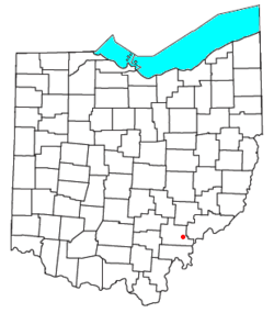
Location of Stewart, Ohio
|
|
| Country | United States |
| State | Ohio |
| County | Athens |
| Elevation | 673 ft (205 m) |
| Population
(2020)
|
|
| • Total | 221 |
| Time zone | UTC-5 (Eastern (EST)) |
| • Summer (DST) | UTC-4 (EDT) |
| ZIP code |
45778
|
| Area code(s) | 740 |
| GNIS feature ID | 2628972 |
Stewart is a small community in Athens County, Ohio, United States. It's known as a census-designated place, which means it's a special area the government counts for population. In 2020, about 221 people lived here. Stewart also has its own post office with the ZIP code 45778.
A Look Back: Stewart's History
Stewart began in 1875. It was planned out when a railroad line reached this area. The community got its name from D. B. Stewart. He was the person who originally owned the land where the town was built. Interestingly, Stewart had a post office even before the town was officially started, opening in 1874.
Where is Stewart?
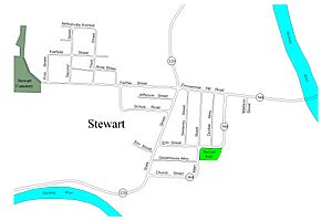
Stewart is found right next to the Hocking River. It's a little bit upstream from where Federal Creek flows into the Hocking River. You can find Stewart where two state roads meet: Route 144 and Route 329.
Want to Learn More?
- You can also read about Stewart, Ohio, in Spanish!
 Stewart (Ohio) para niños
 | Roy Wilkins |
 | John Lewis |
 | Linda Carol Brown |


