
Stockwell, Indiana facts for kids
Quick facts for kids
Stockwell, Indiana
|
|
|---|---|

The corner of Orchard and Monroe.
|
|

Location of Stockwell in Tippecanoe County, Indiana.
|
|
| Country | United States |
| State | Indiana |
| County | Tippecanoe County |
| Township | Lauramie Township |
| Founded | 1859 |
| Area | |
| • Total | 2.47 sq mi (6.40 km2) |
| • Land | 2.47 sq mi (6.40 km2) |
| Elevation | 771 ft (235 m) |
| Population
(2020)
|
|
| • Total | 494 |
| • Density | 199.92/sq mi (77.19/km2) |
| Time zone | UTC-5 (Eastern (EST)) |
| • Summer (DST) | UTC-4 (EDT) |
| ZIP code |
47983
|
| Area code(s) | 765 |
| GNIS feature ID | 2583472 |
Stockwell, originally named Lauramie, is a small community in Indiana, United States. It is a census-designated place, which means it's an area identified by the government for counting people. However, it is not an officially incorporated town or city. Stockwell is located in Tippecanoe County. It was once a stop along a train line, but that railway is no longer there. This community is also part of the larger Lafayette metropolitan area.
Contents
A Look Back at Stockwell's History
Stockwell has had a few different names over the years! One old name for the community was Bakers Corner.
A post office was first opened in 1853 under the name Bakers Corners. Later, in 1859, its name was changed to Stockwell. The post office is still open and serving the community today.
Where is Stockwell Located?
Stockwell is found in Lauramie Township. It sits on a bend in Lauramie Creek. The community is less than two miles west of U.S. Route 52, a major road.
How Many People Live Here?
The number of people living in Stockwell changes over time. In 2010, the population was 545 people. By 2020, the population was counted as 494 people.
| Historical population | |||
|---|---|---|---|
| Census | Pop. | %± | |
| 2010 | 545 | — | |
| 2020 | 494 | −9.4% | |
| U.S. Decennial Census | |||
Images for kids
-
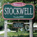
A welcome sign in Stockwell
-

A July 2007 wedding at the town's gazebo
-
Stockwell in 1878


See also
 In Spanish: Stockwell (Indiana) para niños
