
Stoneboro, Pennsylvania facts for kids
Quick facts for kids
Stoneboro, Pennsylvania
|
|
|---|---|
|
Borough
|
|

Houses on Walnut Street
|
|

Location of Stoneboro in Mercer County, Pennsylvania.
|
|
| Country | United States |
| State | Pennsylvania |
| County | Mercer |
| Established | 1825 |
| Area | |
| • Total | 2.94 sq mi (7.61 km2) |
| • Land | 2.83 sq mi (7.34 km2) |
| • Water | 0.10 sq mi (0.27 km2) |
| Elevation
(center of borough)
|
1,180 ft (360 m) |
| Highest elevation
(southwest corner of borough)
|
1,440 ft (440 m) |
| Lowest elevation
(Sandy Lake)
|
1,157 ft (353 m) |
| Population
(2020)
|
|
| • Total | 946 |
| • Estimate
(2021)
|
941 |
| • Density | 345.80/sq mi (133.50/km2) |
| Time zone | UTC-4 (EST) |
| • Summer (DST) | UTC-5 (EDT) |
| ZIP code |
16153
|
| Area code(s) | 724 |
| Website | http://www.stoneboropa.com |
Stoneboro is a small town, called a borough, in eastern Mercer County, Pennsylvania, United States. In 2020, about 946 people lived there. It is part of the Hermitage micropolitan area, which is a group of towns connected by jobs and daily life.
Contents
Exploring Stoneboro's Location
Stoneboro is located at these coordinates: 41°20′21″N, 80°6′29″W. This helps us find it on a map!
How Big is Stoneboro?
The town covers about 2.9 square miles (7.6 square kilometers) in total. Most of this area is land, about 2.8 square miles (7.3 square kilometers). A small part, about 0.1 square miles (0.27 square kilometers), is water.
Who Lives in Stoneboro?
The number of people living in Stoneboro has changed over the years. Here's a quick look at the population counts:
| Historical population | |||
|---|---|---|---|
| Census | Pop. | %± | |
| 1860 | 218 | — | |
| 1870 | 471 | 116.1% | |
| 1880 | 1,186 | 151.8% | |
| 1890 | 1,394 | 17.5% | |
| 1900 | 1,061 | −23.9% | |
| 1910 | 1,074 | 1.2% | |
| 1920 | 1,405 | 30.8% | |
| 1930 | 1,189 | −15.4% | |
| 1940 | 1,194 | 0.4% | |
| 1950 | 1,294 | 8.4% | |
| 1960 | 1,267 | −2.1% | |
| 1970 | 1,129 | −10.9% | |
| 1980 | 1,177 | 4.3% | |
| 1990 | 1,091 | −7.3% | |
| 2000 | 1,104 | 1.2% | |
| 2010 | 1,051 | −4.8% | |
| 2020 | 946 | −10.0% | |
| 2021 (est.) | 941 | −10.5% | |
| Sources: | |||
A Look at the People in 2000
In the year 2000, there were 1,104 people living in Stoneboro. These people lived in 475 households, and 314 of those were families.
Most of the people (about 98.73%) were White. A very small number were African American (0.09%), Native American (0.09%), or Asian (0.18%). About 0.91% of the people were from two or more races. Less than 1% (0.45%) were Hispanic or Latino.
Families and Ages
About 31.6% of the households had children under 18 living with them. More than half (55.6%) were married couples. About 8.0% were households led by a woman without a husband present.
The average household had about 2.32 people. The average family had about 2.91 people.
The population was spread out by age:
- 24.3% were under 18 years old.
- 7.9% were between 18 and 24 years old.
- 26.1% were between 25 and 44 years old.
- 22.9% were between 45 and 64 years old.
- 18.8% were 65 years or older.
The average age in Stoneboro was 39 years. For every 100 females, there were about 94 males.
Wesleyan Methodist Camp
Stoneboro is home to the Wesleyan Methodist Camp. This is a campground owned by the Allegheny Wesleyan Methodist Connection. It was built in 1900 and has been a place for gatherings and events ever since.
Images for kids
-
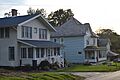
Houses on Walnut Street
-
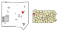
Location of Stoneboro in Mercer County, Pennsylvania.
See also
 In Spanish: Stoneboro para niños
