Stonerstown, Pennsylvania facts for kids
Quick facts for kids
Stonerstown, Pennsylvania
|
|
|---|---|

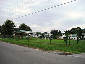
Park in Stonerstown
|
|
| Country | United States |
| State | Pennsylvania |
| County | Bedford |
| Township | Liberty |
| Area | |
| • Total | 0.3 sq mi (0.9 km2) |
| • Land | 0.3 sq mi (0.9 km2) |
| • Water | 0 sq mi (0.0 km2) |
| Elevation | 889 ft (271 m) |
| Population
(2020)
|
|
| • Total | 369 |
| • Density | 1,057/sq mi (408.0/km2) |
| Time zone | UTC-5 (Eastern (EST)) |
| • Summer (DST) | UTC-4 (EDT) |
| FIPS code | 42-74360 |
| GNIS feature ID | 2630041 |
Stonerstown is a small community in Pennsylvania, United States. It is known as a census-designated place, which means it's an area identified by the government for counting people. It's not a city or a town with its own local government.
About Stonerstown
Stonerstown is located in Liberty Township. This area is part of Bedford County, Pennsylvania. It is a quiet place where people live and work.
Where is Stonerstown?
You can find Stonerstown in the state of Pennsylvania. It is situated just west of a borough called Saxton. A main road, Pennsylvania Route 913, runs right by it.
How Many People Live Here?
According to the 2020 census, 369 people lived in Stonerstown. This makes it a small community.
See also
 In Spanish: Stonerstown para niños
Black History Month on Kiddle
Renowned African-American Artists:
 | Kyle Baker |
 | Joseph Yoakum |
 | Laura Wheeler Waring |
 | Henry Ossawa Tanner |

All content from Kiddle encyclopedia articles (including the article images and facts) can be freely used under Attribution-ShareAlike license, unless stated otherwise. Cite this article:
Stonerstown, Pennsylvania Facts for Kids. Kiddle Encyclopedia.


