Strongstown, Pennsylvania facts for kids
Quick facts for kids
Strongstown, Pennsylvania
|
|
|---|---|
|
Unincorporated community
|
|

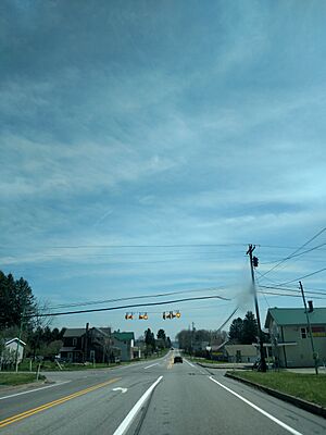
Eastbound along US 422
|
|
| Country | United States |
| State | Pennsylvania |
| County | Indiana |
| Township | Pine |
| Elevation | 1,890 ft (580 m) |
| Time zone | UTC-5 (Eastern (EST)) |
| • Summer (DST) | UTC-4 (EDT) |
| ZIP code |
15957
|
| Area code(s) | 814 |
| GNIS feature ID | 1188890 |
Strongstown is a small place in Indiana County, Pennsylvania, in the United States. It's not a city or a town with its own local government. Instead, it's known as an unincorporated community. This means it's a group of homes and businesses that are part of a larger area, like a township, rather than having its own separate government.
Strongstown is located where two important roads meet: U.S. Route 422 and Pennsylvania Route 403. These roads help people travel to and from the community. It is about 11.4 miles (which is about 18.3 kilometers) west-northwest of a town called Ebensburg.
Where is Strongstown?
Strongstown is found in the state of Pennsylvania, which is in the eastern part of the United States. It's specifically located within Indiana County.
How to find Strongstown
If you were looking at a map, you would find Strongstown by looking for the spot where U.S. Route 422 and Pennsylvania Route 403 cross paths. This makes it easy to find for travelers. The community is also about 1,890 feet (or 576 meters) above sea level, which is quite high up!
 | Sharif Bey |
 | Hale Woodruff |
 | Richmond Barthé |
 | Purvis Young |


