Stroud Lake (Oklahoma) facts for kids
Quick facts for kids Stroud Lake |
|
|---|---|
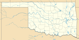
| Coordinates | 35°48′43″N 96°36′11″W / 35.812°N 96.603°W |
| Type | Reservoir |
| Etymology | City of Stroud, Oklahoma |
| Designation | Reservoir |
| First flooded | 1968 |
| Surface area | 621 acres (2,510,000 m2) |
| Max. depth | 46.9 feet (14.3 m) |
| Water volume | 8,800 acre-feet (10,900,000 m3) |
| Shore length1 | 14.2 miles (22.9 km) |
| Surface elevation | 855 feet (261 m) |
| Settlements | Stroud, Oklahoma |
| 1 Shore length is not a well-defined measure. | |
Stroud Lake is a man-made lake, also called a reservoir. It is located in Creek County, Oklahoma, United States. The lake is about 4.6 miles (7.4 km) from the town of Stroud, Oklahoma. It was built in 1968.
When it was being built, Stroud Lake had a different name. It was called "Salt Camp Creek Watershed Dam No. 12." The City of Stroud and the Creek County Conservation District worked together to build it. They also got help from other groups like the Oklahoma Conservation Commission.
The main reason for building the lake was to control floods. But the City of Stroud also paid for more space in the lake. This extra space was for storing drinking water for the city. It also provided water for fun activities like boating and fishing.
About Stroud Lake
The Oklahoma Water Resources Board (OWRB) provides details about Stroud Lake. The lake was created by building a dam across Lincoln Creek.
Lake Size and Features
Stroud Lake covers an area of about 600 acres (240 ha). It can hold about 8,800 acre-feet (10,900,000 m3) of water. The edge of the lake, called the shoreline, is about 14 miles (23 km) long. The normal height of the water in the lake is about 855 feet (261 m) above sea level.
What Stroud Lake is Used For
Stroud Lake serves three main purposes. First, it helps control floods, protecting nearby areas. Second, it provides a source of water for the city. Third, it offers a place for people to enjoy outdoor activities.


