Stump Pond (Pembroke, Massachusetts)
Quick facts for kids Stump Pond |
|
|---|---|
| Location | Pembroke, Massachusetts |
| Coordinates | 42°04′55″N 70°46′23″W / 42.08194°N 70.77306°W |
| Type | reservoir |
| Basin countries | United States |
| Surface area | 100 acres (40 ha) |
| Settlements | East Pembroke |
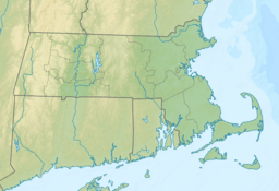
Stump Pond, also known as Reservoir MA94127, was a large reservoir in Pembroke, Massachusetts. It was located in the East Pembroke part of town. You could find it east of where Routes 14 and 53 meet. It was also west of Keene Pond and southwest of Arnold School Pond.
Stump Pond was drained in December 1992. This happened because a dam made of earth broke. The dam was on the northwest side of the pond, next to a cranberry farm that was no longer in use.
The pond was first created sometime between 1920 and 1935. It was made by flooding a swampy area. This was done to help private cranberry farms. Water flowed into Stump Pond from Pudding Brook and McFarland Brook. These are smaller streams that feed into the North River.
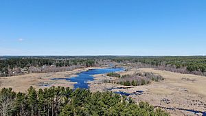
Even though it was drained over 25 years ago, Stump Pond still appears on many maps. The land where it used to be has changed a lot. It is now home to many different kinds of swamp plants and animals. These creatures probably lived there before the area was flooded. You can still see the old shoreline of the pond in satellite pictures. However, it will likely become harder to see as trees grow into the wet area.
Who Owns the Land Now?
Most of the land that was once Stump Pond was owned by one person. This changed on April 4, 2012. On that day, the Town of Pembroke, Massachusetts, bought the large 268.49-acre piece of land. They paid $1.325 million for it.
Some parts of the land around the edge of the wetland are still privately owned. These are from homes on Edgewater Drive, Mera Mesa Drive, and Pleasant Street. The Town of Pembroke wants to use the land to get well water. This water would help new businesses and homes grow in North Pembroke.


