Butman Township, Michigan facts for kids
Quick facts for kids
Butman Township, Michigan
|
|
|---|---|

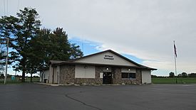
Butman Township Hall
|
|

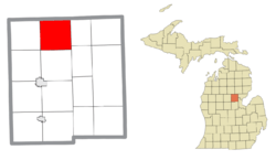
Location within Gladwin County
|
|
| Country | United States |
| State | Michigan |
| County | Gladwin |
| Established | 1883 |
| Area | |
| • Total | 35.64 sq mi (92.31 km2) |
| • Land | 34.00 sq mi (90.65 km2) |
| • Water | 1.64 sq mi (4.25 km2) |
| Elevation | 840 ft (256 m) |
| Population
(2020)
|
|
| • Total | 2,086 |
| • Density | 58.530/sq mi (22.598/km2) |
| Time zone | UTC-5 (Eastern (EST)) |
| • Summer (DST) | UTC-4 (EDT) |
| ZIP code(s) |
48624 (Gladwin)
|
| Area code(s) | 989 |
| FIPS code | 26-12180 |
| GNIS feature ID | 1626014 |
Butman Township is a special kind of local government area called a civil township. It is located in Gladwin County, which is part of the U.S. state of Michigan. In 2020, about 2,086 people lived here.
Contents
History of Butman Township
Butman Township was officially started in 1883. It was named after a man named Myron Butman. He was a businessman who worked in the lumber industry.
Communities in Butman Township
Butman Township is home to a few small places called unincorporated communities. This means they are not officially towns or cities with their own local government.
- Butman is one of these communities. You can find it where Butman and Cemetery county roads meet.
- Hockaday is another unincorporated community. It is located where Hockaday and Ritchie county roads cross. This community was named after Robert Hockaday, who was a local shop owner.
- Sugar Rapids is also an unincorporated community. It is found along the Sugar River. This community is about one mile east of Hockaday.
Geography of Butman Township
Butman Township covers an area of about 35.64 square miles (92.31 square kilometers). Most of this area, about 34.00 square miles (90.65 square kilometers), is land. The rest, about 1.64 square miles (4.25 square kilometers), is water.
Major Roads in Butman Township
Several important roads are near or run through Butman Township.
- Michigan Highway 18 (M-18) just touches the very southwest corner of the township. It doesn't go all the way through Butman Township.
- Michigan Highway 30 (M-30) runs from south to north. It forms most of the eastern border of the township.
- County Designated Highway F-97 (CDH F-97) is also known as Round Lake Road. This road runs from south to north and forms most of the western border of the township.
See also
 In Spanish: Municipio de Butman para niños


