
Summit Township, Marion County, Kansas facts for kids
Quick facts for kids
Summit Township
Marion County, Kansas |
|
|---|---|

Location within Marion County
|
|

Summit Township
Marion County, Kansas Location in Kansas
|
|
| Country | United States |
| State | Kansas |
| County | Marion |
| Area | |
| • Total | 36 sq mi (90 km2) |
| Dimensions | |
| • Length | 6.0 mi (9.7 km) |
| • Width | 6.0 mi (9.7 km) |
| Elevation | 1,463 ft (446 m) |
| Population
(2010)
|
|
| • Total | 80 |
| • Density | 2.22/sq mi (0.86/km2) |
| Time zone | UTC-6 (CST) |
| • Summer (DST) | UTC-5 (CDT) |
| Area code | 620 |
| FIPS code | 20-69100 |
| GNIS ID | 477782 |
| Website | County website |
Summit Township is a small local government area in Marion County, Kansas, United States. It's like a small community or district. In 2010, only 80 people lived there, making it a very quiet place.
Contents
About Summit Township
Where is Summit Township?
Summit Township is located in Marion County, Kansas. It covers an area of about 36 square miles (93 square kilometers). That's a pretty big area, even if not many people live there.
Past Communities in Summit Township
The township once had a community called Watchorn. This was a "ghost town," meaning it's now abandoned. Watchorn used to be a busy place during the 1910s and 1920s. It was an "oil boom" town, which means many people moved there when oil was discovered nearby. It was located about 5 miles (8 km) east of Peabody, Kansas.
Cemeteries in the Township
Summit Township is home to two cemeteries:
- Summit Township Cemetery: This cemetery is also known as the United Brethren Cemetery. A church used to be next to it, but it was closed and taken down in the 2010s.
- Whitewater Center Cemetery: This one is sometimes called the Stone Church Cemetery. There is still a church located across the road from this cemetery.
Images for kids
-
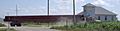
A large truck carrying a pipe for the Keystone Pipeline in 2010. This photo was taken near the Whitewater Center Church in Marion County.
See also
 In Spanish: Municipio de Summit (condado de Marion, Kansas) para niños
