Suttontown, North Carolina facts for kids
Quick facts for kids
Suttontown, North Carolina
|
|
|---|---|
| Country | United States |
| State | North Carolina |
| County | Sampson |
| Elevation | 171 ft (52 m) |
| Time zone | UTC-5 (Eastern (EST)) |
| • Summer (DST) | UTC-4 (EDT) |
| ZIP code |
28341
|
| Area codes | 910, 472 |
| GNIS feature ID | 995733 |
Suttontown is a small, unincorporated community located in Sampson County, North Carolina, in the United States. An unincorporated community means it's not an official city or town with its own local government. Instead, it's part of the larger county area.
Contents
Exploring Suttontown's History
Suttontown has a special place in history. One important landmark is the Marshall Kornegay House and Cemetery. This historic site was added to the National Register of Historic Places in 1986.
What is the National Register?
The National Register of Historic Places is like a special list of places in the United States that are important to history. When a building or site is on this list, it means it's recognized for its historical or architectural value. It helps protect these places for future generations to learn from and enjoy.
Where is Suttontown Located?
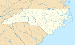
Suttontown is found in the eastern part of North Carolina. It's part of Sampson County, which is one of the largest counties in the state.
Geographic Details
The community sits at an elevation of about 171 feet above sea level. This means it's not very high up, but it's also not right at sea level. The exact coordinates for Suttontown are 35 degrees, 12 minutes, 13 seconds North latitude and 78 degrees, 14 minutes, 26 seconds West longitude.
Local Information
If you needed to send mail to Suttontown, the ZIP code for the area is 28341. For phone calls, the area codes are 910 and 472.
 | Jewel Prestage |
 | Ella Baker |
 | Fannie Lou Hamer |


