Swannanoa, New Zealand facts for kids
Quick facts for kids
Swannanoa
|
|
|---|---|
|
Village
|
|

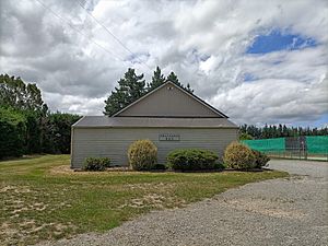
View of Swannanoa Hall across the road from the primary school
|
|
| Country | |
| Island | South Island |
| Region | Canterbury |
| Ward | Oxford-Ohoka Ward |
| Community | Oxford-Ohoka Community |
| Electorates |
|
| Area | |
| • Total | 61.77 km2 (23.85 sq mi) |
| Population
(June 2023)
|
|
| • Total | 1,040 |
| • Density | 16.84/km2 (43.61/sq mi) |
| Time zone | UTC+12 (NZST) |
| • Summer (DST) | UTC+13 (NZDT) |
Swannanoa is a small village located in the Canterbury region of New Zealand. It is about 35 kilometres northwest of Christchurch, which is the largest city on the South Island.
Swannanoa is a growing area. Its population is slowly getting bigger as new housing areas are being built there and in the nearby village of Mandeville North. The local primary school has 280 students.
Contents
History of Swannanoa
Who Named Swannanoa?
The name "Swannanoa" comes from an American man named John Evans Brown. He arrived in Canterbury in 1864 and people called him "Yankee Brown." He started a farm on land owned by his brother-in-law, John Thomas Peacock. John Evans Brown named his farm after the Swannanoa River in North Carolina, USA.
He was active in the local community. In 1865, he was chosen to be part of the Rangiora and Mandeville Road Board, which helped manage local roads. He also won prizes for his birds at a local farming show in 1866. Later, when he went back to North Carolina, he named his home there "Zealandia", after New Zealand.
The Peacock and Petrie Families
The land where Swannanoa farm was located first belonged to John Thomas Peacock in 1864. Then, in 1865, it was passed to his father, John Jenkins Peacock. The Peacock family owned the land until 1903.
Since 1957, the Swannanoa farm has been owned and run by the Petrie Family.
The Community Church
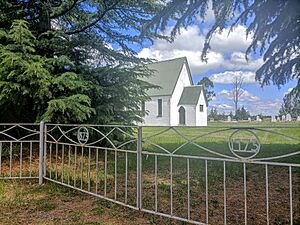
The Swannanoa Community Church is located near Swannanoa School. It first opened in 1873. John Evans Brown, who named the area, was a main supporter and helped pay for the church to be built.
Tram Road and the Railway Line
In the 1870s, it was hard for people in the Swannanoa area to travel and move goods. It could take up to two days to get to Kaiapoi by dray (a type of cart). People wanted better transport.
A plan for a railway line from Oxford to Rangiora was already approved. However, local settlers in the Eyre area asked for the railway to pass through their district, including Swannanoa. They kept asking, and eventually, the government agreed to build two railway lines about 10 kilometres apart. One of these became the Eyreton Branch line.
Construction of the Eyreton line began in August 1872 and was finished in 1875. The first train left West Eyreton for Kaiapoi on December 27, 1875. Later, the West Eyreton line was connected to the Oxford line in 1878. The road known as Tram Road today was surveyed in 1871 as a possible route for a railway line.
Swannanoa's Population
The Swannanoa-Eyreton area, which includes the village of Swannanoa and nearby Eyreton, covers about 61.77 square kilometres. As of June 2023, the estimated population for this area is 1,040.
The population has been growing steadily. In 2006, there were 699 people, which grew to 906 in 2013, and then to 954 in 2018. This shows a good increase over time.
Most people living here are of European background. About 6% identify as Māori, and smaller numbers are from other ethnic groups. About 16.7% of the people in Swannanoa-Eyreton were born outside New Zealand.
When asked about religion, most people (55.7%) said they had no religion. About 33.3% identified as Christian.
Education in Swannanoa
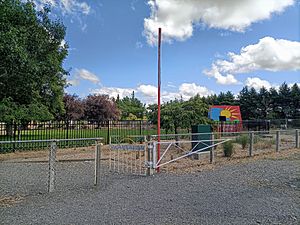
Swannanoa School is a state primary school for both boys and girls. It was started in 1871. The school currently has 280 students.
World Land Speed Record
Swannanoa is famous for a special event that happened on Tram Road. On July 2, 1955, a New Zealand motorcycle rider named Russell Wright set a Motorcycle land-speed record. He reached an amazing speed of 184.83 miles per hour (about 297.45 kilometres per hour) on a special Vincent-HRD Black Lightning motorcycle. A plaque on Tram Road remembers this achievement.
Tram Road is a very straight, two-lane road that is about 22 kilometres long. Because it's so straight, it's a popular place for speed trials. It's quite unique that a world record was set here, as most are usually achieved on large, flat salt plains like the Bonneville Salt Flats in the United States. This record was set on a public road that was still a bit wet from rain!
After Russell Wright set his record, another person named Bob Burns attached a sidecar to the same motorcycle. Bob Burns then set another world record for sidecars, averaging 162 miles per hour (about 260.7 kilometres per hour) over two runs.
 | Aaron Henry |
 | T. R. M. Howard |
 | Jesse Jackson |


