Sweet Grass, Montana facts for kids
Quick facts for kids
Sweetgrass, Montana
|
|
|---|---|

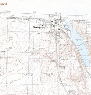
Topographical map of the Sweet Grass area
|
|
| Country | United States |
| State | Montana |
| County | Toole |
| Area | |
| • Total | 0.48 sq mi (1.25 km2) |
| • Land | 0.48 sq mi (1.25 km2) |
| • Water | 0.00 sq mi (0.00 km2) |
| Elevation | 3,547 ft (1,081 m) |
| Population
(2020)
|
|
| • Total | 65 |
| • Density | 134.58/sq mi (51.94/km2) |
| FIPS code | 30-73075 |
| GNIS feature ID | 2583856 |
Sweet Grass is a small community located in Toole County, Montana, United States. It sits right on the border with Canada. It's known as a "census-designated place," which means it's a specific area counted by the government. However, it's not officially a city or town with its own local government. In 2020, only 65 people lived here.
Sweet Grass is very important because it's where Interstate 15 ends in the north. This big highway connects western Canada, the western United States, and even Mexico!
In 2004, a special building opened here. It's a "joint border facility" that houses both Canadian and American officials. This helps make crossing the border smoother for everyone. The nearby town of Coutts, Alberta in Canada helps Sweet Grass with fire services through its volunteer fire department.
Sweet Grass Weather
Sweet Grass has a climate that can be described as semi-arid. This means it's generally dry, but it also has some features of a humid continental climate, which means it has cold winters and warm summers. The weather can change a lot between seasons.
| Climate data for Sweet Grass, Montana | |||||||||||||
|---|---|---|---|---|---|---|---|---|---|---|---|---|---|
| Month | Jan | Feb | Mar | Apr | May | Jun | Jul | Aug | Sep | Oct | Nov | Dec | Year |
| Record high °F (°C) | 64 (18) |
70 (21) |
72 (22) |
84 (29) |
91 (33) |
96 (36) |
105 (41) |
105 (41) |
95 (35) |
88 (31) |
74 (23) |
67 (19) |
105 (41) |
| Mean daily maximum °F (°C) | 31 (−1) |
35 (2) |
43 (6) |
54 (12) |
65 (18) |
73 (23) |
82 (28) |
81 (27) |
70 (21) |
57 (14) |
40 (4) |
31 (−1) |
55 (13) |
| Mean daily minimum °F (°C) | 8 (−13) |
12 (−11) |
20 (−7) |
30 (−1) |
39 (4) |
47 (8) |
52 (11) |
50 (10) |
42 (6) |
31 (−1) |
19 (−7) |
10 (−12) |
30 (−1) |
| Record low °F (°C) | −39 (−39) |
−35 (−37) |
−29 (−34) |
−7 (−22) |
16 (−9) |
30 (−1) |
35 (2) |
30 (−1) |
12 (−11) |
−12 (−24) |
−26 (−32) |
−44 (−42) |
−44 (−42) |
| Average precipitation inches (mm) | 0.30 (7.6) |
0.23 (5.8) |
0.58 (15) |
1.00 (25) |
2.61 (66) |
3.13 (80) |
1.96 (50) |
1.94 (49) |
1.45 (37) |
0.62 (16) |
0.45 (11) |
0.30 (7.6) |
14.57 (370) |
| Average snowfall inches (cm) | 9.5 (24) |
8.3 (21) |
8.9 (23) |
6.6 (17) |
2.3 (5.8) |
0.4 (1.0) |
0.1 (0.25) |
0.1 (0.25) |
2.6 (6.6) |
4.2 (11) |
7.4 (19) |
9.1 (23) |
59.5 (151.9) |
Population Facts
The number of people living in Sweet Grass is counted every ten years by the United States government. This is called a census.
| Historical population | |||
|---|---|---|---|
| Census | Pop. | %± | |
| 2020 | 65 | — | |
| U.S. Decennial Census | |||
See also
 In Spanish: Sweet Grass (Montana) para niños
 | George Robert Carruthers |
 | Patricia Bath |
 | Jan Ernst Matzeliger |
 | Alexander Miles |

