Tamarac River (Gatineau River tributary) facts for kids
Quick facts for kids Tamarac |
|
|---|---|

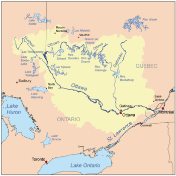
Watershed plan of Ottawa River
|
|
| Country | Canada |
| Province | Quebec |
| Regions |
|
| Physical characteristics | |
| Main source | Tamarac Lake Senneterre (Buies Township), Abitibi-Témiscamingue, Quebec 444 m (1,457 ft) 48°06′50″N 75°32′36″W / 48.11389°N 75.54333°W |
| River mouth | Gatineau River (via Pain de Sucre Lake) La Tuque (Radison Township), Mauricie, Quebec 402 m (1,319 ft) 47°53′55″N 75°31′21″W / 47.89861°N 75.52250°W |
| Length | 44.0 km (27.3 mi) |
| Basin features | |
| Tributaries |
|
The Tamarac River is a river in Quebec, Canada. It flows into Pain de Sucre Lake (La Tuque), which then leads to the Gatineau River. The Gatineau River eventually joins the larger Ottawa River.
The Tamarac River starts in the Abitibi-Témiscamingue region, near the town of Senneterre. It then flows through the Mauricie region, ending its journey in the territory of La Tuque.
This river winds through a quiet forest area. There are no towns or resorts directly along its banks. During the cold Canadian winter, the river's surface usually freezes over. This happens from early December until early April.
Where the Tamarac River Starts and Ends
The Tamarac River is about 44.0 km (27.3 mi) long. It begins at a place called Tamarac Lake. This lake is quite high up, at an altitude of 444 m (1,457 ft).
The river's journey ends when it flows into Pain de Sucre Lake. This lake is a source for the Gatineau River. The spot where the Tamarac River joins Pain de Sucre Lake is at an altitude of 402 m (1,319 ft).
The River's Path
The Tamarac River flows through a small valley surrounded by forests. It passes through several lakes along its way.
- Upper Part: The river starts at Tamarac Lake. It then flows east, crossing the northern part of Lake Neault. After that, it goes northeast through Lake Dozois. It continues southeast through Lake Canier, then south towards Douville township. It crosses Lake Hallé and Alexandra Lake before reaching the lower part of the river.
- Lower Part: In this section, the river flows southwest, passing through Hayes Lake and Primeau Lake. It then makes a curve, going south, then northeast, and finally southwest again before reaching its mouth. A forest road bridge is located where the river ends its journey.
The river's mouth is located in Radisson Township, near the eastern edge of the township. It is about 70 km (43 mi) west of the village of Parent and 144 km (89 mi) southeast of downtown Senneterre.
Naming the Tamarac River
The name "Tamarac River" was officially recognized on December 5, 1968. This was done by the Commission de toponymie du Québec, which is the organization responsible for naming places in Quebec.
 | Isaac Myers |
 | D. Hamilton Jackson |
 | A. Philip Randolph |

