Gatineau River facts for kids
Quick facts for kids Gatineau River |
|
|---|---|
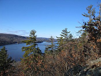
The upper Gatineau River
|
|
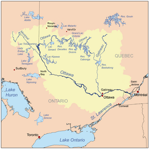
Map of the Ottawa River drainage basin with the Gatineau River
|
|
| Other name(s) | Rivière Gatineau |
| Country | Canada |
| Province | Quebec |
| Region | Outaouais |
| Physical characteristics | |
| Main source | Unnamed wilderness near boundary between Outaouais and Mauricie regions |
| River mouth | Ottawa River City of Gatineau 45°27′15″N 75°41′42″W / 45.45417°N 75.69500°W |
| Length | 386 km (240 mi) |
| Basin features | |
| Progression | Ottawa River→ Saint Lawrence River→ Gulf of Saint Lawrence |
| River system | Ottawa River drainage basin |
| Basin size | 23,724 km2 (9,160 sq mi) |
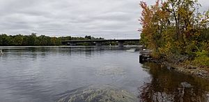
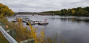
The Gatineau River (also called Rivière Gatineau in French) is a long river in western Quebec, Canada. It starts in lakes north of the Baskatong Reservoir. The river then flows south until it joins the Ottawa River in the city of Gatineau, Quebec.
The Gatineau River is about 386 kilometers (240 miles) long. It drains an area of 23,700 square kilometers (9,150 square miles). This means it collects water from a very large region.
Some people say the river was named after Nicolas Gatineau. He was a fur trader who might have drowned in the river in 1683. However, the Algonquin Anicinabek, who are the original inhabitants, have a different story. They say the name comes from their language, "Te-nagàdino-zìbi". This means "The River that Stops [One's Journey]".
Contents
Exploring the Gatineau River's Geography
The landscape around the Gatineau River changed when the Baskatong Reservoir was built. This reservoir is a large artificial lake. You can still travel upstream on the Gatineau River. From there, a short portage (carrying a boat over land) can take you to the very beginning of the Ottawa River. The Ottawa River then flows in a big loop before connecting with the Gatineau River.
The Gatineau River flows through several communities. These towns and villages are located along its banks:
There was once a famous covered wooden bridge in Wakefield. It was built in 1915 but was sadly destroyed by arson (a fire set on purpose) in 1984. Luckily, the community rebuilt it, and it stands today.
A Look Back at the Gatineau River's History
How the Gatineau River Got Its Name
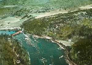
For a long time, this river was a very important travel route. Native people and early explorers used it to move around the region. On June 4, 1613, Samuel de Champlain, a famous French explorer, passed by the river. He was traveling on the Ottawa River.
Champlain wrote about seeing a "river coming from the north." He noted that the "Algoumequins" (Algonquin people) lived near it. He also mentioned that this river had many difficult waterfalls. People sometimes used it to avoid their enemies because it was so hard to travel. However, Champlain did not give the river a name.
Over the years, different names appeared on maps and in reports. In 1783, a report called it "River Lettinoe." Later, in the early 1800s, a fur trader named Jean-Baptiste Perrault called it "nàgàtinong" or "àgatinung." By the 1830s, maps started showing the name "Gatteno" or "R. Gatineau."
The name "Gatineau" is believed to honor a 17th-century fur trader, Nicolas Gatineau. Some historians think the river was named after his sons, Louis and Jean-Baptiste. They set up a trading post at the river's mouth. This spot later became known as Point-Gatineau.
The River's Role in Local Economy
From the 1800s until 1991, the Gatineau River was like a highway for logs. Trees cut down in the forests were floated down the river to sawmills. These sawmills were located closer to the river's mouth. Philemon Wright and his family were key figures in developing this lumber industry. Later, as the quality of the wood changed, the logs were used to make pulp and paper.
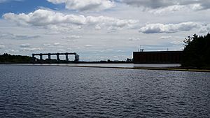
The river is also a major source of hydroelectric power. This means its flowing water is used to create electricity. In 1925, three large hydroelectric dams were built on the lower part of the Gatineau River. These dams were a huge project for the region. Today, they are known as the Paugan, Chelsea, and Rapides-Farmers Hydroelectric Stations. They are located in the towns of Low, Cantley, and Gatineau.
A fun fact about the river's past is the Hull-Chelsea-Wakefield Railway. This was a tourist steam train that followed the Gatineau valley up to Wakefield. It offered scenic rides for visitors.
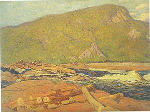
In 1915, a famous Canadian artist, J. E. H. MacDonald, painted the logging operations on the river. He was a member of the well-known Group of Seven artists. His painting is called Logs on the Gatineau.
Flooding Events
Rivers can sometimes flood, especially in spring when snow melts. In the spring of 1974, the Gatineau River experienced a lot of flooding. This caused widespread water damage along its banks.
Rivers Joining the Gatineau
Many smaller rivers and lakes flow into the Gatineau River. These are called tributaries. Here are some of the major ones, listed from the mouth of the river upstream:
- La Pêche River
- Kazabazua River
- Picanoc River
- Grand Lac Rond
- Thirty-one Mile Lake
- Rivière Désert
- Rivière de l'Aigle (Eagle River)
- Tomasine River
- Désert Lake
- Ignace River
- Baskatong Reservoir
- Gens de Terre River
- Wapus River
- Belinge River
- Cabonga Reservoir
- Rivière d'Argent
- Notawassi River
- Petawaga River
- Petawaga Lake
- Gens de Terre River
- Bazin River
- Rivière aux Bleuets
- Rivière à la Marte (Marten River)
- Dandurand River
- Rivière du Canot (Canoe River)
- Choquette River
- Chabot River
- Fortier River
- Chouart River
- Tamarac River
- Clova River
 | Shirley Ann Jackson |
 | Garett Morgan |
 | J. Ernest Wilkins Jr. |
 | Elijah McCoy |


