
Maniwaki facts for kids
Quick facts for kids
Maniwaki
|
||
|---|---|---|
|
City
|
||

Main street (Hwy. 105)
|
||
|
||

Location within La Vallée-de-la-Gatineau RCM
|
||

Maniwaki
Location in Western Quebec
|
||
| Country | Canada | |
| Province | Quebec | |
| Region | Outaouais | |
| RCM | La Vallée-de-la-Gatineau | |
| Constituted | March 15, 1904 | |
| Area | ||
| • Total | 8.82 km2 (3.41 sq mi) | |
| • Land | 5.67 km2 (2.19 sq mi) | |
| Population
(2021)
|
||
| • Total | 3,757 | |
| • Density | 662.8/km2 (1,717/sq mi) | |
| • Pop (2016–21) | ||
| • Dwellings | 2,110 | |
| Time zone | UTC−5 (EST) | |
| • Summer (DST) | UTC−4 (EDT) | |
| Postal code(s) |
J9E 1Z9
|
|
| Area code(s) | 819 | |

Maniwaki is a town in the province of Quebec, Canada. It is about 130 kilometers (81 miles) north of Ottawa, Ontario. The town sits on the Gatineau River. It is located where Route 105 and Route 107 meet. Route 117 (Trans-Canada Highway) is also nearby. Maniwaki is the main center for the La Vallée-de-la-Gatineau Regional County Municipality.
Contents
History of Maniwaki
The story of Maniwaki is closely tied to the nearby Kitigan Zibi Reserve. The town of Maniwaki grew on land that was once part of this reserve. The town's land was part of old land claims by Kitigan Zibi. Some of these claims were settled as recently as 2007.
Early Settlements and Naming
In the early 1800s, Algonquins from the mission at Lake of Two Mountains came to the area. They were led by Chief Pakinawatik. Soon after, in 1832, the Hudson's Bay Company set up a trading post. This post was where the Désert and Gatineau rivers meet.
About ten years later, Missionary Oblates of Mary Immaculate started the Notre-Dame-du-Desert mission. By 1849, they asked for a township to be marked out. This was to create a reserve for the Algonquins. The township borders were drawn in 1850. The Oblates named the settlement Maniwaki at this time. In the Algonquin language, "Maniwaki" means "Mary's Land."
Soon, people came to live in Maniwaki. These included wood merchants, farmers, and business people. They were drawn by the rich forests in the area.
Growth and Development
In 1851, the Oblates started the L'Assomption-de-Maniwaki church parish. Forestry became a very important job for many people in the region. Irish, French, and Algonquins all helped the town grow. These three cultures lived together in harmony. Maniwaki was officially founded in 1851. It became a township municipality in 1904. It was called a "village" in 1930 and a "Ville" (city) in 1957.
A train line connected Ottawa to Maniwaki. It was part of the Canadian Pacific Railroad. This line was about 82.3 miles long. It opened in stages between 1893 and 1902. Passenger trains stopped running in 1964. The entire line was closed in 1986.
Important Events
After World War I, a sickness called the Spanish influenza spread. It affected Maniwaki, like many places around the world. In less than two weeks, about twenty people died from this sickness. People were scared and stayed indoors. For the first time, no Sunday mass was held at the Assumption church.
The flood of 1974 is an event many local people remember. On May 14, 1974, the Gatineau and Désert rivers overflowed. The water rose very quickly, about 3 to 6 inches an hour. Over 1,000 homes in the Maniwaki area were flooded. About 3,000 people had to leave their homes. No one was hurt, but the damage cost millions of dollars.
Since 1974, there have been no other big disasters. The area continues to do well in two main areas: forestry and tourism.
Geography and Climate
Maniwaki has a humid continental climate. This means it has warm summers and cold winters. The average yearly temperature in Maniwaki is about 4.6 degrees Celsius (40.3 degrees Fahrenheit). The average yearly rainfall is about 939.2 millimeters (37 inches). October is usually the wettest month.
Temperature Extremes
The warmest temperatures are usually in July, around 19.1 degrees Celsius (66.4 degrees Fahrenheit). The coldest temperatures are in January, around -12.0 degrees Celsius (10.4 degrees Fahrenheit). The hottest temperature ever recorded in Maniwaki was 37.8 degrees Celsius (100 degrees Fahrenheit) on August 1, 1975. The coldest temperature ever recorded was -46.7 degrees Celsius (-52.1 degrees Fahrenheit) on January 11, 1954.
| Climate data for Maniwaki, 1991–2020 normals, extremes 1953−present | |||||||||||||
|---|---|---|---|---|---|---|---|---|---|---|---|---|---|
| Month | Jan | Feb | Mar | Apr | May | Jun | Jul | Aug | Sep | Oct | Nov | Dec | Year |
| Record high humidex | 11.0 | 11.2 | 28.3 | 32.9 | 38.9 | 43.3 | 45.6 | 47.8 | 40.8 | 35.9 | 24.1 | 16.7 | 47.8 |
| Record high °C (°F) | 10.9 (51.6) |
11.1 (52.0) |
27.2 (81.0) |
30.7 (87.3) |
35.0 (95.0) |
34.8 (94.6) |
36.8 (98.2) |
37.8 (100.0) |
35.3 (95.5) |
28.0 (82.4) |
23.1 (73.6) |
15.0 (59.0) |
37.8 (100.0) |
| Mean daily maximum °C (°F) | −6.4 (20.5) |
−4.3 (24.3) |
2.0 (35.6) |
10.0 (50.0) |
18.6 (65.5) |
23.4 (74.1) |
25.6 (78.1) |
24.3 (75.7) |
19.6 (67.3) |
11.8 (53.2) |
4.1 (39.4) |
−3.1 (26.4) |
10.5 (50.9) |
| Daily mean °C (°F) | −12.0 (10.4) |
−10.4 (13.3) |
−4.0 (24.8) |
4.0 (39.2) |
11.7 (53.1) |
16.7 (62.1) |
19.1 (66.4) |
17.9 (64.2) |
13.3 (55.9) |
6.7 (44.1) |
−0.2 (31.6) |
−7.7 (18.1) |
4.6 (40.3) |
| Mean daily minimum °C (°F) | −17.4 (0.7) |
−16.5 (2.3) |
−10.0 (14.0) |
−2.1 (28.2) |
4.8 (40.6) |
10.0 (50.0) |
12.6 (54.7) |
11.5 (52.7) |
7.1 (44.8) |
1.5 (34.7) |
−4.5 (23.9) |
−12.2 (10.0) |
−1.3 (29.7) |
| Record low °C (°F) | −46.7 (−52.1) |
−43.9 (−47.0) |
−38.9 (−38.0) |
−23.3 (−9.9) |
−8.3 (17.1) |
−2.2 (28.0) |
1.6 (34.9) |
−0.3 (31.5) |
−4.7 (23.5) |
−11.7 (10.9) |
−25.5 (−13.9) |
−38.3 (−36.9) |
−46.7 (−52.1) |
| Record low wind chill | −45.7 | −46.8 | −38.7 | −26.8 | −9.7 | −4.1 | 0.0 | 0.0 | −6.0 | −12.7 | −29.5 | −42.5 | −46.8 |
| Average precipitation mm (inches) | 75.8 (2.98) |
55.8 (2.20) |
70.7 (2.78) |
72.3 (2.85) |
72.7 (2.86) |
79.6 (3.13) |
87.0 (3.43) |
94.6 (3.72) |
86.6 (3.41) |
96.2 (3.79) |
72.1 (2.84) |
75.9 (2.99) |
939.2 (36.98) |
| Average precipitation days (≥ 0.2 mm) | 14.8 | 12.0 | 11.6 | 11.9 | 11.6 | 11.1 | 12.5 | 12.3 | 11.9 | 12.9 | 13.8 | 14.6 | 150.9 |
| Average relative humidity (%) (at 3pm) | 68.7 | 59.3 | 51.2 | 46.6 | 46.4 | 51.4 | 53.9 | 55.9 | 59.8 | 61.6 | 69.6 | 74.7 | 58.3 |
| Average dew point °C (°F) | −13.8 (7.2) |
−12.3 (9.9) |
−6.9 (19.6) |
−1.6 (29.1) |
4.2 (39.6) |
11.2 (52.2) |
13.7 (56.7) |
13.2 (55.8) |
9.2 (48.6) |
3.5 (38.3) |
−1.9 (28.6) |
−10.5 (13.1) |
0.7 (33.2) |
| Source: Environment and Climate Change Canada (dew point 1pm, 1951–1980) | |||||||||||||
Population and Languages
In the 2021 Canadian census, Maniwaki had a population of 3,757 people. They lived in 1,881 homes. The total number of homes was 2,110. This was a small decrease of 2.2% from its 2016 population of 3,843. The town has a land area of 5.67 square kilometers (2.19 square miles). This means there were about 662.8 people per square kilometer in 2021.
| Canada census – Maniwaki community profile | |||
|---|---|---|---|
| 2016 | |||
| Population: | 3,853 (-2.0% from 2011) | ||
| Land area: | 5.98 km2 (2.31 sq mi) | ||
| Population density: | 644.3/km2 (1,669/sq mi) | ||
| Median age: | 52.4 (M: 50.8, F: 53.7) | ||
| Total private dwellings: | 2,061 | ||
| Median household income: | $37,419 | ||
| Notes: 2021 population change based on revised count. – References: 2016 earlier | |||
| Historical census populations – Maniwaki | |||||||||||||||||||||||||||||||||||||
|---|---|---|---|---|---|---|---|---|---|---|---|---|---|---|---|---|---|---|---|---|---|---|---|---|---|---|---|---|---|---|---|---|---|---|---|---|---|
|
|
||||||||||||||||||||||||||||||||||||
| 2016 figure is revised count from 2021. 2001 figure is based on revised count. Source: Statistics Canada |
|||||||||||||||||||||||||||||||||||||
Main Languages Spoken
Most people in Maniwaki speak French as their first language.
- French as first language: 90.7%
- English as first language: 5.5%
- English and French as first language: 0.7%
- Other languages as first language: 3.1%
Famous People from Maniwaki
Maniwaki has been home to several notable people:
- Annie Galipeau - an actress who was in the 1999 movie about Grey Owl. She acted alongside Pierce Brosnan.
- Matt Lang - a country music artist.
- Gino Odjick - an NHL player. He played for teams like the Vancouver Canucks and Montreal Canadiens.
- Bridget Tolley - an activist who works for Missing and Murdered Indigenous Women (MMIW). She started the group Families of Sisters in Spirit.
Disappearance of Maisy Odjick and Shannon Alexander
On September 6, 2008, two young people, Maisy Odjick and Shannon Alexander, went missing from the Kitigan Zibi Nation. Search and Rescue Global One helped look for them. Two separate searches were done, but they were not found. Since then, police have carried out investigations. However, the case has not yet been solved.
Images for kids
-
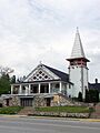
Christ-Roi church

See also
 In Spanish: Maniwaki para niños
