Tanganasoga facts for kids
Quick facts for kids Tanganasoga |
|
|---|---|

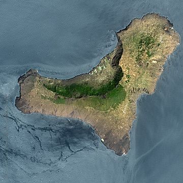
A large brown ring within the largest green area marks the location of the cinder cone.
|
|
| Highest point | |
| Elevation | 1,384 m (4,541 ft) |
| Geography | |
| Location | El Hierro, Canary Islands |
| Parent range | Canary Islands |
| Geology | |
| Mountain type | Cinder cone atop shield volcano |
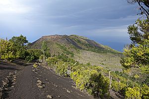
Tanganasoga is a major volcano located on El Hierro, one of the beautiful Canary Islands. It's a type of volcano called a cinder cone, which is a cone-shaped hill made of volcanic ash and rock. This cone is actually part of a much bigger volcano system, shaped like a shield volcano.
Contents
El Hierro: An Island of Volcanoes
El Hierro is an island about 278 square kilometers in size. It formed around 1.2 million years ago from powerful volcanic eruptions. The island first rose from the ocean as a tall volcanic cone, over 2,000 meters high.
Over time, more eruptions happened. This made the island grow and gave it the most volcanoes in the Canary Islands. There are over 500 visible volcanic cones and another 300 hidden under newer rock. El Hierro also has about 70 caves and tunnels formed by lava, like the Cueva de Don Justo, which has channels over 6 kilometers long!
Giant Landslides and the El Golfo Valley
El Hierro has been shaped by huge landslides over hundreds of thousands of years. These are like giant chunks of the island sliding into the ocean. The most recent big one was called the 'El Golfo' landslide. It happened about 15,000 years ago.
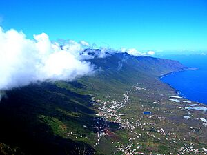
This landslide caused the northern side of the island to collapse. It created the large, curved El Golfo valley we see today. This event moved a massive amount of rock, enough to fill 150 to 180 cubic kilometers! Scientists have found evidence of this landslide far away in the ocean, showing how powerful it was. It likely caused huge ocean waves, called tsunamis, but there's no direct proof of them yet. Tanganasoga volcano formed right near the top edge of this giant landslide scar.
Recent Volcanic Activity
El Hierro is a quiet island, with only one volcano eruption ever officially recorded. This happened in 1793 from a vent of Tanganasoga called Volcan de Lomo Negro. The eruption lasted for about a month.
More recently, in 2011 and 2012, there was underwater volcanic activity near La Restinga, on the southern part of the island. Scientists believe this activity was connected to Tanganasoga. During this time, the ground around Tanganasoga started to change shape quickly. This showed that magma (molten rock) was moving deep beneath the volcano. In June 2012, new earthquakes and ground movement around Tanganasoga signaled more magma activity.
See also
 In Spanish: Tanganasoga para niños
- 2011-2012 El Hierro eruption


