
Tāpora facts for kids
Quick facts for kids
Tāpora
|
|
|---|---|

Bird's Beach, Tapora, New Zealand at low tide
|
|
| Country | New Zealand |
| Region | Auckland Region |
| Ward | Rodney ward |
| Community board | Rodney Local Board |
| Subdivision | Wellsford subdivision |
| Electorates |
|
Tāpora is a small community located on the Okahukura Peninsula in New Zealand. It sits on the eastern side of the large Kaipara Harbour. Tāpora is part of the Rodney District within the Auckland Region.
To the east of Tāpora, you'll find the town of Wellsford, along with Port Albert and the Wharehine River. To the west, across the harbour, is Manukapua Island.
Contents
The Story of Tāpora's Past
Early Māori Life in Tāpora
Long ago, the western shores of the Okahukura Peninsula were covered in sand dunes. These dunes stretched all the way to the entrance of the Kaipara Harbour. There were two channels leading into the harbour back then, not just one like today. This sandy area was known as Tāpora, and Māori people lived there.
Over time, big storms caused the sand dunes to wash away. The sea slowly moved in, leaving only sand bars in the harbour. Before this, there was even a whare, or meeting house, on the original sand dunes.
The name Tāpora was given by the crew of the Māhuhu-ki-te-rangi canoe. They were early voyagers who named the area after a place in their home in Polynesia. The name Okahukura comes from Kahukura, an important leader who arrived in New Zealand on the Tākitimu canoe.
For many generations, the land of Okahukura belonged to the Ngāti Whātua tribe. They continued to live on the peninsula for more than ten years after the government bought the nearby land known as Albertland.
European Settlement and Land Changes
Around 1876, a person named T. E. FitzGerald bought the land from Ngāti Whātua. This included the Okahukura point and a large area of about 24,000 acres (97 square kilometers). FitzGerald built his first home around 1880. It was on a ridge that looked over the Ōruawharo River.
He also built a small jetty for boats to use at high tide. There was a main landing spot in deeper water that could be used at any tide. Because there were many kauri trees on the land, FitzGerald rented out the rights for gum-diggers to collect gum. When FitzGerald got old, he retired and ended his twenty years of living at Okahukura.
After FitzGerald, A. H. Walker rented the land for two and a half years. He made big changes by putting up new fences and planting grass. Then, T.C. Williams leased the land, with W. Williams managing it. For the next ten years, the Williams family and their workers cleared and burned bush to create more grasslands. They also opened gumfields and a store in one of FitzGerald's old homes.
In 1910, T.C. Williams was in the process of handing over management to C. Kemp when he accidentally shot himself and died. Kemp then took over managing Okahukura. He continued to develop the land, especially by building boundary fences. Near the end of 1910, Okahukura was sold to Messrs Bowron and Smith from Christchurch. Kemp remained the manager. He divided the property into smaller sections and sold them. He also built roads for access and set up a telephone line for communication. The land changed owners many times between World War One and World War Two.
Tāpora's Modern History


During World War Two, the United States Marines set up a camp in the area. They used the wider area for target practice. In April 1945, the New Zealand Government took over Okahukura. They planned to use it as a settlement for soldiers returning from the war. The name Okahukura was then changed to Tāpora. This was done to avoid confusion with another place called Okahukura in New Zealand.
The Minister of 'Land and Returned Services' Association worked out a plan to develop the Okahukura peninsula for these returning soldiers. A community called Tāpora was planned. It was meant to have a shop, a school, a church, and houses for workers. Only the school and a few houses were actually built. In 1947, the land was divided up for the Returned Services' Association members. Tāpora then became a settlement focused on dairy farming.
In 2006, Pierre and Jackie Chatelanat generously gave Atiu Creek Regional Park to the Auckland Regional Council. This park is now a popular place for people to visit.
In 2013, a large fire started near Okahukura Road in Tāpora. It burned through 85 hectares (about 210 acres) of land. Much of this land had wild pines, Gorse, Pampas Grass, and coastal scrub.
Since the mid-2010s, many of the dairy farms in Tāpora have changed. They have been converted into orchards, with tens of thousands of avocado trees planted.
People and Population
Tāpora Community Statistics
The Tāpora area, which includes Birds Beach, covers about 42.71 square kilometers. In the 2023 New Zealand census, 99 people lived here. This was a decrease of 24 people since the 2018 census. The average age of people in Tāpora was 43.7 years.
- 18.2% of people were under 15 years old.
- 15.2% were aged 15 to 29.
- 54.5% were aged 30 to 64.
- 18.2% were 65 or older.
Most people (87.9%) identified as European (Pākehā). About 30.3% identified as Māori. English was spoken by everyone, and 6.1% spoke Māori language. About 12.1% of people were born outside New Zealand.
When it came to religion, 18.2% were Christian. A large number, 69.7%, said they had no religion.
For those aged 15 and over, 14.8% had a university degree or higher. Many people (59.3%) had a certificate or diploma after high school. The average income was $33,700. Most people (63.0%) worked full-time.
Okahukura Peninsula Population
The wider Okahukura Peninsula area includes Tāpora, Port Albert, and Te Hana. This area covers about 211.06 square kilometers. As of 2023, it had an estimated population of 1,563 people.
In the 2023 New Zealand census, the Okahukura Peninsula had 1,563 residents. This was an increase of 117 people since the 2018 census. The average age was 42.9 years.
- 20.7% of people were under 15 years old.
- 14.4% were aged 15 to 29.
- 47.4% were aged 30 to 64.
- 17.7% were 65 or older.
Most people (87.5%) identified as European (Pākehā). About 23.6% identified as Māori. English was spoken by 97.9% of people. About 15.2% of people were born overseas.
Regarding religion, 29.6% were Christian. Over half (57.4%) said they had no religion.
For those aged 15 and over, 11.6% had a university degree or higher. Many (59.8%) had a post-high school certificate or diploma. The average income was $37,600. Most people (51.6%) worked full-time.
Places to See in Tāpora
Tāpora has several important community spots:
- Atiu Creek Regional Park: A beautiful park gifted to the Auckland Regional Council.
- Bird's Beach: A local beach.
- Tapora Golf Club: A place for golf enthusiasts.
- Tapora Hall: A community gathering place.
- Tapora Reserve: This area has a playground, seating, and tennis courts.
- Tapora School: The local school.
Education in Tāpora
Tapora School is a coeducational school for students in years 1 to 8 (full primary). As of 2023, the school has about 70 students. The school was first opened in 1956.
Images for kids
-
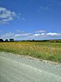
Farm scene from Okahukura Road, Tāpora
-

Okahukura Road near the Junction with Journey's End, Tāpora
