Rodney District facts for kids
Quick facts for kids
Rodney District
|
|
|---|---|
|
Former local government area
|
|
 |
|
| Country | New Zealand |
| Island | North Island |
| Region | Auckland Region |
| Area | |
| • Land | 2,427.01 km2 (937.07 sq mi) |
| Extent | Muriwai to Hibiscus Coast; south to Helensville |
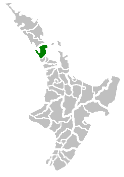
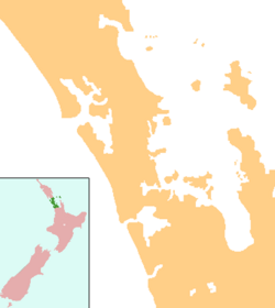
Rodney District was a special area in the northern part of New Zealand's Auckland Region. It was like a local government area, which means it had its own council that helped manage things for the people living there. This district also included a beautiful place called Kawau Island.
Rodney District was created in 1989. It was formed by joining two smaller areas: Helensville Borough and Rodney County. The main office for the Rodney District Council was in a town called Orewa. Both Rodney District and Rodney County got their names from Cape Rodney. This cape is a piece of land that sticks out into the sea, right across from Little Barrier Island. Captain James Cook named it on November 24, 1769. He named it after a famous naval leader, Admiral Sir George Brydges Rodney.
What Happened to Rodney District?
The Auckland Council now manages the area that was once Rodney District. This change happened on November 1, 2010. The land area of the old district is mostly covered by the Rodney ward of the Auckland Region today. However, some parts, like the Hibiscus Coast and Orewa (where the council office used to be), are now part of the Albany ward.
Before it became part of Auckland Council, Rodney District had a leader called a mayor. The last mayor was Penny Webster. She worked with 12 councillors to make decisions for the district.
Leaders of Rodney District
During its 21 years of existence, Rodney District had four different mayors. A mayor is like the main leader of a city or district. They help make important decisions and represent the people living there.
| Number | Name | Years in Office |
|---|---|---|
| 1 | Gordon Mason | 1989–1992 |
| 2 | Doug Armstrong | 1992–2000 |
| 3 | John Law | 2001–2007 |
| 4 | Penny Webster | 2007–2010 |
 | John T. Biggers |
 | Thomas Blackshear |
 | Mark Bradford |
 | Beverly Buchanan |


