
Hibiscus Coast facts for kids
Quick facts for kids
Hibiscus Coast
|
|
|---|---|
|
Suburban area
|
|
|
|
|

Hibiscus Coast
Location in Auckland
|
|
| Country | New Zealand |
| Island | North Island |
| Region | Auckland |
| Electoral ward | Albany Ward |
| Local board | Hibiscus and Bays |
| Electorate | Whangaparāoa Te Tai Tokerau |
| Area | |
| • Total | 49.38 km2 (19.07 sq mi) |
| Population | |
| • Estimate
(June 2023)
|
64,660 |
| Time zone | UTC+12 (NZST) |
| • Summer (DST) | UTC+13 (NZDT) |


The Hibiscus Coast is a lively area on the coast of the Hauraki Gulf in New Zealand. It's part of the Auckland Region. This area is home to many people, making it one of the biggest urban areas in New Zealand. It's also the second largest in the Auckland Region, right after Auckland city itself.
The Hibiscus Coast includes places like Hatfields Beach, Orewa, Silverdale, and the Whangaparāoa Peninsula. Some nearby communities like Waiwera and Stillwater are also considered part of this area.
Māori people have lived here for a very long time, since at least the 1200s. They used the rivers and bays for food and travel. Later, European settlers arrived, drawn by the forests and hot springs. The area became popular for logging and as a tourist spot.
In the 1920s, people started building holiday homes, called baches, in Orewa and on the Whangaparāoa Peninsula. During World War II, a military base was built there. The area grew quickly in the 1950s and 1960s, especially after the Auckland Harbour Bridge opened. Today, it's a popular place to live and visit.
Contents
- Where is the Hibiscus Coast located?
- How did the Hibiscus Coast get its name?
- What is the history of the Hibiscus Coast?
- Who are some famous people from the Hibiscus Coast?
- What can you do for fun on the Hibiscus Coast?
- What schools are on the Hibiscus Coast?
- How do people travel around the Hibiscus Coast?
- What is the weather like on the Hibiscus Coast?
- What sports can you play on the Hibiscus Coast?
- Images for kids
Where is the Hibiscus Coast located?

The Hibiscus Coast is in the northern part of the Auckland Region. It stretches between the Waiwera River in the north and the Ōkura River in the south. It sits right next to the beautiful Hauraki Gulf.
This area includes the Whangaparāoa Peninsula and Tiritiri Matangi Island. Tiritiri Matangi Island is about 3.4 kilometers east of the peninsula. Key towns and villages here are Orewa, the Whangaparāoa Peninsula, Silverdale, Stillwater, Hatfields Beach, and Waiwera.
Six rivers, estuaries, and streams flow through the area. These include the Waiwera Estuary, Ōtānerua Stream, Nukumea Stream, Ōrewa River, Weiti River, and Ōkura River.
The beaches here are mostly sandy and gently sloped. They are great for sunbathing, swimming, and water sports. Red Beach and Orewa are good for beginner surfers. Other beaches are perfect for families.
Tiritiri Matangi Island is a special open sanctuary. It's the largest island on the Hibiscus Coast. You can find it near the Shakespear Regional Park. Mahurangi Island is smaller and sits near the Waiwera River. It's part of the Wenderholm Regional Park. The tiniest island is Kotanui Island, also called Frenchman's Cap. It's located between Matakatia and Gulf Harbour Marina.
Before Europeans arrived, the inland areas were covered in thick forests. These forests had many kauri trees. The upper Ōrewa River area was a wetland. By the mid-1800s, the Whangaparāoa Peninsula had lost its forests. It was mostly covered in mānuka scrub and swamps.
How did the Hibiscus Coast get its name?

The name Hibiscus Coast came about in the early 1960s. Business people from Whangaparāoa and Orewa wanted a name for their growing area. They chose "hibiscus" because it made them think of beaches and holidays.
The hibiscus is not a native New Zealand flower. However, it was also the name of a mineral bath at the Waiwera Hot Pools long ago. The Hibiscus Coast Association was formed in the 1960s. They worked to make sure other regions didn't use the hibiscus as their symbol. The name became official in 1971. This happened when the Whangaparaoa Riding was renamed the Hibiscus Coast Riding.
In the Māori language, Hibiscus Coast is called Te Kūiti o te Puarangi. This name refers to puarangi, which is a rare native hibiscus plant.
What is the history of the Hibiscus Coast?
Early Māori Settlement
The Hibiscus Coast has been settled since at least the 1200s. The first Māori people here were often called Ngā Oho. The wider area, between the Ōrewa and Mahurangi Rivers, was known as Mahurangi. This name came from a pā (fortified village) at the mouth of the Waiwera River.
Many old Māori sites are found at Karepiro Bay, the Ōrewa River estuary, and Shakespear Regional Park. The Ōrewa River estuary was a safe harbor. It provided seafood like shellfish and flounder. It also connected to inland walking paths. The Tainui canoe visited Whangaparāoa in the 1300s. Tahawhakatiki, from the Arawa canoe, also settled here.
The Whangaparāoa Peninsula was an important travel route. People traveling between Northland and Auckland often stopped here. There were also portages. These were places where canoes could be carried overland between waterways. This connected the Hibiscus Coast to the Kaipara Harbour in the west.
The Arrival of Maki
Around the 1600s, a warrior named Maki came to the Auckland Region. He united many Tāmaki Māori tribes. These included tribes from the North Shore and Hibiscus Coast. They became known as Te Kawerau ā Maki. After Maki passed away, his sons settled different areas. They formed new family groups, called hapū. These included Ngāti Manuhiri, Ngāti Maraeariki, Ngāti Poataniwha, and Ngāti Kahu.
Ngāti Kahu settled at Te Haruhi Bay, which is now Shakespear Regional Park. They also had a strong defensive pā called Rarowhara. This pā was located at the eastern end of the Weiti River. Other pā were built around the area. These included sites near the Waiwera hot spring and at Big Manly Beach.
Shark Fishing and Conflicts
The Hibiscus Coast was important for shark fishing. This fishing area was between Kawau Island and the Whangaparāoa Peninsula. Different tribes often fought over who controlled this valuable resource. By the mid-1700s, Marutūāhu tribes, especially Ngāti Pāoa, wanted control. Ngāti Pāoa built a pā on Tiritiri Matangi Island for their fishing trips.
Wars between Ngāti Pāoa and Ngāti Kahu lasted until the 1790s. Rarowhara Pā was attacked but successfully defended by Ngāti Kahu. During this time, the Kawerau-descended hapū owned the land. However, fishing rights were shared with Marutūāhu tribes.
In 1821, during the Musket Wars, a Ngāpuhi war party attacked. They defeated the Kawerau-descendant tribes. Rarowhara Pā was taken. Survivors fled but gradually returned in the 1830s. Ngāti Kahu continued to live at Whangaparāoa until the 1870s.
Early European Settlement
.jpg)
.jpg)
.jpg)
The French explorer Jules Dumont d'Urville visited the Hibiscus Coast in 1827. The first known European to land here was a missionary in 1833. Timber merchants soon came to the Weiti River area.
After the Treaty of Waitangi was signed in 1840, the Crown bought land here in 1841. Some Māori tribes were not involved in these land deals. This caused problems for tribes like Ngāti Manuhiri.
Logging grew in the 1840s. A settlement called The Wade (now Silverdale) was built around 1853. It became a busy logging town. The first permanent settler along the Weiti River was John Robey Cole Hatfield in 1844. By 1853, about 200 to 300 people lived in The Wade. The Wade Hotel was a social hub, but it had a bad reputation. Silverdale School, then called Wade School, opened in 1869. It was the first school on the Hibiscus Coast.
In 1844, Robert Graham built a house near the Waiwera Hot Pools. He promoted the hot pools as a tourist spot from 1848. A hotel was built there in 1864. Ferry services ran from Auckland to the hotel by 1878. The Tiritiri Matangi Lighthouse was built in 1864. It is New Zealand's oldest working lighthouse.
In 1856, Captain Isaac Rhodes Cooper built Orewa House. It became a guest house in 1906.
The Early 1900s
As kauri gum became harder to find, land in Orewa was used for orchards. They grew apples, pears, grapes, and citrus fruits. By the early 1900s, dairy farming became popular. This led to higher land prices. By the 1920s, dairy farms replaced the orchards. In 1911, The Wade was renamed Silverdale because of its poor reputation.
Orewa became a popular place for campers and holidaymakers in the 1920s. The first holiday homes, called baches, were built on Whangaparāoa. Small coastal communities grew around each bay.
By the 1930s, roads improved, so coastal steamers were used less. In 1939, the Waiwera Hotel burned down.
During World War II, a military base was built at the end of the Whangaparāoa Peninsula. This was to defend against a possible Japanese invasion. Many pillboxes and army barracks were built. By 1961, most military equipment was removed. The base is still active today as the RNZN Tamaki Training Centre.
Suburban Growth
.jpg)
In the 1950s, Orewa and the Whangaparāoa Peninsula were divided for housing. Orewa's town center opened in 1953, followed by Whangaparāoa's in 1957. The Hibiscus Coast grew rapidly in the 1960s. This was thanks to the opening of the Auckland Harbour Bridge. Orewa and western Whangaparāoa became urbanized between 1964 and 1975. The eastern Whangaparāoa peninsula developed later, in the late 1980s.
The Orewa Skating Rink was built in 1957. It became a fun entertainment spot in the 1960s, with mini-golf and concerts. It was taken down in 1983.
In the mid-1960s, local business people formed the Hibiscus Coast Association. They wanted to create a shared identity for the area. Over 1,000 hibiscus trees were planted in 1964. By the end of the 1960s, the peninsula had about 2,000 permanent residents. This number swelled to over 25,000 in the summer.
In 1965, Wenderholm Regional Park opened. It was Auckland's first new regional park. Shakespear Regional Park followed in 1967.
By the 1980s, large housing developments were built on the Whangaparāoa Peninsula. The Centrestage Theatre opened in Orewa in 1990.
On December 20, 1999, the Auckland Northern Motorway was extended to Silverdale. This greatly improved travel to Auckland city. In 2004, the Nautilus, a 12-story apartment building, was finished in Orewa. It's the only high-rise on the Hibiscus Coast. Silverdale also grew quickly in the early 2000s.
The Waiwera Hot Pools closed in 2018 for renovations but never reopened. The old water park was torn down in 2023.
During the early COVID-19 pandemic in New Zealand in 2020, New Zealanders returning from Wuhan quarantined at the Whangaparāoa Naval Base.
In late 2022, construction began on O Mahurangi Penlink. This new motorway will connect the Auckland Northern Motorway to the Whangaparāoa Peninsula. It will cross the Weiti River at Stillwater. This road is expected to open in 2026. Future development areas include the Highgate Business Park and Weiti Lands.
Who are some famous people from the Hibiscus Coast?
- Russell Coutts – a world-famous sailing champion. He lives on the Hibiscus Coast and is president of the Manly Sailing Club.
- Janet Frame – a well-known author. She lived at Whangaparāoa near Shakespear Regional Park in the 1970s.
- Edmund Hillary – a famous mountaineer and explorer. His family had a holiday home in Orewa. Hillary Square was named after him in 1953.
- Robert Muldoon – a former Prime Minister of New Zealand. He owned a holiday home in Hatfields Beach.
What can you do for fun on the Hibiscus Coast?

The Hibiscus Coast has many beautiful beaches that attract people. Other fun places to visit include:
- Snowplanet: An indoor ski slope.
- Auckland Adventure Park: A park with exciting rides and activities.
- Orewa Beach: A popular beach for swimming and relaxing.
- Shakespear Regional Park: A great place for walking and enjoying nature.
- Gulf Harbour: A marina area.
- Tiritiri Matangi Island: A wildlife reserve you can visit by ferry from Gulf Harbour.
What schools are on the Hibiscus Coast?

Primary Schools
- Gulf Harbour School (opened 1998)
- KingsWay School - Junior Campus (Christian school, opened 1986)
- Nukumea Primary School (opened 2023)
- Orewa Beach Primary School (opened 1978)
- Orewa Primary School (opened 1956)
- Red Beach Primary (established 1989)
- Silverdale Primary School (oldest school, founded 1869)
- Stanmore Bay Primary
- Wentworth Primary (private school, opened 2008)
- Whangaparāoa Primary
Secondary Schools
- Orewa College (formed 1974)
- Wentworth College (private school, started 2003)
- Whangaparaoa College (formed 2005)
- KingsWay School - Senior Campus (Christian school, opened 1992)
How do people travel around the Hibiscus Coast?

Roads
The Northern Motorway (State Highway One) marks the inner edge of the Hibiscus Coast. It was extended to Orewa in the late 1990s. In 2009, it was extended further to Puhoi, creating the Northern Gateway Toll Road.
The Hibiscus Coast Highway connects State Highway One at Silverdale to Puhoi. It goes through Orewa and Hatfields Beach. This road used to be part of State Highway 17 and then State Highway One. Now it helps local growth.
O Mahurangi Penlink is a new road being built. It will connect State Highway One to Stillwater and Stanmore Bay. This road will cross the Weiti River. It is expected to open in 2026.
Buses
AT Metro operates local bus routes across the Hibiscus Coast. Urban Rapid Transit buses run from the Hibiscus Coast Busway Station. They connect the coast to central Auckland and Warkworth. InterCity services also stop at the Hibiscus Coast Busway Station.
Ferries
Auckland Transport commuter ferries are run by Fullers360. They travel between Gulf Harbour and Downtown Auckland on weekdays. For tourists, Explore operates ferries from Gulf Harbour to Tiritiri Matangi Island. These run all year round.
What is the weather like on the Hibiscus Coast?
The Hibiscus Coast has a warm, mild oceanic climate. This means it has mild temperatures all year.
| Climate data for Whangaparāoa (2010-2020) | |||||||||||||
|---|---|---|---|---|---|---|---|---|---|---|---|---|---|
| Month | Jan | Feb | Mar | Apr | May | Jun | Jul | Aug | Sep | Oct | Nov | Dec | Year |
| Record high °C (°F) | 28.65 (83.57) |
27.66 (81.79) |
26.68 (80.02) |
22.72 (72.90) |
20.75 (69.35) |
17.78 (64.00) |
16.8 (62.2) |
17.78 (64.00) |
19.76 (67.57) |
21.74 (71.13) |
22.72 (72.90) |
26.68 (80.02) |
28.65 (83.57) |
| Mean daily maximum °C (°F) | 21.66 (70.99) |
22.25 (72.05) |
20.94 (69.69) |
18.93 (66.07) |
16.69 (62.04) |
14.7 (58.5) |
13.61 (56.50) |
13.97 (57.15) |
14.61 (58.30) |
16.19 (61.14) |
18.07 (64.53) |
20.71 (69.28) |
17.65 (63.77) |
| Daily mean °C (°F) | 19.89 (67.80) |
20.33 (68.59) |
19.12 (66.42) |
17.32 (63.18) |
15.31 (59.56) |
13.54 (56.37) |
12.29 (54.12) |
12.54 (54.57) |
13.11 (55.60) |
14.52 (58.14) |
16.34 (61.41) |
18.45 (65.21) |
16.06 (60.91) |
| Mean daily minimum °C (°F) | 16.63 (61.93) |
17.28 (63.10) |
16.38 (61.48) |
15.19 (59.34) |
13.47 (56.25) |
11.94 (53.49) |
10.54 (50.97) |
10.66 (51.19) |
10.9 (51.6) |
11.87 (53.37) |
13.12 (55.62) |
15.27 (59.49) |
13.6 (56.5) |
| Record low °C (°F) | 11.86 (53.35) |
11.86 (53.35) |
10.87 (51.57) |
10.87 (51.57) |
4.94 (40.89) |
5.93 (42.67) |
5.93 (42.67) |
3.95 (39.11) |
4.94 (40.89) |
5.93 (42.67) |
4.94 (40.89) |
10.8 (51.4) |
3.95 (39.11) |
| Average rainfall mm (inches) | 85.35 (3.36) |
92.54 (3.64) |
96.2 (3.79) |
116.12 (4.57) |
143.69 (5.66) |
157.72 (6.21) |
132.52 (5.22) |
144.99 (5.71) |
135.34 (5.33) |
85.51 (3.37) |
98.28 (3.87) |
103.59 (4.08) |
115.99 (4.57) |
| Average rainy days | 9.07 | 11.05 | 11.59 | 13.2 | 15.18 | 15.45 | 15.26 | 17.15 | 15.81 | 13.29 | 12.21 | 11.5 | 13.4 |
| Source: Weather and Climate | |||||||||||||
What sports can you play on the Hibiscus Coast?

Bowling
The Hibiscus Coast has two outdoor lawn bowling clubs. One is in Orewa, and the other is in Manly.
Football
The Hibiscus Coast AFC is an amateur football club. It was founded in 1974 and is based in Stanmore Bay. They play in the Lotto Sport Italia NRFL Division 2.
Golf
The Hibiscus Coast used to have three golf clubs. Now, only the Whangaparaoa Golf Club is open. It opened in the 1950s in Army Bay. The former Peninsula Golf Course closed in 2014 to make way for housing.
The Gulf Harbour Country Club opened in 1997. It hosted the 1998 World Cup of Golf. It also hosted the New Zealand Open in 2005 and 2006. The club closed in July 2023.
Netball
The Hibiscus Coast Netball Centre has six netball courts. It is located in Manly, at Edith Hopper Park. The Silverdale Seahawks Netball Club was started in 2009.
Rugby
Rugby Union
The Silverdale United Rugby Club is a rugby union club in Silverdale. It was established in 1887. During the 2011 Rugby World Cup, the Silverdale War Memorial Park hosted teams from Japan, Namibia, and Samoa.
Rugby League
The Hibiscus Coast Raiders rugby league club is based in Stanmore Bay. They are part of the Auckland Rugby League. They compete in the Fox Memorial Championship.
Sailing
The Hibiscus Coast has two Yacht and Sailing Clubs. The Gulf Harbour Yacht Club is in Gulf Harbour. The Manly Sailing Club is on Big Manly Beach. Both clubs host many sailing events. The Manly Sailing Club offers "Learn to Sail" programs.
Surf Life Saving
Two Hibiscus Coast beaches, Orewa and Red Beach, have lifeguards in summer. The Orewa Surf Lifesaving Club started in 1950. The Red Beach Surf Life Saving Club formed in 1953.
Auckland Surf Park is a planned artificial surfing lagoon. It is set to open between 2026 and 2027 in nearby Dairy Flat.
Tennis
The Silverdale Tennis Club is in the Silverdale War Memorial Park. There are two tennis clubs in Manly. Another tennis club is in Victor Eaves Park, Orewa.
Images for kids
-
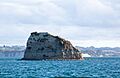
Kotanui Island

