Orewa facts for kids
Quick facts for kids Orewa |
|
|---|---|
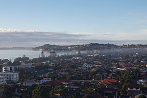
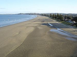
Orewa township, looking south towards the Whangaparāoa Peninsula
|
|
| Basic information | |
| Local authority | Auckland |
| Electoral ward | Albany ward |
| Local board | Hibiscus and Bays |
| Land area | 716 ha (2.76 sq mi)* |
| Coordinates | 36°35′06″S 174°41′42″E / 36.585°S 174.695°E |
| Population | 12330 (June 2023) |
| Postcode(s) | 0931, 0932 |
|
|
||
Orewa (Māori: Ōrewa) is a town in the northern Auckland Region of New Zealand. It's part of the Hibiscus Coast, located just north of the Whangaparāoa Peninsula. Orewa is about 40 kilometers (25 miles) north of central Auckland. The main highway, State Highway 1, passes close to Orewa.
Māori people, called Tāmaki Māori, first settled in the Orewa area a long time ago, around the 1200s. They used the resources from the Ōrewa River and Whangaparāoa Bay. An important place for catching sharks was also located here. Later, a warrior named Maki brought many Tāmaki Māori groups together. His son, Maraeariki, settled along the Ōrewa River. Māori groups, including Ngāti Kahu, lived in Orewa until the mid-1800s.
Europeans started coming to Orewa in the 1840s and 1850s. Some were kauri loggers, cutting down large trees, and others were kauri gum diggers, collecting resin from the ground. Orewa House was built in 1856 and became a family home for many years. It later turned into a guesthouse. In the 1920s, Orewa became a popular spot for people to go camping and enjoy holidays.
Orewa grew quickly in the 1950s and 1960s, especially after the Auckland Harbour Bridge opened, making it easier to travel from Auckland. The town center and Hillary Square were developed in 1953. Orewa continued to grow in the 1980s and 2000s. From 1989 to 2010, it was the main office for the Rodney District. In 2004, Orewa was in the news when a politician named Don Brash gave a speech there about how different groups of people in New Zealand get along.
Contents
Exploring Orewa's Landscape and Location
Orewa is a town right by the sea on the Hibiscus Coast. It's located on the northern side of the Ōrewa River. Ōrewa Beach stretches along the eastern edge of the town. This beach is one of the main beaches in Whangaparāoa Bay. The highest point in Orewa is a 134-meter (440-foot) hill in the Nukumea Scenic Reserve.
To the north of Orewa, across the Nukumea Stream, is Hatfields Beach. To the south, towards the Whangaparāoa Peninsula, you'll find Red Beach. The areas of Highgate and Millwater are located to the southwest.
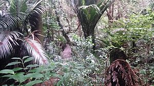
Before people settled here, Orewa was mostly covered in kauri forests. By the 1840s, Orewa beach had many sandhills. The Alice Eaves Scenic Reserve in Orewa still has some of these old kauri forests, including one tree that is thought to be over 300 years old.
The Name of Orewa
The name Orewa first described the Ōrewa River and its estuary (where the river meets the sea). Later, Europeans started using the name for the beach and the town. The meaning of the Māori name Ōrewa isn't fully known. However, it might be a shorter version of Te Wai-o-Rewa, which means "The Waters of Rewa." Rewa was an important Māori leader from the Kawerau group. People have been calling the river Ōrewa in English since at least the 1840s.
Orewa's Early History
Māori Settlement and Life
The Hibiscus Coast area has been lived in since at least the 1200s. Many of the first Māori people here were known as Ngā Oho. The wider area between the Ōrewa River and Mahurangi River was traditionally called Mahurangi. This name came from a pā (a fortified village) located at the mouth of the Waiwera River.
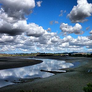
The Ōrewa River estuary has many old archaeological sites. It was an important safe harbor where people could find shellfish and flounder. It also connected to walking paths further inland. Māori used waka (canoes) and sometimes carried them overland between waterways. This allowed them to travel between the Hibiscus Coast and the Kaipara Harbour in the west.
Around the 1600s, a warrior named Maki came to the Auckland Region. He brought together many Tāmaki Māori tribes, including those on the North Shore and Hibiscus Coast. After Maki passed away, his sons settled in different areas, forming new family groups called hapū. These included Ngāti Manuhiri, Ngāti Maraeariki, Ngāti Poataniwha, and Ngāti Kahu on the wider Hibiscus Coast.
Maki's younger son, Maraeariki, mainly settled at the top of the Ōrewa River. An island in the river was named Te Motu-o-Marae-Ariki in his memory. His hapū, Ngāti Maraeariki, eventually lived in lands between Whangaparāoa and Ōmaha. By the mid-1700s, other Māori tribes from the Hauraki Gulf wanted to control the shark fishing in Whangaparāoa Bay. They fought against Ngāti Kahu, a hapū based on the Whangaparāoa Peninsula. During this time, the hapū descended from Kawerau had special rights to the land on the Hibiscus Coast. However, fishing rights were shared between Ngāti Kahu and the Marutūāhu tribes.
Orewa has two known pā sites, which were defensive villages. Nukuhau Pā is in the Alice Eaves Scenic Reserve, above the Nukumea Stream. The second is Orewa South Bridge Pa, at the southern entrance of the Orewa estuary. Some traditional names for the area include Nukumea, Wahakataka, and Te Rua Taniwha. Te Rua Taniwha is linked to a story about an ancestor who defeated a taniwha (a mythical water creature) there.
In 1821, during a time of tribal wars, a war party from Ngāpuhi came south. The Kawerau-descendant tribes were defeated, and many survivors went to the Waikato region. They slowly returned in the 1830s. After returning, Ngāti Kahu formed new family ties with Ngāti Whātua o Kaipara. They would move between Orewa, Te Haruhi Bay, and Ōkura depending on the season. In 1853, a settlement called Poaheke was recorded at the mouth of the Ōrewa River. Ngāti Kahu continued to live in Whangaparāoa until the 1870s.
Early European Settlers and Holidays
In the late 1830s, early kauri timber merchants were interested in the Weiti River area south of Orewa. The Ōrewa River area was also used for logging, but less so. Because of the old kauri forests, Orewa was a place where kauri gum diggers came to collect the resin. They worked in the area until the early 1900s.
After the Treaty of Waitangi was signed in 1840, the New Zealand government bought land in the Mahurangi and Omaha areas in 1841. This included Orewa. Some Māori tribes were involved in these sales, but others, like Te Kawerau ā Maki, were not. This meant that some Māori groups lost their land on the Hibiscus Coast.
The first European person to live permanently in Orewa was probably John Ryan, a sawyer and boat builder. He bought land in 1854 but had been living there since the 1840s. In the early 1850s, the Brunton family bought land near the Orewa waterfall. They built a home and a jetty. The Brunton family built a bridge in 1880, and their house was also home to the Orewa Falls post office.
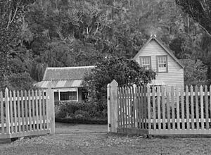
In 1856, Captain Isaac Rhodes Cooper built Orewa House. In 1868, the de Jersey Grut family, who had moved from the Channel Islands, bought it. Orewa House was their family home for three generations. In 1906, it became a guesthouse. By the late 1880s, the main road to Auckland changed. So, the de Grut family built their own road to Waiwera.
In the late 1800s, as kauri gum became harder to find, land in Orewa was used for orchards. People grew apples, pears, grapes, and citrus fruits to sell in Auckland. In the 1920s, dairy farms slowly replaced the orchards as fruit growing became less profitable.
In 1918, Francis Hitchins bought the de Grut farm. He sold Orewa House to Alice and Edward Eaves in 1919. Hitchins tried to divide the farm into smaller sections, but not many people bought them. So, he sold the farm to Dr. E. B. Gunson in the mid-1920s. Orewa became a very popular place for campers and holidaymakers in the 1920s. This made Orewa House very popular. By the 1930s, roads had improved, so coastal steamers were no longer the main way to travel. In the 1940s, Orewa Hall was built, where movies were shown to the community.
Orewa's Modern Growth
Suburban Development and Community
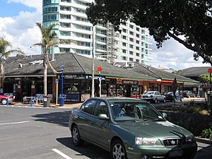
Orewa was divided into sections for suburban houses in the 1950s. The Orewa town center was built in 1953. It included shops and Hillary Square. The square is named after Sir Edmund Hillary, who was a famous New Zealand explorer. His family had a holiday home in Orewa, where he stayed in the summers during the 1930s. During this time, the Orewa Surf Life Saving Club started in 1950, and the Orewa Bowling Club in 1952. In 1957, the Orewa Skating Rink was built. This rink became a fun place for entertainment in the 1960s, with mini-golf and concerts. The rink was taken down in 1983.
Orewa saw a big increase in building and population in the 1960s. This was because the Auckland Harbour Bridge opened, making it much easier to get to the city. Orewa quickly became more urban between 1964 and 1975. In 1966, the Alice Eaves Scenic Reserve was created on land next to Orewa House. The Eaves family gave the land to the local council after Alice Eaves passed away. In the same year, the Orewa Picture Theatre was built near Hillary Square.
In 1968, Alan Horobin opened Orewa Marineland. It was a home for rescued animals like chimpanzees, llamas, seals, dolphins, and a sea elephant named Sid. Marineland closed in 1978. The Orewa Combined Business Association was formed in 1970. The Orewa Community Centre was built in 1972. New developments on the northern side of the Ōrewa River began in 1983 and continued in 1995.
A 2.5-meter (8.2-foot) concrete statue of Sir Edmund Hillary was put in Hillary Square in 1983. Over time, the statue wore down. It was replaced with a bronze statue in 1991. In 1990, the Centrestage Theatre was developed in Orewa by a group called the United Players.
By the late 1990s, the Auckland Northern Motorway was extended to Orewa. This created a very important link for the area to Auckland city. In 2004, a 12-story apartment building called the Nautilus was finished in Orewa. It is the only tall building on the Hibiscus Coast and is home to over 300 people.
Orewa made political news on January 27, 2004. The leader of the National Party, Don Brash, gave a speech there. It was called the Orewa Speech. In his speech, he talked about how different groups of people in New Zealand should be treated equally.
In 2008, Kensington Park, which used to be the Orewa Caravan Park, was turned into a new housing area.
Orewa's Population and People
Orewa covers 7.16 square kilometers (2.76 square miles). It has an estimated population of 13,107 people as of 2023. This means there are about 1,831 people living in each square kilometer.
| Historical population | ||
|---|---|---|
| Year | Pop. | ±% p.a. |
| 2006 | 7,371 | — |
| 2013 | 8,586 | +2.20% |
| 2018 | 10,242 | +3.59% |
| 2023 | 13,107 | +5.06% |
| The 2006 population is for a smaller area of 6.80 km2. | ||
In the 2023 New Zealand census, Orewa had 13,107 people. This was a big increase of 2,865 people (28.0%) since the 2018 census. The average age in Orewa was 51.4 years. About 14.4% of the people were under 15 years old, and 34.6% were 65 or older.
Most people in Orewa are of European descent (81.4%). There are also Māori (6.4%), Asian (15.2%), and Pasifika (2.6%) people. English is spoken by 96.4% of the people. About 39.8% of the people in Orewa were born outside New Zealand.
When it comes to religion, 41.9% of people identified as Christian. About 46.1% said they had no religion.
Learning in Orewa
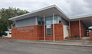
Orewa District High School was started in 1956. In 1974, it was split into two separate schools: Orewa School and Orewa College. Orewa Beach School opened in 1978 (it was first called Orewa North School). Another primary school opened in Red Beach to the south in 1988.
Orewa College is a secondary school for students in years 7 to 13. It has about 2,056 students.
Orewa School and Orewa Beach School are primary schools for students in years 1 to 6. Orewa School has about 540 students, and Orewa Beach School has about 475 students.
All three schools welcome both boys and girls. The student numbers are from November 2023.
 | James B. Knighten |
 | Azellia White |
 | Willa Brown |


