Te Hāpua / Sutherland Sound facts for kids
Quick facts for kids Te Hāpua / Sutherland Sound |
|
|---|---|
| Location | Tasman Sea |
| Coordinates | 44°44′S 167°34′E / 44.73°S 167.57°E |
| Native name | Te Hāpua Error {{native name checker}}: parameter value is malformed (help) |
| River sources | Light River, Dark River |
| Basin countries | New Zealand |
| Max. length | 10 km (6.2 mi) |
| Max. width | 1 km (0.62 mi) |
Te Hāpua / Sutherland Sound is a beautiful fiord located on the South Island of New Zealand. A fiord is like a long, narrow arm of the sea that reaches inland, surrounded by tall cliffs. This fiord is special because it is the smallest one in the amazing Fiordland area. It also has a unique entrance with a large sandbar, which is a shallow area of sand.
Contents
About Te Hāpua / Sutherland Sound
Te Hāpua / Sutherland Sound is one of many stunning fiords found along the coast of Fiordland. It is known for being the smallest of these natural wonders. What makes it even more unique is that it has limited access to the open sea. This is because a large sandbar sits at the entrance to its narrower part.
Where is Te Hāpua Located?
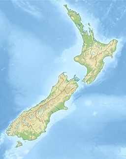
This fiord is the second most northerly of the fiords in the region. It is about 22 kilometers (14 miles) southwest of Milford Sound. It is also about 8 kilometers (5 miles) northeast of Hāwea / Bligh Sound. Its location makes it a quiet and less visited part of the Fiordland coast.
How Big is This Fiord?
Te Hāpua / Sutherland Sound stretches for about 10 kilometers (6 miles) in length. It is roughly 1 kilometer (0.6 miles) wide. Two rivers, the Light River and the Dark River, flow into the eastern end of the fiord. These rivers bring fresh water into the salty sea water of the fiord.
History and Naming
The fiord was first named Sutherland Sound. It was named after an explorer called Donald Sutherland. He visited this fiord way back in 1883.
In October 2019, the official name of the fiord was changed. It is now known as Te Hāpua / Sutherland Sound. This new name includes the Māori name "Te Hāpua," which is important to the local culture and history of New Zealand.
 | Madam C. J. Walker |
 | Janet Emerson Bashen |
 | Annie Turnbo Malone |
 | Maggie L. Walker |


