
Telford Parliamentary church facts for kids
The Telford Parliamentary churches, also known as the Telford Kirks, are a group of Presbyterian churches in Scotland. They were built with money from the parliament of the United Kingdom. This funding came from the Church of Scotland Act 1824, which provided a grant of £50,000. These churches were designed by surveyor William Thomson and built by the famous Scottish engineer and architect Thomas Telford. In total, 32 churches were constructed. Many of them are still used today, while others have been changed into homes or are no longer standing.
History of the Churches
At the start of the 1800s, there weren't enough churches in Britain, especially in the Scottish Highlands. Many people lived far from their local church, making it hard for them to attend services regularly. This was seen as a problem by the Church of Scotland and the government.
After the Napoleonic Wars, the British Parliament decided to give money to build churches. In 1819, £1,000,000 was given, and another £500,000 in 1824, for churches in England. This was a way to show thanks for winning the wars. Many "Commissioners' Churches" were built or fixed up in England.
A similar plan for the Church of Scotland was much smaller. After many delays, only £50,000 was given for the whole of the Highlands in 1824. This was a small amount compared to what England received. The plan was to build no more than 30 churches with homes for the ministers (called manses). Each church and manse could cost no more than £1500.
The job of choosing where to build these churches and managing the construction went to the Commissioners for Building Highland Roads and Bridges. Their main surveyor was Thomas Telford. Local landowners, called heritors, had to ask for a new church and provide the land. By 1826, sites were chosen for 32 churches and 41 manses. Some places already had a church but needed a manse.
How the Churches Were Designed
Between 1823 and 1830, Thomas Telford was in charge of building these churches across the Highlands, from Islay to the Shetland islands. He created standard plans and designs for the buildings. These plans were based on an idea from one of his surveyors, William Thomson.
Thomson had asked his surveyors to design a church and manse that would fit a certain budget and be strong enough to handle stormy weather. The designs chosen were from William Thomson and were quite simple.
Each church had a basic rectangular shape or a T-shape. They all had a small bell tower. In the rectangular churches, tall windows were placed on the side walls. For the T-shaped churches, an extra part was built at the back, with windows on the side walls of that extension. The windows were all the same size and design, so they could be made in advance by James Abernethy of Aberdeen. You can still see some of these original window frames in churches like Croick, Iona, and Ullapool. The doors also had a standard design with a four-centred arch for support.
Images for kids
-
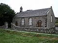
Acharacle Parish Church
-
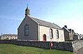
Ardgour Parish Church
-
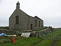
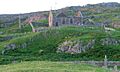
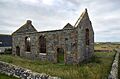
Berneray Church ruins
-
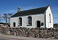
Carnoch Parliamentary Church
-
Croick Parish Church
-
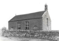
Cross Parish Church (demolished)
-
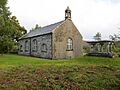
Duror Parish Church
-
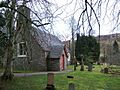
Old Church in Hallin
-
Iona Parish Church
-
Keiss Parish Church
-
Kinlochbervie Kirk
-
Kinlochluichart and Strathgarve Church
-
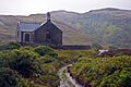
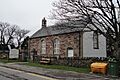
Kinlochspelve Church (now a house)
-
The Oa Parish Church, Risabus
-
Plockton Parish Church
-
Poolewe Parish Church
-
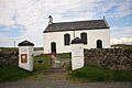
Portnahaven Parish Church
-
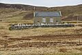
Quarff Parish Kirk
-
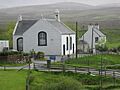
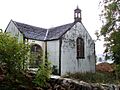
Shieldaig Parish Church
-
Skye, Staffin, Stenscholl Parish Church
-
Ruined Church, Stoer
-
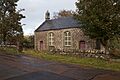
Strathy Parliamentary Church (now a house)
-
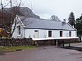
Strontian Church of Scotland
-
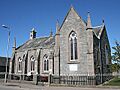
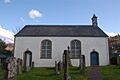
Tomintoul Parish Church
-
Truimsgarry Church (roof missing)
-
Lochbroom & Ullapool Parish Church (now Ullapool Museum)
-
St. Ewan's church on Ulva


.jpg)


_-_geograph.org.uk_-_1266656.jpg)

.jpg)


