Tetlin Junction, Alaska facts for kids
Quick facts for kids
Tetlin Junction
|
|
|---|---|
| Country | United States |
| State | Alaska |
| Census area | Southeast Fairbanks |
| Elevation | 1,745 ft (532 m) |
| Time zone | UTC-9 (Alaska (AKST)) |
| • Summer (DST) | UTC-8 (AKDT) |
| GNIS feature ID | 1410767 |
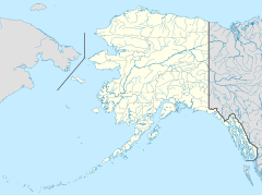
Tetlin Junction is a small, unincorporated community located in the Southeast Fairbanks Census Area in Alaska, United States. An "unincorporated community" means it's a place where people live together, but it doesn't have its own local government like a city or town. Instead, it's governed by the larger area around it.
This community is also known by other names, such as Forty Mile, Tetlin Center, or Tetling Junction.
About Tetlin Junction
Tetlin Junction sits at an elevation of 1,745 feet (which is about 532 meters) above sea level. It is located along the north bank of the Tanana River.
Where is Tetlin Junction?
The name "Tetlin Junction" comes from its important location. It's found where two major roads meet: the Alaska Highway and the Taylor Highway.
It is located:
- About 8 miles (13 km) east of Tok Junction.
- About 13 miles (21 km) north-northwest of Tetlin.
- About 11 miles (18 km) east-southeast of Tanacross.
How Tetlin Junction Got Its Name
The official spelling of the community's name, "Tetlin Junction," was decided by the United States Board on Geographic Names in 1950. This board helps make sure place names are spelled correctly and consistently across the United States.


