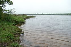
Thayer Lake (Keweenaw County, Michigan) facts for kids
Quick facts for kids Thayer Lake |
|
|---|---|
 |
|
| Location | Keweenaw County, Michigan |
| Coordinates | 47°17′18″N 88°16′00″W / 47.2882257°N 88.2667268°W |
| Primary inflows | Camp Creek and Finn's Creek |
| Primary outflows | Tobacco River (Keweenaw County, Michigan) |
| Surface area | 116 acres (47 ha) |
| Max. depth | 10 feet (3.0 m) |
| Surface elevation | 761 feet (232 m) |
Thayer Lake is a cool lake located in Keweenaw County, Michigan, in the United States. Sometimes people also call it Thayer's Lake or Finn's Lake. Its official name, Thayer Lake, has been used for a very long time, at least since 1897!
About Thayer Lake
Thayer Lake is a natural body of water that gets its water from streams and then flows out into a river. It's an important part of the local environment in Michigan.
Where is Thayer Lake?
This lake is found in the northern part of Michigan, specifically in Keweenaw County. This area is known for its beautiful natural landscapes and many lakes. Thayer Lake sits at an elevation of about 761 feet (which is about 232 meters) above sea level. Imagine being that high up!
How Big and Deep is it?
Thayer Lake covers an area of about 116 acres. To give you an idea, that's roughly the size of 88 football fields! While it's a good-sized lake, it's not super deep. The deepest part of Thayer Lake is about 10 feet (which is about 3 meters). That's roughly the height of a basketball hoop.
Water Flow: In and Out
Lakes often have water flowing into them and out of them. For Thayer Lake, water flows into it from two streams: Camp Creek and Finn's Creek. Think of these as the lake's water supply lines. Then, the water flows out of Thayer Lake into the Tobacco River (Keweenaw County, Michigan). This means the lake is always getting fresh water and staying healthy.
 | Delilah Pierce |
 | Gordon Parks |
 | Augusta Savage |
 | Charles Ethan Porter |


