The Rythe facts for kids
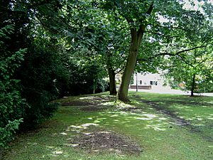
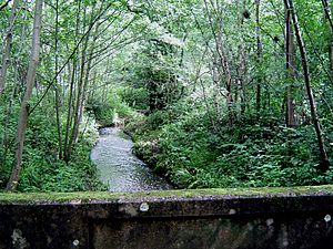
The Rythe is a small river or stream located in northern Surrey, England. For about half of its journey, it flows openly through natural woodlands. After that, it sometimes goes underground through pipes (this is called being culverted) or becomes part of suburban gardens. The Rythe flows between the towns of Thames Ditton and Long Ditton before finally joining the big Thames. Its longest branch is called the Arbrook, which helps drain the wooded area known as Arbrook Common, part of the larger Esher Commons.
Where Does the Rythe Flow?
The Rythe, sometimes also called the Wrythe, starts from several different places. The furthest starting points are four small streams found in Prince's Coverts, which is a woodland area. All these streams are located in the Oxshott area. On the northern edge of Oxshott, these streams join together to form the Arbrook.
The Arbrook then flows underneath the large six-lane A3 highway. It continues into the wooded Arbrook Common. Here, three more small streams join it from the nearby village of Claygate, which is to the east. The river then keeps flowing north, passing by Littleworth Common and Hinchley Wood. It reaches the Scilly Isles roundabout, which is near a small remaining part of the old Ditton Marsh, now in Esher.
After this, the Rythe follows the Portsmouth Road east through a part of Thames Ditton and runs alongside the South Western Main Line railway. It then meets a shorter branch that starts in Surbiton Golf Course in Long Ditton. Finally, the Rythe turns and flows into the River Thames near Ferry Road, about 800 meters north. The Rythe flows into the Thames just before Teddington Lock, marking the border between Surrey and London. Its very last section is in Thames Ditton.
What About the Rythe's Water Quality?
The Environment Agency is a group in England that checks how clean river systems are. They give each river an overall "ecological status," which tells us how healthy the river's environment is. This status can be one of five levels: high, good, moderate, poor, or bad.
To figure this out, they look at different things:
- Biological status: This checks the types and numbers of living things in the river, like tiny water bugs (invertebrates), flowering plants, and fish.
- Chemical status: This checks for different chemicals in the water and compares them to safe levels. The chemical status is either "good" or "fail."
Here's what the water quality of the Rythe was like in 2019:
| Section | Ecological Status |
Chemical Status |
Overall Status |
Length | Catchment | Channel |
|---|---|---|---|---|---|---|
| Rythe | Poor | Fail | Poor | 5.099 km (3.168 mi) | 20.04 km2 (7.74 sq mi) | Heavily modified |
As you can see from the table, in 2019, the Rythe's water quality was rated as "poor" overall. This means there are problems with both the living things in the river and the chemicals found in its water. The river's path is also "heavily modified," meaning humans have changed it a lot.
 | Georgia Louise Harris Brown |
 | Julian Abele |
 | Norma Merrick Sklarek |
 | William Sidney Pittman |


