Thomasville, Missouri facts for kids
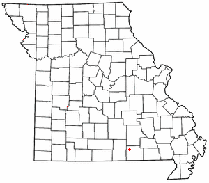
Thomasville is a small community in Oregon County, Missouri, in the United States. It's not a big city, but a quiet place where people live. You can find it about nine miles northwest of a town called Alton, right on Route 99. In 2020, only 23 people lived there.
Quick facts for kids
Thomasville
|
|
|---|---|
 |
|
| County | Oregon |
| State | |
| Area | |
| • Total | 0.38 sq mi (0.98 km2) |
| • Land | 0.37 sq mi (0.97 km2) |
| • Water | 0.01 sq mi (0.02 km2) |
| Elevation | 640 ft (200 m) |
| Population
(2020)
|
|
| • Total | 23 |
| • Density | 61.66/sq mi (23.78/km2) |
| Area code(s) | 573 |
| FIPS code | 29-73006 |
| GNIS feature ID | 2587117 |
A Look Back in Time
Thomasville was officially mapped out, or platted, in 1846. The community got its name from George Thomas, who was one of the first people to settle there. A post office, where people could send and receive mail, was opened in Thomasville in 1846. It stayed open for many years, finally closing in 1979.
Learning and Books
Even though it's a small place, Thomasville has a public library. It's called the Thomasville Branch library. This means people in the community can borrow books and learn new things.
Quick Facts
- Population: In 2020, Thomasville had 23 residents.
- Location: It is in northern Oregon County, Missouri.
- Elevation: The community is about 640 feet (195 meters) above sea level.
See also
 In Spanish: Thomasville (Misuri) para niños
 | Ernest Everett Just |
 | Mary Jackson |
 | Emmett Chappelle |
 | Marie Maynard Daly |

