
Oregon County, Missouri facts for kids
Quick facts for kids
Oregon County
|
|
|---|---|

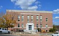
Oregon County Courthouse in Alton
|
|

Location within the U.S. state of Missouri
|
|
 Missouri's location within the U.S. |
|
| Country | |
| State | |
| Founded | February 14, 1845 |
| Named for | Oregon Territory |
| Seat | Alton |
| Largest city | Thayer |
| Area | |
| • Total | 792 sq mi (2,050 km2) |
| • Land | 790 sq mi (2,000 km2) |
| • Water | 1.7 sq mi (4 km2) 0.2% |
| Population
(2020)
|
|
| • Total | 8,635 |
| • Density | 10.903/sq mi (4.2096/km2) |
| Time zone | UTC−6 (Central) |
| • Summer (DST) | UTC−5 (CDT) |
| Congressional district | 8th |
Oregon County is a special area called a county in southern Missouri, a state in the United States. In 2020, about 8,635 people lived there. The main town, or county seat, is Alton. The county was officially started on February 14, 1845. It got its name from the Oregon Territory, which was a large area in the northwestern U.S. at that time.
Oregon County is famous for its beautiful nature. A big part of the Mark Twain National Forest is located here. This means Oregon County has more national forest land than any other county in Missouri! You can also find the Irish Wilderness here, which is the largest protected wilderness area in the state.
If you love being outdoors, there are many fun things to do. You can go hiking, backpacking, or horseback riding on the Ozark Trail and the White's Creek Trail. For water fun, the Eleven Point River is perfect for canoeing, kayaking, or fishing. It's special because it's Missouri's only National Wild and Scenic River.
A new park, Eleven Point State Park, is being built near Alton, Missouri. It will have six miles along the Eleven Point River. Also, Grand Gulf State Park, close to Thayer, has a cool natural feature called a karst window. It's like a collapsed cave that forms a big canyon.
Contents
History of Oregon County
Oregon County was created in 1845. This was a time when there was a big discussion about where the border of the Oregon Territory should be. This event was known as the Oregon boundary dispute.
Geography and Nature
Oregon County covers about 792 square miles. Most of this is land, and a small part is water. The state of Arkansas is right to the south of Oregon County.
Neighboring Counties
Oregon County shares its borders with several other counties:
- Shannon County (to the north)
- Carter County (to the northeast)
- Ripley County (to the east)
- Randolph County, Arkansas (to the southeast)
- Sharp County, Arkansas (to the south)
- Fulton County, Arkansas (to the southwest)
- Howell County (to the west)
Main Roads
These are the important roads that go through Oregon County:
 U.S. Route 63
 U.S. Route 160
 Route 19
 Route 99
 Route 142
Protected Natural Areas
A part of the Mark Twain National Forest is located within Oregon County. This forest helps protect many plants and animals.
People of Oregon County
| Historical population | |||
|---|---|---|---|
| Census | Pop. | %± | |
| 1850 | 1,432 | — | |
| 1860 | 3,009 | 110.1% | |
| 1870 | 3,287 | 9.2% | |
| 1880 | 5,791 | 76.2% | |
| 1890 | 10,467 | 80.7% | |
| 1900 | 13,906 | 32.9% | |
| 1910 | 14,681 | 5.6% | |
| 1920 | 12,889 | −12.2% | |
| 1930 | 12,220 | −5.2% | |
| 1940 | 13,390 | 9.6% | |
| 1950 | 11,978 | −10.5% | |
| 1960 | 9,845 | −17.8% | |
| 1970 | 9,180 | −6.8% | |
| 1980 | 10,238 | 11.5% | |
| 1990 | 9,470 | −7.5% | |
| 2000 | 10,344 | 9.2% | |
| 2010 | 10,881 | 5.2% | |
| 2020 | 8,635 | −20.6% | |
| U.S. Decennial Census 1790-1960 1900-1990 1990-2000 2010-2015 |
|||
In 2020, the population of Oregon County was 8,635 people. Most people living here are White (92.5%). About 5% of the population is of mixed races, and 1.35% are Hispanic or Latino.
The average age of people in the county is 41 years old. About 24% of the people are under 18 years old.
Religious Beliefs
Oregon County is part of an area known as the Bible Belt. This means that many people here are Protestant Christians. The most common groups are Southern Baptists and National Association of Free Will Baptists.
Learning and Schools
Most adults in Oregon County (72%) have at least a high school diploma. About 9% have a bachelor's degree or higher.
Public Schools
Oregon County has several public school districts:
- Alton R-IV School District in Alton
- Alton Elementary School (Kindergarten to 6th grade)
- Alton High School (7th to 12th grade)
- Couch R-I School District in Myrtle
- Couch Elementary School (Kindergarten to 6th grade)
- Couch High School (7th to 12th grade)
- Oregon-Howell R-III School District in Koshkonong
- Koshkonong Elementary School (Kindergarten to 6th grade)
- Koshkonong High School (7th to 12th grade)
- Thayer R-II School District in Thayer
- Thayer Elementary School (Kindergarten to 6th grade)
- Thayer High School (7th to 12th grade)
Public Libraries
The Oregon County Library District provides books and resources for everyone in the county.
Towns and Communities
Cities
- Alton (This is the county seat, the main town for county government)
- Koshkonong
- Thayer
Other Places
- Thomasville (a census-designated place)
Small Towns and Villages
Images for kids
-
Oregon County Courthouse in Alton
See also
 In Spanish: Condado de Oregón para niños
