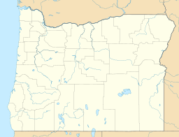
Thomson Reservoir (Oregon) facts for kids
Quick facts for kids Thomson Reservoir |
|
|---|---|
| Coordinates | 42°57′52″N 121°05′16″W / 42.96444°N 121.08778°W |
| Primary inflows | intermittent streams |
| Primary outflows | Silver Creek |
| Basin countries | United States |
| Surface area | 2,159.2 acres (10 km2) |
| Water volume | 7,750 acre⋅ft (9,560,000 m3) |
| Shore length1 | 26.7 mi (40 km) |
| Surface elevation | 4,953 ft (1,510 m) |
| 1 Shore length is not a well-defined measure. | |
Thomson Reservoir, also known as Thomson Valley Reservoir, is a large artificial lake built to store water for irrigation. It is located on the upper East Fork of Silver Creek in the Fremont National Forest in the United States. You can find it about ten miles upstream from Silver Lake, Oregon.
This reservoir was built in 1930 by the Silver Lake Irrigation District, along with a dam. Thomson Reservoir covers about 1800 acres, which is like 1800 football fields! It can hold 7750 acre-feet of water, which is a huge amount.
What Lives in the Water?
Thomson Reservoir is considered mesotrophic. This means it has a medium amount of nutrients in its water. It's not too rich, and not too poor in nutrients.
In the spring, you might find small amounts of tiny plants called Asterionella formosa. In the summer, other tiny plants like Ceratium hirundinella and Melosira granulata can be seen.
Larger water plants, called macrophytes, are not very common here. This is because the water levels in the reservoir change a lot due to how it's used for irrigation.
Fun Activities and Fish
Thomson Reservoir is easy to reach by road. It has two campgrounds managed by the United States Forest Service, which is a government agency that takes care of national forests. Even though the reservoir is in the National Forest, about half of its shoreline is owned by private people.
The most common type of fish in the reservoir is the tui chub. There are so many of these fish that the number of rainbow trout has gone down. To help the rainbow trout population, about 200,000 tiny trout, called fingerlings, are added to the reservoir each spring.
Because there are so many "rough fish" like the tui chub, the camping areas around the reservoir are not used very often.
 | George Robert Carruthers |
 | Patricia Bath |
 | Jan Ernst Matzeliger |
 | Alexander Miles |


