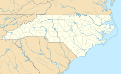
Three Mile, North Carolina facts for kids
Quick facts for kids
Three Mile
|
|
|---|---|
| Country | United States |
| State | North Carolina |
| County | Avery County |
| Elevation | 2,890 ft (881 m) |
| Time zone | UTC-5 (Eastern (EST)) |
| • Summer (DST) | UTC-4 (EDT) |
| ZIP code |
28657
|
| Area code(s) | 828 |
| GNIS feature ID | 1023507 |
Three Mile is a small place in Avery County, North Carolina, United States. It is called an unincorporated community. This means it is not an official town with its own local government.
The name "Three Mile" comes from its location. It is about three miles in a straight line between two main roads: US 19-E and US 221. The community is found along NC 194, also known as Three Mile Highway. It is part of the Green Valley Community and fire district, located near the South Toe River.
Contents
Where is Three Mile Located?
Three Mile is in the western part of North Carolina. It is about 4 miles from the border of Mitchell County. The town of Spruce Pine in Mitchell County is 5 miles to the east. Many people from Three Mile go to Spruce Pine for shopping and other needs. This is because the roads to Spruce Pine are better, and it is closer than Newland, which is the county seat of Avery County. Newland is about 11 miles north.
Other nearby places include:
- Linville Falls, 4 miles east, where Avery, Burke, and McDowell Counties meet.
- Burnsville in Yancey County, 18 miles west.
- Asheville, 55 miles southwest.
- Boone, 30 miles east.
- Johnson City, Tennessee, about 50 miles north.
Roads and Travel in Three Mile
Three Mile has a special section of highway. It is the only part of Avery County with a 4-lane highway. This 2-mile section of US 19E runs from Gushers Knob Road to the Toe River bridge.
The North Carolina Department of Transportation (NC DOT) plans to make this highway even longer. They want to expand it to 4 lanes for 3 more miles. This will connect it to the 4-lane US 19E Highway at the edge of Spruce Pine. In 2020, US 19E was extended all the way to Interstate 26 near Mars Hill. This makes traveling to the Asheville area much quicker.
What's in the Three Mile Community?
The Three Mile area has several important places and services:
- Education: Mayland Community College has its main campus nearby.
- Industry: The Schoolhouse Mine is a mica and quartz mine owned by Sibelco.
- Public Services: There are two large state facilities, Mountain View and Avery-Mitchell.
The community also has:
- Several churches for worship.
- The Avery County Airport (7A8), which is a public airport. It has a paved runway that is 3,100 feet long for small planes. It also has hangars and aviation fuel.
- Riverside P-5 Elementary School for young students.
- The Green Valley Fire Station, which helps keep the community safe.
- An Avery County park for recreation.
- An Avery County EMS (Emergency Medical Services) station.
- A campground for visitors.
- Two shops that make gravestones.
- An automotive garage for car repairs.
- A shooting range.
- Several small stores for daily needs.
- A public landfill.
Education for Children in Three Mile
Children living in Three Mile attend local schools.
- Elementary School: Students in grades P-5 go to Riverside Elementary School.
- Middle School: For grades 6-8, students attend Avery Middle School in Newland.
- High School: Students in grades 9-12 go to Avery County High School. They can also take classes at Mayland Community College.
Avery County School buses provide transportation for students. Avery County transportation services also help people get around.
 | Lonnie Johnson |
 | Granville Woods |
 | Lewis Howard Latimer |
 | James West |


