Tocsin, Indiana facts for kids
Quick facts for kids
Tocsin, Indiana
|
|
|---|---|

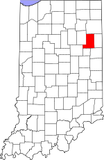
Wells County's location in Indiana
|
|
| Country | United States |
| State | Indiana |
| County | Wells |
| Township | Lancaster |
| Elevation | 833 ft (254 m) |
| Time zone | UTC-5 (Eastern (EST)) |
| • Summer (DST) | UTC-4 (EDT) |
| ZIP code |
46777
|
| Area code(s) | 260 |
| FIPS code | 18-76076 |
| GNIS feature ID | 2830583 |
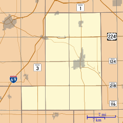
Tocsin is a small place in Indiana, United States. It is called an unincorporated community. This means it's a group of homes and businesses that isn't officially a town or city. Tocsin is located in Wells County, right on the edge of Lancaster Township and Jefferson Township.
The Story of Tocsin
Tocsin was officially planned and marked out on a map in 1884. This process is called "platting." Before it was platted, a post office opened there in 1882. The post office helped people send and receive mail for many years. It closed down in 1966.
Black History Month on Kiddle
Famous African-American Artists:
 | Delilah Pierce |
 | Gordon Parks |
 | Augusta Savage |
 | Charles Ethan Porter |

All content from Kiddle encyclopedia articles (including the article images and facts) can be freely used under Attribution-ShareAlike license, unless stated otherwise. Cite this article:
Tocsin, Indiana Facts for Kids. Kiddle Encyclopedia.

