Tongue River Dam facts for kids
Quick facts for kids Tongue River Reservoir |
|
|---|---|

Tongue River Dam
|
|
| Location | Big Horn County, Montana |
| Coordinates | 45°03′38″N 106°47′24″W / 45.06056°N 106.79000°W |
| Lake type | Reservoir |
| Primary inflows | Tongue River |
| Primary outflows | Tongue River |
| Basin countries | United States |
| Max. length | 5.5 miles (8.9 km) |
| Max. width | 1.1 miles (1.8 km) |
| Surface area | 3,700 acres (1,500 ha) |
| Water volume | 79,071 acre-feet (97,533,000 m3) |
| Surface elevation | 4,222 feet (1,287 m) |
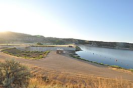
The Tongue River Reservoir is a large lake in Montana. It was created by building the Tongue River Dam across the Tongue River. This reservoir is a very important place for both nature and people. It helps control floods and stores water for farms.
Contents
Tongue River Reservoir: A Montana Adventure Spot
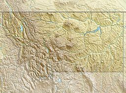
The Tongue River Dam is located in Big Horn County, Montana. It sits just a few miles north of the Wyoming state border. The dam holds back the water of the Tongue River, forming the Tongue River Reservoir.
How the Dam Was Built
The Tongue River Dam was built in 1939. It is an earthen dam, which means it was made mostly from earth and rocks. The dam is 91 feet tall, which is about as high as a nine-story building. It stretches 1,824 feet across the river canyon.
The dam and the reservoir are managed by the Montana Department of Natural Resources and Conservation. This group makes sure the dam works well and the reservoir is used properly.
What the Reservoir Is Used For
The Tongue River Reservoir helps people in two main ways:
- Flood Control: It holds back extra water during heavy rains or snowmelt. This stops the river from overflowing and flooding nearby towns and farms.
- Water Storage: The reservoir stores water for irrigation. This means farmers can use the water to grow their crops, especially during dry times.
The reservoir is about 12 miles long. It covers an area of 5.5 square miles when the water level is normal. This is a very large area, perfect for holding lots of water.
Fun Things to Do Here
The Tongue River Reservoir is a popular place for outdoor activities. Many people visit the Tongue River Reservoir State Park to enjoy nature.
Water Activities
- Boating: You can bring your boat and cruise across the water.
- Fishing: The reservoir is a great spot for fishing. You might catch bass, crappie, walleye, or northern pike.
- Rafting: For those who like a gentle adventure, the Tongue River below the dam is a Class I river. This means it's easy and safe for white-water rafting.
Camping and Nature
- Camping: The state park offers places to camp. You can stay overnight and enjoy the peaceful surroundings.
- Wildlife: The area around the reservoir is home to various animals. You might spot birds, deer, or other wildlife.
The Tongue River Reservoir is a wonderful example of how nature and human engineering can work together. It provides important resources and a beautiful place for everyone to enjoy.
 | Victor J. Glover |
 | Yvonne Cagle |
 | Jeanette Epps |
 | Bernard A. Harris Jr. |


