
Turangarere railway station facts for kids
Quick facts for kids
Turangarere railway station
|
|||||||||||
|---|---|---|---|---|---|---|---|---|---|---|---|

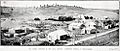
Hautapu Bridge from the horseshoe curve in 2018.
A substation is at the site of Turangerere station |
|||||||||||
| Location | New Zealand | ||||||||||
| Coordinates | 39°35′08″S 175°43′57″E / 39.585536°S 175.732558°E | ||||||||||
| Elevation | 702 m (2,303 ft) | ||||||||||
| Line(s) | North Island Main Trunk | ||||||||||
| Distance | Wellington 270.79 km (168.26 mi) | ||||||||||
| History | |||||||||||
| Opened | 1906 | ||||||||||
| Closed | 23 October 1966 | ||||||||||
| Electrified | June 1988 | ||||||||||
| Services | |||||||||||
|
|||||||||||
Turangarere was a small train stop, also called a flag station, located on the main railway line of New Zealand's North Island. It was in the Ruapehu District, within the valley of the Hautapu River.
This station was about 3.05 kilometers (1.9 miles) south of Hīhītahi and 3.91 kilometers (2.4 miles) north of Ngaurukehu. Turangarere was on a gentle slope, 62 meters (203 feet) higher than Ngaurukehu and 39 meters (128 feet) lower than Hīhītahi. The railway line here had a special "horseshoe curve" shape. This curve was built to avoid a very steep hill, even though it made the track about 2.4 kilometers (1.5 miles) longer. Today, only one train track runs through where the station used to be.
What's in a Name?
In 1909, people thought about calling this train stop Hautapu. But it was first named Gardner & Son's Siding, or often just Gardners Siding. On October 25, 1928, its name was officially changed to Turangaarere. The Geographical Board confirmed this name change in 1929. Interestingly, the nearby settlement of Hīhītahi, which is further up the line, also had its name changed from Turangaarere in 1910.
Station History
The railway line from Mataroa to Turangarere was finished in 1906. It also had a telegraph line for sending messages. The Public Works Department built this section. By August 1906, the line reached the tunnel entrance to the south.
The railway line was handed over to the New Zealand Railways (NZR) on July 1, 1908. In 1920, houses for railway workers were built at Turangarere. The station was closed on October 23, 1966.
The Hautapu Bridge
The Turangarere Bridge crosses the Hautapu River. It has five sections, each about 13.4 meters (44 feet) long. The bridge was built by 1899 by a group of workers who worked together. All the wood for the bridge, except for some special blocks, had to be brought from Taihape. In 1905, the river was moved a bit. This meant they didn't need to build two more bridges, which saved a lot of work.
Gardner's Sawmill
In 1905, a company called Gardner and Sons had the right to cut down trees in a large area nearby. They cut down different types of native trees like kahikatea, rimu, matai, and totara. At first, most of the wood was used for building the railway. This was because the roads were too bad to carry the heavy timber to Taihape, which was the end of the railway line at that time.
The sawmill used a powerful 36-horsepower steam engine to cut the wood. Gardner's asked for a private railway siding here in 1906. By December 1, 1908, they had an agreement to use it for five years.
The area around the sawmill grew big enough to have its own school and a public hall. The sawmill stopped working in 1927 when all the trees around it had been cut down. At that time, about 20 people worked at the mill.
Images for kids
-
Gardner's sawmill in 1919

