Turkey River Mounds State Preserve facts for kids
Quick facts for kids Turkey River MoundsState Preserve |
|
|---|---|
| Location | Clayton, Iowa, United States |
| Area | 62 acres (25 ha) |
| Elevation | 761 ft (232 m) |
| Established | 1968 |
| Governing body | Iowa Department of Natural Resources |
|
Turkey River State Preserve
Archeological District |
|
| MPS | Prehistoric Mounds of the Quad-State Region of the Upper Mississippi River Valley MPS |
| NRHP reference No. | 90000774 |
| Added to NRHP | May 30, 1990 |
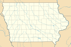
The Turkey River Mounds State Preserve is a special historical place in Iowa, near a small community called Millville, Iowa. This preserve covers about 62 acres of land. It is famous for its many ancient mounds built by Native American people long ago.
These mounds are found on a narrow plateau, which is a flat area of land high above the surrounding area. This plateau is where the Mississippi River and the Turkey River meet.
Contents
Discovering the Ancient Mounds
The Turkey River Mounds State Preserve is home to 38 of 43 Native American mounds in the area. These mounds come in different sizes and shapes. They can be from 1.3 feet to 6 feet tall.
What Are These Mounds?
The mounds were built by Native American groups during the Woodland period. This time was between 500 BCE (Before Common Era) and 900 CE (Common Era). The mounds were used for important purposes. They served as burial sites for people and as special places for ceremonies.
There are different types of mounds you can see:
- Conical mounds: These are cone-shaped, like a small hill. They range from 20 feet to over 100 feet wide.
- Linear mounds: These are long and straight, like a line. They can be from 80 feet to 175 feet long.
- Effigy mound: There is one unique mound shaped like a panther. It is 98 feet long and 40 feet wide.
- Compound mounds: These are mounds that combine different shapes.
Today, these mounds are protected by law. This helps make sure they stay safe for future generations to learn from and enjoy.
A Look Back in Time
People first studied these mounds in 1885. Later, in the 1930s, a person named Ellison Orr did more research on them. In 1934, some people from Dubuque, Iowa bought the land. They gave it to the Iowa Conservation Commission in 1940 to protect it.
More studies of the mounds happened in 1964 and 1973. In 1968, the area officially became a state preserve. It was recognized for its important archaeological finds, interesting geology, and unique plant and animal life. In 1990, the preserve was added to the National Register of Historic Places. This means it is a very important historical site in the United States.
Nature at the Preserve
Besides the ancient mounds, the preserve is also a home for nature. You can find many different kinds of trees growing here. There are also beautiful prairie grasses and wildflowers. It's a great place to see both history and nature.
 | Claudette Colvin |
 | Myrlie Evers-Williams |
 | Alberta Odell Jones |


