Upper Lead Mountain Pond facts for kids
Quick facts for kids Upper Lead Mountain Pond |
|
|---|---|

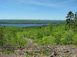
Upper Lead Mountain Pond from the east
|
|
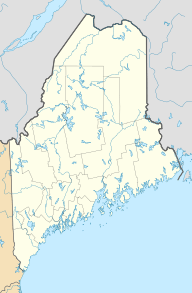
| Location | Hancock County, Maine, United States |
| Coordinates | 44°51′07″N 68°08′27″W / 44.851848°N 68.140843°W |
| Lake type | Glacial |
| Primary inflows | Meadow Brook and others |
| Primary outflows | Unnamed stream to Middle/Lower Lead Mountain Pond |
| Basin countries | United States |
| Max. length | 2.6 mi (4.2 km) |
| Max. width | 1.0 mi (1.6 km) |
| Surface area | 977 acres (395 ha) |
| Max. depth | 57 ft (17 m) |
| Water volume | 24,970 acre-feet (30.80×10⁶ m3) |
| Surface elevation | 350 ft (110 m) |
| Islands | 2+ |
Upper Lead Mountain Pond is a beautiful lake located in Hancock County, Maine, in the United States. It is a great spot for nature lovers and those who enjoy fishing. The lake is surrounded by thick forests, making it a peaceful place to visit.
Contents
Discovering Upper Lead Mountain Pond
Upper Lead Mountain Pond is a large lake, about 2.6 miles (4.2 km) long and 1.0 mile (1.6 km) wide. It covers an area of 977 acres (395 hectares). The deepest part of the lake is about 57 feet (17 meters) deep.
Where is this Lake?
This lake is found in the state of Maine, in the northeastern part of the United States. It is located less than 1.5 miles (2.4 km) west of Lead Mountain. The lake is also very close to Maine State Route 9, about 0.25 miles (0.40 km) north of it. The nearby town is Beddington. You can reach the lake using several unpaved roads. These roads also lead to private homes around the lake.
How was it Formed?
Upper Lead Mountain Pond is a type of lake known as a glacial lake. This means it was formed a very long time ago by huge sheets of ice called glaciers. As these glaciers moved across the land, they carved out valleys and depressions. When the glaciers melted, these depressions filled with water, creating lakes like Upper Lead Mountain Pond.
Water Flow and Connections
The lake gets its water from several small streams, including one called Meadow Brook. Water also flows out of Upper Lead Mountain Pond through a small stream. This stream is about 500 feet (150 meters) long. It connects Upper Lead Mountain Pond to another body of water called Middle/Lower Lead Mountain Pond.
What Lives in the Lake?
Upper Lead Mountain Pond is surrounded by forests, which provide a home for many animals. The lake itself is full of different kinds of fish. If you like fishing, you might find:
These fish make the lake a popular spot for anglers.
 | Frances Mary Albrier |
 | Whitney Young |
 | Muhammad Ali |


