Upper South Providence, Providence, Rhode Island facts for kids
Upper South Providence is a neighborhood located in the southern part of Providence, Rhode Island. It is bordered by Interstate 95 to the north, the Providence River to the east, Public Street to the south, and Broad Street to the west. While it is sometimes linked with Lower South Providence, it is its own unique area.
A Look at History
After Providence was founded, the land that is now Upper South Providence was part of Cranston, Rhode Island from 1754 to 1868. This area didn't grow much until the late 1800s. During this time, many factories and businesses started, which is called industrialization. This growth brought many new people to the area, including families from Ireland and Jewish communities.
In June 1781, a famous event happened in the Pine/Friendship street area. Troops led by General Rochambeau camped there. They were on their way to Yorktown for an important battle during the American Revolutionary War.
By 1832, people began building homes for middle and upper-class families. Later in the 1800s, many large and beautiful houses were built. These homes belonged to wealthy people who owned textile and jewelry businesses, like the president of the Gorham Manufacturing Company.
As the 1900s began, better transportation made it easier for richer residents to move to other parts of the city. In 1868, most of this area became part of Providence again. For the next 90 years, many people living here were Irish Catholic, and there was also a large Jewish community. You can still see many Roman Catholic churches in the area today.
Who Lives Here?
As of 2007, many different groups of people live in Upper South Providence. About 41% of residents were Hispanic, 34% were Black or African-American, and 28.7% were White. There were also smaller groups of Asian or Pacific Islander people and Native American people.
Many young children in public schools, especially those under six, speak a language other than English at home. This shows the rich mix of cultures in the neighborhood.
The area faces challenges with poverty. In 2007, the average family income was lower than the city's average. Also, in 2000, the unemployment rate was high. Some families rely on public assistance. A concern for children's health is exposure to lead, mostly from old paint in older homes.
Green Spaces and Parks
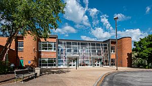
Upper South Providence does not have many large parks. The biggest green area is the Davey Lopes Recreation Center. It is located at the corner of Dudley Street and Prairie Avenue. There are also smaller parks like the Dudley Street Gateway and Pearl Street Park.
Peace & Plenty Park is a playground near the neighborhood in Elmwood. It is one of the few playgrounds in the South Side of Providence.
Hospitals in the Area
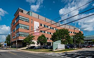
Upper South Providence is home to several important hospitals. These include Rhode Island Hospital, Women & Infants Hospital of Rhode Island, and Hasbro Children's Hospital.
Rhode Island Hospital is a large hospital with many beds. It is also a teaching hospital, connected with Brown University's School of Medicine.
 | Bessie Coleman |
 | Spann Watson |
 | Jill E. Brown |
 | Sherman W. White |


