Cranston, Rhode Island facts for kids
Quick facts for kids
Cranston, Rhode Island
|
||
|---|---|---|
|
City
|
||
|
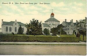
The William Hall Library, Rosedale Apartments, Pawtuxet Village, the Furnace Hill Brook Historic and Archeological District
|
||
|
||

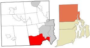
Location in Providence County and the state of Rhode Island.
|
||
| Country | United States | |
| State | Rhode Island | |
| County | Providence | |
| Incorporated (town) | 1754 | |
| Incorporated (city) | 1910 | |
| Government | ||
| • Type | Mayor-council | |
| Area | ||
| • Total | 30.02 sq mi (77.75 km2) | |
| • Land | 28.34 sq mi (73.41 km2) | |
| • Water | 1.67 sq mi (4.33 km2) | |
| Elevation | 66 ft (20 m) | |
| Population
(2020)
|
||
| • Total | 82,934 | |
| • Density | 2,925.88/sq mi (1,129.68/km2) | |
| Time zone | UTC−5 (EST) | |
| • Summer (DST) | UTC−4 (EDT) | |
| ZIP Codes |
02823, 02831, 02905, 02907, 02909–02910, 02920–02921
|
|
| Area code(s) | 401 | |
| FIPS code | 44-19180 | |
| GNIS feature ID | 1218689 | |
| Website | www.cranstonri.gov | |
Cranston, once called Pawtuxet, is a city in Rhode Island, United States. It's located in Providence County. In 2020, 82,934 people lived there. This makes Cranston the second-largest city in Rhode Island. It's also part of the larger Providence metropolitan area.
In 2014, a survey by 247wallst.com named Cranston one of "America's 50 Best Cities to Live."
Cranston became a town in 1754. It was formed from a part of Providence. Over time, it lost some land to nearby towns. On March 10, 1910, Cranston officially became a city.
Contents
History of Cranston
Much of the land that is now Cranston was bought by Roger Williams in 1638. He bought it from the Narragansett Indians. Early settlers like William Arnold and William Harris soon followed.
One settler, Stephen Arnold, built a gristmill (a mill for grinding grain) on the Pawtuxet falls. He also created Arnold Road, which is now Broad Street. Stephen's son, Benedict Arnold, later became the first Governor of Rhode Island.
For many years, people couldn't agree on a name for the new town. Finally, in 1754, the area became the Town of Cranston. It was named after either Governor Samuel Cranston or his grandson Thomas Cranston.
During the 1770s, Cranston residents strongly opposed the British Parliament's Coercive Acts. These were strict laws passed by Britain. The town supported the American side during the American Revolutionary War. Cranston lost some land to nearby areas in the 1800s. Then, on March 10, 1910, it officially became a city.
Many Italian Americans in Cranston came from Itri, Italy. They settled in the Knightsville area in the early 1900s. Cranston is famous for the St. Mary's Feast. This festival is inspired by a similar celebration in Itri. Since 1905, the St. Mary's Feast has been a week-long event in July. It includes vendors, a carnival, fireworks, and a religious parade. In 2000, Cranston and Itri became sister cities.
For a long time, Cranston was the third-largest city in Rhode Island. It was smaller than Providence and Warwick. But in 2017, Cranston grew and became the second-largest city. This growth is partly because of new housing in the western part of the city.
The 2010 Flood
In March 2010, the Pawtuxet River overflowed. This happened after a lot of rain. The flood caused many important places to close for repairs. These included the Warwick Mall and other local buildings.
Geography of Cranston
Cranston covers about 29.9 square miles (77.75 square kilometers). About 1.4 square miles (4.33 square kilometers) of this is water. The city makes up about three percent of Rhode Island's total land.
Cranston has many neighborhoods and villages, including:
- Alpine Estates
- Apple Hill Estates
- Arlington
- Bellefonte
- Castleton Estates
- Auburn
- Dean Estates
- Eden Park
- Edgewood
- Fiskeville (also in Scituate)
- Forest Hills
- Friendly Community
- Garden City
- Garden Hills
- Glen Woods
- Hillside Farms
- Howard
- Jackson (also in Scituate)
- Knightsville
- Laurel Hill
- Meshanticut
- Oakhill Terrace
- Oak Lawn
- Orchard Valley Estates
- Pawtuxet Village (also in Warwick)
- Pontiac
- Stadium
- Thornton (this includes part of Johnston)
- Webster
- Westend
- Western Hills Village
- Woodridge
Cranston's Population
| Historical population | |||
|---|---|---|---|
| Census | Pop. | %± | |
| 1790 | 1,990 | — | |
| 1800 | 1,644 | −17.4% | |
| 1810 | 2,161 | 31.4% | |
| 1820 | 2,274 | 5.2% | |
| 1830 | 2,653 | 16.7% | |
| 1840 | 2,902 | 9.4% | |
| 1850 | 4,311 | 48.6% | |
| 1860 | 7,500 | 74.0% | |
| 1870 | 4,822 | −35.7% | |
| 1880 | 5,940 | 23.2% | |
| 1890 | 8,099 | 36.3% | |
| 1900 | 13,343 | 64.7% | |
| 1910 | 21,107 | 58.2% | |
| 1920 | 29,407 | 39.3% | |
| 1930 | 42,911 | 45.9% | |
| 1940 | 47,085 | 9.7% | |
| 1950 | 55,060 | 16.9% | |
| 1960 | 66,766 | 21.3% | |
| 1970 | 74,287 | 11.3% | |
| 1980 | 72,534 | −2.4% | |
| 1990 | 75,043 | 3.5% | |
| 2000 | 79,269 | 5.6% | |
| 2010 | 80,387 | 1.4% | |
| 2020 | 82,934 | 3.2% | |
| U.S. Decennial Census | |||
Population in 2020
The 2020 United States census counted 82,934 people living in Cranston. There were 32,676 households. The population density was about 2,926 people per square mile.
Most people in Cranston are white (68.14%). Other groups include black or African-American (5.65%) and Asian (6.99%). About 18.17% of the population is Hispanic or Latino.
About 27.9% of households had children under 18. The average household had 2.5 people. The average family had 3.2 people.
In 2020, the median household income was about $74,425. The median family income was about $89,180. About 7.4% of the population lived below the poverty line.
The largest Hispanic groups in Cranston are Dominican American and Guatemalan American. There is also a notable Cambodian American community. Italian Americans are still the largest ethnic group, making up 38% of the population. This makes Cranston one of the largest Italian-American communities in the United States.
Economy of Cranston
Cranston is home to several businesses. The jewelry company Alex and Ani has its headquarters here. Coastway Community Bank is also based in Cranston. The very first Del's Lemonade stand opened in Cranston in 1948.
Arts and Culture in Cranston
Important Sites
The first auto race track in the country was in Cranston. It was called Narragansett Park. It opened in 1867 as a track for horse racing. Today, this spot is the Stadium Ball Field.
The Budlong Pool is Cranston's only public swimming pool. It's located at 198 Aqueduct Road. This huge pool was built in the 1930s as a Works Progress Administration project. The pool closed in 2019 because it needed expensive repairs. There is now a debate about whether to fix it or build a smaller new one.
The Sprague Mansion is an old house from the 1700s. It is listed on the National Register of Historic Places. The Thomas Fenner House, built around 1677, is one of the oldest houses in Rhode Island. The Edgewood Yacht Club is also a historic place on the Providence River.
Sports in Cranston
Little League Achievements
- 1996 United States Champions (CWLL)
- 2015 New England Champions (CWLL)
Education in Cranston
The public schools in Cranston are part of the Cranston School District.
Public high schools:
- Cranston High School East
- Cranston High School West
Public middle schools:
- Western Hills Middle School
- Hugh B. Bain Middle School
- Park View Middle School
- Hope Highlands Middle School
Public elementary schools:
- Arlington Elementary School
- Chester Barrows Elementary School
- William R. Dutemple Elementary School
- Eden Park Elementary School
- Edgewood Highlands Elementary School
- Garden City Elementary School
- Gladstone Elementary School
- Glen Hills Elementary School
- Oak Lawn Elementary School
- Orchard Farms Elementary School
- George J. Peters Elementary School
- Edward S. Rhodes Elementary School
- Stadium Elementary School
- Stone Hill Elementary School
- Daniel D. Waterman Elementary School
- Woodridge Elementary School
Other public schools:
- Cranston Area Career And Technical Center
Private schools:
- Immaculate Conception Catholic Regional School (Roman Catholic Diocese of Providence)
- Saint Paul School
School Committee
The Cranston School Committee has seven members. Six members represent different parts of the city. One member represents the whole city. They are elected every two years.
Transportation in Cranston
Several major roads pass through Cranston. These include I-95, I-295, RI 10, and RI 37. Other state roads are also in Cranston.
Buses from the Rhode Island Public Transit Authority serve Cranston. Train lines like Amtrak's Northeast Corridor and the MBTA's Providence/Stoughton Line go through Cranston. However, there is no train station in the city. The closest train stations are in Providence and Warwick.
Notable people
Sister and Friendship Cities
 Itri, Lazio, Italy (Sister City)
 Stepanakert, Artsakh (Friendship City)
See also
 In Spanish: Cranston para niños
 | Dorothy Vaughan |
 | Charles Henry Turner |
 | Hildrus Poindexter |
 | Henry Cecil McBay |


