
Scituate, Rhode Island facts for kids
Quick facts for kids
Scituate, Rhode Island
|
||
|---|---|---|
|
||

Location in Providence County and the state of Rhode Island.
|
||
| Country | United States | |
| State | Rhode Island | |
| County | Providence | |
| Incorporated | 1731 | |
| Government | ||
| • Type | Town commission | |
| Area | ||
| • Total | 54.8 sq mi (141.9 km2) | |
| • Land | 48.7 sq mi (126.1 km2) | |
| • Water | 6.1 sq mi (15.8 km2) | |
| Elevation | 345 ft (105 m) | |
| Population
(2020)
|
||
| • Total | 10,384 | |
| • Density | 213/sq mi (82.3/km2) | |
| Time zone | UTC−5 (Eastern (EST)) | |
| • Summer (DST) | UTC−4 (EDT) | |
| ZIP Codes | ||
| Area code(s) | 401 | |
| FIPS code | 44-64220 | |
| GNIS feature ID | 1220077 | |
| Website | Town of Scituate | |

Scituate (pronounced SIH-choo-ayt) is a town in Providence County, Rhode Island, United States. About 10,384 people lived there in 2020. It's a place with a rich history and a very important water supply for the state.
Contents
A Look Back in Time
Scituate was first settled in 1710 by people from another town called Scituate, Massachusetts. The name "Scituate" comes from a Native American word, "Satuit." It means "cold brook" or "cold river."
Early Leaders and Important Events
Scituate was part of Providence until 1731. The first town meeting was held at the Angell Tavern. Stephen Hopkins was chosen as the first leader. He later became a governor of Rhode Island. He also signed the Declaration of Independence, a very important document for the United States.
His brother, Esek Hopkins, became the Commander in Chief of the Continental Navy in 1776. This was during the American Revolutionary War. In 1788, a Scituate leader named William West led a group of farmers to protest the U.S. Constitution. Later, in 1791, the U.S. Supreme Court decided its first case, West v. Barnes, which was about a farm in Scituate.
Villages and Changes
Scituate used to have many small villages. Some of these were North Scituate, Hope, Ashland, and Clayville. In 1781, the western part of Scituate became its own town, called Foster.
In 1915, a big change happened. The state decided to use a large part of Scituate to create a reservoir. This reservoir would provide fresh water to the city of Providence. About 38% of the town's land was used for this project. Many buildings, including houses, schools, and churches, were taken down. Several villages, like Kent and Rockland, disappeared forever under the water.
Scituate's Role in Wars
Scituate has played a part in many U.S. wars. During the Revolutionary War, 76 cannons were made at the Hope Furnace in the village of Hope. In World War II, a special listening station was set up near Chopmist Hill. This station helped intercept German radio messages. Because of this, Chopmist Hill was even considered as a possible location for the United Nations headquarters in 1946.
Where is Scituate?
Scituate covers about 54.8 square miles (141.9 square kilometers). Most of this area is land, but about 6.1 square miles (15.8 square kilometers) is water.
The Scituate Reservoir
.jpg)
One of the most important features of Scituate is the Scituate Reservoir. This huge reservoir covers a big part of the town. It changed the landscape forever. When it was built, many villages were flooded. Sometimes, during very dry periods, you can still see the old foundations of these buildings. The Providence Water Supply Board owns and takes care of the reservoir and the land around it.
The main reservoir was created by building a large dam across the Pawtuxet River. The dam is about 3,200 feet (975 meters) long and 100 feet (30 meters) high. Water started filling the reservoir in 1925. A special system carries water from the dam to a treatment plant. This plant started working in 1926.
The Scituate Reservoir is the biggest man-made body of fresh water in Rhode Island. It can hold about 39 billion US gallons (148 million cubic meters) of water. Its surface area is about 5.3 square miles (13.7 square kilometers). The reservoir and its six smaller reservoirs provide drinking water to more than 60% of Rhode Island's population.
The water treatment plant was very advanced when it was built. It was considered one of the most high-tech plants of its time. Over the years, it has been expanded and updated. Today, it can treat up to 144 million US gallons (545,000 cubic meters) of water every day. It is still the largest treatment facility in New England.
People of Scituate
| Historical population | |||
|---|---|---|---|
| Census | Pop. | %± | |
| 1790 | 2,315 | — | |
| 1800 | 2,523 | 9.0% | |
| 1810 | 2,568 | 1.8% | |
| 1820 | 2,834 | 10.4% | |
| 1830 | 3,993 | 40.9% | |
| 1840 | 4,090 | 2.4% | |
| 1850 | 4,582 | 12.0% | |
| 1860 | 4,251 | −7.2% | |
| 1870 | 3,846 | −9.5% | |
| 1880 | 3,810 | −0.9% | |
| 1890 | 3,174 | −16.7% | |
| 1900 | 3,361 | 5.9% | |
| 1910 | 3,493 | 3.9% | |
| 1920 | 3,006 | −13.9% | |
| 1930 | 2,292 | −23.8% | |
| 1940 | 2,838 | 23.8% | |
| 1950 | 3,905 | 37.6% | |
| 1960 | 5,210 | 33.4% | |
| 1970 | 7,489 | 43.7% | |
| 1980 | 8,405 | 12.2% | |
| 1990 | 9,796 | 16.5% | |
| 2000 | 10,324 | 5.4% | |
| 2010 | 10,329 | 0.0% | |
| 2020 | 10,384 | 0.5% | |
| U.S. Decennial Census | |||
In 2000, there were 10,324 people living in Scituate. The town had 3,780 households. Most people (98.13%) were White. About 0.75% of the population was Hispanic or Latino.
Many households (36.2%) had children under 18 living with them. The average household had 2.72 people. The average family had 3.12 people. The median age in Scituate was 40 years old.
The median income for a household was $60,788. For a family, it was $67,593. About 3.9% of the population lived below the poverty line.
Learning in Scituate
.jpg)
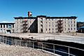
In 1839, the Smithville Seminary was founded in North Scituate. It was a school that operated on and off until 1876. Later, the Pentecostal Collegiate Institute moved to this campus in 1902.
After this school moved away in 1919, another school, the Watchman Industrial School and Camp, took its place in 1923. This school closed in 1938, but its summer camp continued until 1974. Today, the old school buildings are apartments called Scituate Commons.
Students in Scituate attend Scituate High School.
Fun Things to Do

The Scituate Art Festival is a popular event. It happens every Columbus Day weekend since 1967. Over 300 artists and craftspeople show and sell their artwork. Between 200,000 and 350,000 people visit the festival each year. Part of the festival takes place on the grounds of the Old Congregational Church.
Important Places and Sites
Scituate has several places listed on the National Register of Historic Places. These are important sites that help tell the story of the town's past. Some of them include:
- Andrews–Luther Farm (built in 1768)
- Dexter Arnold Farmstead (built in 1813)
- Clayville Historic District
- Hope Village Historic District
- Old Congregational Church (North Scituate, Rhode Island) (built in 1834)
- Smithville Seminary (founded in 1839)
- Smithville – North Scituate
Famous People from Scituate
Many notable people have connections to Scituate:
- James Burrill Angell – A president of the University of Michigan and University of Vermont.
- Robert Capron – An actor known for playing Rowley Jefferson in the Diary of a Wimpy Kid movies.
- Esek Hopkins – A famous sailor during the Revolutionary War.
- Stephen Hopkins – A colonial governor of Rhode Island and a signer of the Declaration of Independence.
- William West – A Revolutionary War General and Chief Justice of Rhode Island.
Images for kids
-
Hope Mill

See also
 In Spanish: Scituate (Rhode Island) para niños
