Urica facts for kids
Quick facts for kids
Urica
|
|
|---|---|
| Time zone | UTC−4 (VET) |
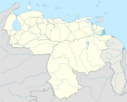
Urica is a small town located in the northeastern part of Venezuela. It's the main town of Urica Parish, which is part of the Pedro María Freites Municipality in Anzoátegui State. In 2011, about 4,517 people lived there.
Contents
Exploring Urica's Location
Urica is about 45 kilometers (28 miles) southeast of Santa Inés. The town sits on a flat area, watered by the Urica and Amana Rivers. This region is well-known for its large farms where animals are raised. It also produces a lot of fruit. Geologists are interested in the Urica fault, which is a crack in the Earth's crust nearby.
Getting to Urica
There is a small airport close to Urica. Its code is AG4119. This makes it easier for people to travel to and from the town.
Urica's Past: A Look at History
Urica was first settled by Spanish people in the mid-1700s. Many important battles have happened near Urica.
Key Battles in Urica
In 1814, during the Venezuelan War of Independence, big fights took place here. Forces led by José Félix Ribas and José Francisco Bermúdez fought against the royalist commander José Tomás Boves.
- The Battle of Curareque happened on September 12, 1814.
- On December 5, 1814, the famous Battle of Urica took place. In this battle, José Tomás Boves was killed. His burial place is in the village.
- Later, on April 27, 1870, the Battle of Altagracia was fought.
- Another battle, the Battle of the Bridge, happened on February 20, 1902.
Urica and State Changes
In 1879, the National Congress of Venezuela created a new state called Oriente. Urica was chosen to be its capital. This new state included areas that are now Anzoátegui, Sucre, and Monagas states. This setup lasted until 1881. Then, the state was renamed Bermúdez. By 1898, it became known as Sucre state.
See also
 In Spanish: Urica para niños


