Vassar, Kansas facts for kids
Quick facts for kids
Vassar, Kansas
|
|
|---|---|

|
|
| Country | United States |
| State | Kansas |
| County | Osage |
| Elevation | 1,106 ft (337 m) |
| Population
(2020)
|
|
| • Total | 584 |
| Time zone | UTC-6 (CST) |
| • Summer (DST) | UTC-5 (CDT) |
| ZIP code |
66543
|
| Area code | 785 |
| FIPS code | 20-73450 |
| GNIS ID | 479316 |
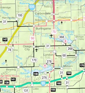
Vassar is a small community in Osage County, Kansas. It is known as a census-designated place (CDP). This means it is an area the U.S. Census Bureau uses for collecting statistics. In 2020, the population of Vassar was 584 people. The community is located about 4 miles (6.4 km) northeast of Lyndon. It is also about half a mile south of Pomona Lake.
Contents
History of Vassar
A post office first opened in a nearby place called La Mont's Hill in 1871. Later, in 1887, this post office was moved to Vassar. Vassar still uses the ZIP code 66543 today.
A railroad track once ran through Vassar. This was part of the Missouri Pacific Railroad system. However, the railroad line was later closed down. The old tracks were then changed into a walking and biking path. This path is now known as the Flint Hills Nature Trail.
Geography and Climate
Vassar is located in a part of Kansas with specific weather patterns.
Understanding Vassar's Climate
The climate in Vassar has hot and humid summers. The winters are usually mild to cool. This type of weather is called a humid subtropical climate. On climate maps, you might see this climate type labeled as "Cfa." This label comes from the Köppen Climate Classification system.
People Living Here
The population of Vassar is counted during the U.S. Decennial Census. This census helps us understand how many people live in different areas.
| Historical population | |||
|---|---|---|---|
| Census | Pop. | %± | |
| 2020 | 584 | — | |
| U.S. Decennial Census | |||
See also
 In Spanish: Vassar (Kansas) para niños


