Vichy, Missouri facts for kids
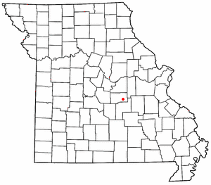
Vichy is a small place in southern Maries County, Missouri, in the United States. It's not a city with its own government, but rather an "unincorporated community." You can find it right on U.S. Route 63, about 10 miles north of a town called Rolla.
Vichy was started in 1880. It got its name from a famous city in Vichy, France. A post office has been open in Vichy since it was founded in 1880. Close by is the Rolla National Airport, which used to be a U.S. Army airfield. It has two runways, each about 5,500 feet long. The special code for mail in Vichy is 65580.
Vichy's Weather: What's the Climate Like?
Vichy has a type of weather called a humid subtropical climate. This means it usually has hot, humid summers and mild winters. On climate maps, this is often shown as "Cfa."
The weather in Vichy can get very hot! The highest temperature ever recorded was 113 degrees Fahrenheit (45 degrees Celsius). This super hot day happened on July 18, 1954. But it can also get very cold. The lowest temperature ever recorded was a chilly -29 degrees Fahrenheit (-34 degrees Celsius) on February 12, 1899.
| Climate data for Vichy, Missouri (Rolla National Airport), 1991–2020 normals, extremes 1897–present | |||||||||||||
|---|---|---|---|---|---|---|---|---|---|---|---|---|---|
| Month | Jan | Feb | Mar | Apr | May | Jun | Jul | Aug | Sep | Oct | Nov | Dec | Year |
| Record high °F (°C) | 76 (24) |
82 (28) |
85 (29) |
94 (34) |
98 (37) |
106 (41) |
113 (45) |
107 (42) |
105 (41) |
95 (35) |
85 (29) |
77 (25) |
113 (45) |
| Mean maximum °F (°C) | 65.1 (18.4) |
70.4 (21.3) |
78.4 (25.8) |
84.3 (29.1) |
87.5 (30.8) |
91.9 (33.3) |
97.2 (36.2) |
97.2 (36.2) |
91.3 (32.9) |
84.3 (29.1) |
74.6 (23.7) |
66.4 (19.1) |
98.9 (37.2) |
| Mean daily maximum °F (°C) | 40.8 (4.9) |
45.9 (7.7) |
56.3 (13.5) |
67.0 (19.4) |
74.9 (23.8) |
83.1 (28.4) |
87.9 (31.1) |
87.0 (30.6) |
79.1 (26.2) |
67.8 (19.9) |
54.9 (12.7) |
44.3 (6.8) |
65.7 (18.7) |
| Daily mean °F (°C) | 31.6 (−0.2) |
36.1 (2.3) |
45.6 (7.6) |
55.8 (13.2) |
64.7 (18.2) |
73.1 (22.8) |
77.4 (25.2) |
76.3 (24.6) |
68.3 (20.2) |
57.1 (13.9) |
45.1 (7.3) |
35.4 (1.9) |
55.5 (13.1) |
| Mean daily minimum °F (°C) | 22.4 (−5.3) |
26.3 (−3.2) |
34.9 (1.6) |
44.6 (7.0) |
54.4 (12.4) |
63.2 (17.3) |
67.0 (19.4) |
65.6 (18.7) |
57.5 (14.2) |
46.4 (8.0) |
35.2 (1.8) |
26.6 (−3.0) |
45.3 (7.4) |
| Mean minimum °F (°C) | 0.6 (−17.4) |
6.0 (−14.4) |
14.5 (−9.7) |
28.1 (−2.2) |
38.1 (3.4) |
50.7 (10.4) |
56.5 (13.6) |
54.9 (12.7) |
42.0 (5.6) |
28.8 (−1.8) |
17.6 (−8.0) |
7.5 (−13.6) |
−2.7 (−19.3) |
| Record low °F (°C) | −16 (−27) |
−29 (−34) |
−7 (−22) |
17 (−8) |
25 (−4) |
39 (4) |
46 (8) |
45 (7) |
31 (−1) |
20 (−7) |
3 (−16) |
−25 (−32) |
−29 (−34) |
| Average precipitation inches (mm) | 2.22 (56) |
2.06 (52) |
3.40 (86) |
4.71 (120) |
5.35 (136) |
4.46 (113) |
4.43 (113) |
3.66 (93) |
3.81 (97) |
3.21 (82) |
3.45 (88) |
2.31 (59) |
43.07 (1,095) |
| Average snowfall inches (cm) | 4.7 (12) |
3.7 (9.4) |
3.5 (8.9) |
0.5 (1.3) |
0.0 (0.0) |
0.0 (0.0) |
0.0 (0.0) |
0.0 (0.0) |
0.0 (0.0) |
0.0 (0.0) |
1.6 (4.1) |
2.3 (5.8) |
16.3 (41.5) |
| Average precipitation days (≥ 0.01 in) | 8.0 | 7.9 | 11.0 | 11.4 | 12.8 | 10.5 | 9.1 | 8.7 | 8.0 | 8.7 | 8.0 | 7.2 | 111.3 |
| Average snowy days (≥ 0.1 in) | 3.1 | 2.1 | 2.5 | 0.3 | 0.0 | 0.0 | 0.0 | 0.0 | 0.0 | 0.0 | 0.6 | 1.6 | 10.2 |
| Source 1: NOAA | |||||||||||||
| Source 2: National Weather Service (snow/snow days 1948–1982) | |||||||||||||
 | Bessie Coleman |
 | Spann Watson |
 | Jill E. Brown |
 | Sherman W. White |


