Viktorsberg facts for kids
Quick facts for kids
Viktorsberg
|
||
|---|---|---|
 |
||
|
||

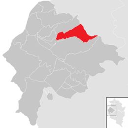
Location in the district
|
||
| Country | Austria | |
| State | Vorarlberg | |
| District | Feldkirch | |
| Area | ||
| • Total | 12.51 km2 (4.83 sq mi) | |
| Elevation | 879 m (2,884 ft) | |
| Time zone | UTC+1 (CET) | |
| • Summer (DST) | UTC+2 (CEST) | |
| Postal code |
6832
|
|
| Website | http://www.viktorsberg.at | |
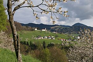
Viktorsberg is a small town, also called a municipality, located in the Feldkirch district. This district is part of Vorarlberg, one of the states in Austria. It is a lovely place nestled in the mountains.
About Viktorsberg
Viktorsberg is a peaceful community in the western part of Austria. It sits high up, about 879 meters (2,884 feet) above sea level. This makes it a great spot for enjoying nature and mountain views. The town covers an area of about 12.51 square kilometers.
Who Leads Viktorsberg?
Like many towns, Viktorsberg has a leader. This person is called the Mayor. The current mayor is Philibert Ellensohn. The mayor helps make important decisions for the community. They work to make sure the town runs smoothly for everyone living there.
How Many People Live Here?
The number of people living in Viktorsberg has changed over time. Knowing the population helps us understand how a town grows or stays the same.
| Historical population | ||
|---|---|---|
| Year | Pop. | ±% |
| 1869 | 196 | — |
| 1880 | 209 | +6.6% |
| 1890 | 203 | −2.9% |
| 1900 | 251 | +23.6% |
| 1910 | 234 | −6.8% |
| 1923 | 232 | −0.9% |
| 1934 | 232 | +0.0% |
| 1939 | 257 | +10.8% |
| 1951 | 271 | +5.4% |
| 1961 | 313 | +15.5% |
| 1971 | 352 | +12.5% |
| 1981 | 363 | +3.1% |
| 1991 | 378 | +4.1% |
| 2001 | 378 | +0.0% |
| 2011 | 377 | −0.3% |
In 1869, only 196 people lived in Viktorsberg. By 1900, the population grew to 251. Over the years, the number of residents slowly increased. In 2001, there were 378 people. The population has stayed around this number in recent years, showing a stable community.
See also
 In Spanish: Viktorsberg para niños
 | Madam C. J. Walker |
 | Janet Emerson Bashen |
 | Annie Turnbo Malone |
 | Maggie L. Walker |


