Vindication Island facts for kids

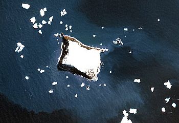
NASA Terra image of Vindication Island
|
|

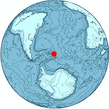
Location of Vindication Island
|
|
| Geography | |
|---|---|
| Coordinates | 57°06′S 26°47′W / 57.100°S 26.783°W |
| Area | 3 km2 (1.2 sq mi) |
| Length | 2.1 km (1.3 mi) |
| Width | 1.6 km (0.99 mi) |
| Highest elevation | 430 m (1,410 ft) |
| Highest point | Quadrant Peak |
| Administration | |
|
United Kingdom
|
|
| Demographics | |
| Population | Uninhabited |
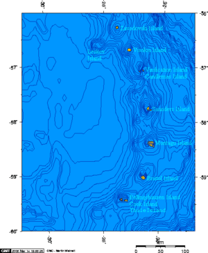
Vindication Island (which is Isla Vindicación in Spanish) is a small island where no one lives. It's part of the South Sandwich Islands. This island is about 3.2 kilometers (2 miles) away from Candlemas Island, with a narrow stretch of water called the Nelson Channel between them. Most of Vindication Island doesn't have ice.
Island Geography
Vindication Island is a small piece of land in the Candlemas Islands group, which is part of the larger South Sandwich Islands.
Island Features
The highest point on the island is a place called Quadrant Peak. It stands tall at 430 meters (1,411 feet) above sea level. The very tip of the island on its southeast side is known as Chinstrap Point.
The island's southwest tip is called Knob Point. This area was mapped in 1930 by people from the Discovery II ship. It was likely named Knob Point because there's a clear, high piece of land overlooking it.
Volcanic Past
Vindication Island is what's left of an old volcanic complex. This means it was once a group of volcanoes that have now worn away over time.
Unlike its neighbor, Candlemas Island, which still has active volcanoes, the volcano on Vindication Island hasn't shown any signs of activity for more than 10,000 years. It's considered a very old, inactive volcano.
Nearby Rocks
There's a rock formation called Buddha Rock located about 0.6 kilometers (0.3 nautical miles) west of Vindication Island.
See also
 In Spanish: Isla Vindicación para niños
 | Isaac Myers |
 | D. Hamilton Jackson |
 | A. Philip Randolph |


