Vizianagaram district facts for kids
Quick facts for kids
Vizianagaram district
|
|
|---|---|

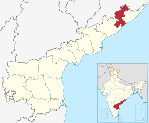
Location of Vizianagaram district in Andhra Pradesh
|
|
| Country | India |
| State | Andhra Pradesh |
| Headquarters | Vizianagaram |
| Tehsils | 34 |
| Area | |
| • District of Andhra Pradesh | 6,539 km2 (2,525 sq mi) |
| Population
(2011)
|
|
| • District of Andhra Pradesh | 2,344,474 |
| • Density | 358.537/km2 (928.61/sq mi) |
| • Urban | 20.94% |
| Demographics | |
| • Literacy | 59.49% |
| • Sex ratio | 1016 |
| Vehicle registration | AP-35 (former) AP–39 (from 30 January 2019) |
| Major highways | NH-16 |
| Coordinates | 18°12′N 83°24′E / 18.200°N 83.400°E |
| Website | Official website: http://vizianagaram.nic.in/ |
Vizianagaram district is a special place in the Indian state of Andhra Pradesh. It is one of the thirteen districts in this state. The main city and headquarters of this district is Vizianagaram. This district is known for its rich history and beautiful landscapes.
Contents
History of Vizianagaram District
The area that is now Vizianagaram district has a long and interesting past. For a time, it was under the rule of the Nizam. However, in 1753, the French army defeated the Nizam. After this, these areas became part of French India. This shows how different powers have influenced the region over many years.
How Was Vizianagaram District Formed?
Vizianagaram district was officially created on June 1, 1979. It was formed by taking parts from two nearby districts: Srikakulam and Visakhapatnam. This helped to organize the region better and manage its resources.
What is Vizianagaram District Like?
Vizianagaram district covers a total area of about 6,539 square kilometers. That's a lot of land! In 2011, more than 2.3 million people lived here. Most of the people live in rural areas, but about 20.94% live in cities and towns.
How Many People Live There?
According to the 2011 census, the total population of Vizianagaram district was 2,344,474 people. This means it's a busy and lively place.
What About Education?
Education is important in Vizianagaram district. The literacy rate, which is the percentage of people who can read and write, was 59.49%. This shows that many people are getting an education.
What is the Sex Ratio?
The sex ratio in the district is 1016. This means for every 1,000 males, there are 1,016 females. This is a good balance compared to many other places.
How is Vizianagaram District Governed?
The district is managed by a special officer called the District collector. Currently, Dr. M. Hari Jawaharlal is the District Collector. This person helps make sure everything runs smoothly in the district.
Political Representation
People in Vizianagaram district are represented in the government in different ways.
- Lok Sabha Constituencies: These are for the national parliament. The district is part of the Araku, Vizianagaram, and Vishakapatnam constituencies.
- Vidhan Sabha Constituencies: These are for the state assembly. There are 9 Vidhan Sabha constituencies in the district.
Getting Around Vizianagaram District
The district has good roads that help people travel easily. One of the main roads is NH-16. This highway connects Vizianagaram to other important places.
Vehicle Registration
If you see a vehicle from Vizianagaram district, its license plate might start with "AP-35" (for older vehicles) or "AP-39" (for newer vehicles registered after January 30, 2019).
Important Places and Culture
Vizianagaram district is home to many interesting places and has a rich culture.
Famous Personalities
One famous person from this area is Gurazada Apparao. He was a well-known writer and playwright. His portrait is displayed in Vizianagaram.
Ancient Temples
The district also has ancient religious sites. For example, there is a 1000-year-old Sri Rama temple on top of Bodhikonda, located in Ramatheertham. This shows the long history and spiritual importance of the region.
Images for kids
-
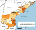
Districts of Andhra Pradesh
-
1000-year-old Sri Rama temple on top of Bodhikonda, Ramatheertham
See also
 In Spanish: Distrito de Vizianagaram para niños
 | Jewel Prestage |
 | Ella Baker |
 | Fannie Lou Hamer |


