
Wallendbeen facts for kids
Quick facts for kids WallendbeenNew South Wales |
|
|---|---|

Streetscape at Wallendbeen
|
|

Wallendbeen
Location in New South Wales
|
|
| Population | 260 (2016 census) |
| Postcode(s) | 2588 |
| Location |
|
| LGA(s) | Cootamundra-Gundagai Regional Council |
| State electorate(s) | Cootamundra |
| Federal Division(s) | Hume |
Wallendbeen is a small town in the southern part of New South Wales, Australia. It is managed by the Cootamundra-Gundagai Regional Council. In 2011, Wallendbeen and the areas around it had about 305 people living there. The town's name comes from an Aboriginal word that means "stony hill."
Contents
About Wallendbeen
Wallendbeen is located where two important roads meet: the Olympic Highway and the Burley Griffin Way. It is also on the main railway line that connects Sydney and Melbourne. This railway line reached Wallendbeen in 1877, which was a big deal for the town.
What Wallendbeen is Known For
Growing wheat is a very important business in the Wallendbeen area. The town also has a great sports oval. A cricket club has been playing there since 1887! The Wallendbeen Post Office opened a long time ago, on July 1, 1885.
Every year, Wallendbeen hosts the Baldry Shield. This is a fun sports event for small primary schools from the area. It's a chance for kids to compete and have fun together.
Wallendbeen's Past Government
For a period from 1895 to 1935, Wallendbeen had its own local government. This meant it had its own council and a mayor who made decisions for the town. Later, it became part of bigger local areas called Jindalee Shire and Demondrille Shire.
Today, Wallendbeen is becoming what's called a "dormitory suburb" for Cootamundra. This means that many people who live in Wallendbeen travel to Cootamundra for work or school.
Images for kids
-
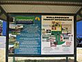
Wallendbeen information sign (2016)
-
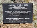
Mackay Park, Wallendbeen


