
Wagga Wagga facts for kids
Quick facts for kids Wagga WaggaNew South Wales |
|||||||||
|---|---|---|---|---|---|---|---|---|---|

An aerial view of central Wagga Wagga
|
|||||||||

Wagga Wagga
Location in New South Wales
|
|||||||||
| Population | 57,003 (2021) (26th) | ||||||||
| Established | 1829 (explored) 1847 (village) 1849 (surveyed) 1849 (town) 1870 (municipality) 1946 (city) |
||||||||
| Postcode(s) | 2650 | ||||||||
| Elevation | 180 m (591 ft) | ||||||||
| Time zone | AEST (UTC+10:00) | ||||||||
| • Summer (DST) | AEDT (UTC+11:00) | ||||||||
| Location |
|
||||||||
| LGA(s) | City of Wagga Wagga | ||||||||
| County | |||||||||
| Parish | South Wagga Wagga | ||||||||
| State electorate(s) | Wagga Wagga | ||||||||
| Federal Division(s) | Riverina | ||||||||
|
|||||||||
Wagga Wagga (/ˌwɒɡə ˈwɒɡə/), often called Wagga, is a large city in the Riverina region of New South Wales, Australia. It sits on the Murrumbidgee River. In 2021, over 57,000 people lived there. Wagga Wagga is an important place for farming, military, and transport in Australia. It is the ninth largest inland city in Australia. Wagga Wagga is located about halfway between Australia's two biggest cities, Sydney and Melbourne. It is a main centre for the Riverina and South West Slopes areas.
The city's main shopping and business area is between Best and Tarcutta Streets, the Murrumbidgee River, and the Sturt Highway. Baylis Street is the main shopping street. It turns into Fitzmaurice Street at the northern end. You can reach Wagga from Sydney using the Sturt and Hume Highways. From Melbourne, you can use the Olympic Highway and Hume Highway. Wagga is in a river valley, and some parts of the city have problems with salty soil.
The first people to live in the Wagga Wagga area were the Wiradjuri people. In 1829, Charles Sturt was the first European explorer to visit the future city site. Settlers arrived soon after. The town was built near a river crossing point. It was officially made a village in 1849 and grew quickly. In 1870, it became a municipality (a self-governing town).
During the time Australia's colonies were joining together to form a country, Wagga Wagga was considered as a possible capital city. In World War I, the "Kangaroo March" started here. This was a march where new soldiers walked towards Sydney, asking others to join them. After World War II, Wagga Wagga became a city in 1946. New suburbs were built south of the city centre. In 1982, Wagga Wagga joined with nearby areas to form the larger City of Wagga Wagga local government area.
Contents
Exploring Wagga Wagga's Location

Wagga Wagga is at the eastern end of the Riverina region. This is where the hills of the Great Dividing Range become flat plains. The city is built along the Murrumbidgee River, which is one of the big rivers in the Murray–Darling basin. The city centre is on the south side of the river. A special wall, called a levee, protects it from floods.
Wagga is located almost exactly halfway between Sydney and Melbourne. It is 452 kilometres southwest of Sydney and 456 kilometres northeast of Melbourne. The main railway line between Sydney and Melbourne also passes through Wagga. The Sturt Highway, a major road in Australia, goes through Wagga. This highway connects Adelaide to the main Sydney–Melbourne road, the Hume Highway, which is 45 kilometres further east.
Because it is on major transport routes, Wagga Wagga is an important place for truck companies. Wagga Wagga is the main centre for the Riverina and South West Slopes regions. It provides education, health, and other services to a large area.
Understanding Land and Soil

Wagga Wagga is in a river valley. Much of the city is on heavy clay soils. Water cannot drain away easily here. This means Wagga Wagga has problems with waterlogged soil and salty soil. The city is working hard to fix this problem and make salty areas healthy again.
City Layout and Neighborhoods

The main business area of Wagga Wagga has been in the same place since the late 1800s. It is still focused around Best and Tarcutta Streets, the Murrumbidgee River, and the Sturt Highway. Baylis Street is the main shopping street. It turns into Fitzmaurice Street at the northern end. The Wollundry Lagoon is a water feature in the city centre. It helps separate the older northern part of the city from the newer southern part.
Most new homes in Wagga Wagga have been built on higher ground south of the city centre. The only residential areas north of the Murrumbidgee River are North Wagga Wagga, which can flood, and the university suburb of Estella. Major industrial areas are in Bomen to the north and East Wagga Wagga to the east.
Thomas Mitchell, a surveyor, named many of the streets after soldiers from the Peninsular War.
Wagga Wagga's Climate
Wagga Wagga has a temperate climate. This means it has hot, dry summers and cool to cold winters. It has four clear seasons. Winters can be quite cold for Australia. The average highest temperature in July is 12.7°C (54.9°F), and the average lowest is 2.8°C (37.0°F). The coldest temperature ever recorded was -6.3°C (20.7°F) in August 1982.
Fog and heavy frosts are common in winter. Snow is very rare. Summers are warm to hot, with average highest temperatures between 29°C (84°F) and 32°C (90°F). The hottest temperature ever recorded was 46.1°C (115.0°F) in January 2020. The air is usually dry in summer. Wagga Wagga has many clear, sunny days each year.
The city gets about 571.5 mm (22.5 inches) of rain each year. This rain is spread out fairly evenly over the year. There is a little more rain in winter and spring. In March 2010, Wagga Wagga Airport recorded a lot of rain in one day, breaking a record. In December 2010, the city had its wettest year ever.
| Climate data for Wagga Wagga AMO (1941–2020); 212 m AMSl; 35.16° S, 147.46° E | |||||||||||||
|---|---|---|---|---|---|---|---|---|---|---|---|---|---|
| Month | Jan | Feb | Mar | Apr | May | Jun | Jul | Aug | Sep | Oct | Nov | Dec | Year |
| Record high °C (°F) | 46.1 (115.0) |
45.2 (113.4) |
39.5 (103.1) |
35.8 (96.4) |
28.7 (83.7) |
23.2 (73.8) |
23.2 (73.8) |
26.6 (79.9) |
32.9 (91.2) |
36.3 (97.3) |
42.8 (109.0) |
43.2 (109.8) |
46.1 (115.0) |
| Mean daily maximum °C (°F) | 31.9 (89.4) |
31.0 (87.8) |
27.7 (81.9) |
22.6 (72.7) |
17.4 (63.3) |
13.9 (57.0) |
12.8 (55.0) |
14.5 (58.1) |
17.7 (63.9) |
21.7 (71.1) |
25.9 (78.6) |
29.6 (85.3) |
22.2 (72.0) |
| Mean daily minimum °C (°F) | 16.4 (61.5) |
16.4 (61.5) |
13.5 (56.3) |
9.2 (48.6) |
5.9 (42.6) |
3.7 (38.7) |
2.8 (37.0) |
3.5 (38.3) |
5.1 (41.2) |
7.8 (46.0) |
10.9 (51.6) |
14.0 (57.2) |
9.1 (48.4) |
| Record low °C (°F) | 3.4 (38.1) |
2.3 (36.1) |
2.6 (36.7) |
−2.1 (28.2) |
−4.4 (24.1) |
−5.2 (22.6) |
−6.3 (20.7) |
−5.4 (22.3) |
−3.8 (25.2) |
−2.2 (28.0) |
−0.2 (31.6) |
3.4 (38.1) |
−6.3 (20.7) |
| Average precipitation mm (inches) | 40.1 (1.58) |
40.2 (1.58) |
44.6 (1.76) |
39.7 (1.56) |
50.6 (1.99) |
50.4 (1.98) |
54.1 (2.13) |
50.7 (2.00) |
48.8 (1.92) |
55.8 (2.20) |
46.5 (1.83) |
46.1 (1.81) |
571.5 (22.50) |
| Average precipitation days (≥ 0.2 mm) | 5.5 | 5.3 | 5.6 | 6.7 | 9.2 | 11.3 | 13.6 | 12.9 | 10.4 | 9.3 | 7.5 | 6.3 | 103.6 |
| Average afternoon relative humidity (%) | 29 | 33 | 35 | 43 | 56 | 64 | 65 | 59 | 54 | 46 | 36 | 30 | 46 |
| Mean daily sunshine hours | 10.8 | 10.1 | 9.3 | 8.2 | 6.3 | 4.6 | 4.8 | 6.4 | 7.6 | 9.2 | 9.7 | 10.4 | 8.1 |
Wagga Wagga's History
Early European Settlement
The original people of the Wagga Wagga area are the Wiradjuri people. They still have a connection to the land today. The word wagga in the Wiradjuri language was once thought to mean 'crow'. So, wagga wagga might have meant 'the place of many crows'. However, in 2019, the City of Wagga Wagga changed the official meaning to 'dance and celebrations'. This new meaning is part of the city's plan to work with Aboriginal people.

European explorers first came to the Wagga Wagga area in 1829. Captain Charles Sturt explored along the Murrumbidgee River. Settlers arrived soon after. Charles Tompson started a farm called 'Eunonyhareenyha' in 1832. Robert Holt Best started the 'Wagga Wagga' farm on the south bank the same year. More settlers came, even though they were settling illegally at first. By 1836, the government started to control land use.
A small village began to form near a river crossing. It had a blacksmith's shop, a hotel, and a post office. In 1849, the town was officially marked out and became a village. Wagga Wagga grew quickly. By 1861, it had 627 people. More hotels, stores, banks, and doctors opened. The Wagga Wagga Advertiser newspaper started in 1868.
Before the 1860s, most goods were moved by bullock wagon. Then, riverboats made transport faster and cheaper for a short time. But the riverboat era ended when the railway line reached North Wagga Wagga in 1878. It crossed the river to Wagga Wagga in 1881.
Chinese people helped a lot in the town. They worked as storekeepers, cleared land, and did other jobs. They were important to the town's growth.
On March 15, 1870, Wagga Wagga officially became a municipality. George Forsyth was chosen as the first mayor. Gas street lights were put in in 1881. A town water system was built by 1885. A free public library opened in 1875. The council also started to create parks, like Bolton Park.

In 1859, locals wanted to build a bridge over the Murrumbidgee River. They built it themselves when the government said no. The bridge opened in 1862. It was over 91 metres long. In 1884, the government bought the bridge. A new bridge, the Hampden Bridge, was built in 1895. It served the city for over 100 years. It was closed in 2006 and taken down in 2014.
Wagga Wagga was also known for some famous bushrangers. Mad Dog Morgan stopped the Wagga police chief in 1863. Captain Moonlite and his gang held up people at Wantabadgery Station in 1879. They were caught by police from nearby towns.

Most people in Wagga Wagga wanted the Australian colonies to join together. This was partly because they wanted free trade across borders. In 1898, some people suggested Wagga Wagga as the site for Australia's new capital city. They said it was halfway between Sydney and Melbourne and had plenty of water. Even though it wasn't chosen, Wagga Wagga residents voted strongly for federation in 1899.
During World War I, the "Kangaroo March" started in Wagga Wagga. This was a march where groups of new soldiers walked towards Sydney. They asked men in towns along the way to join them. Eighty-eight recruits left Wagga Wagga on December 1, 1915. One of them was John Ryan, who later won a special medal for bravery. The march ended with over 220 recruits.

After the war, some land around Wagga Wagga was given to soldiers who had returned. But many of them had a hard time farming. Wagga Wagga's population grew to 11,631 by 1921. New homes were built on higher ground to the south. A poor area called "Tent Town" grew along the river. In 1922, the town got electricity.
During the Great Depression, many people faced hardship. This led to a movement that wanted the Riverina region to become its own state. The movement held a big meeting in Wagga Wagga in 1931. They asked the government to help farmers or let the Riverina become separate. The movement faded away as the economy improved.
World War II brought military bases to Wagga Wagga. Royal Australian Air Force (RAAF) bases were built at Forest Hill in 1940 and Uranquinty in 1941. A large Australian Army camp was built at Kapooka in 1942. Wagga became a "garrison town" with many soldiers training there.
After the war, Wagga Wagga kept growing. It was officially made a city on April 17, 1946. Suburbs like Turvey Park and Kooringal were built. In the 1960s, growth spread to areas like Tolland and Lake Albert. The main shopping area also moved south. New industrial areas were created in Bomen.

In the 1950s, the defence bases became important again. The Army camp at Kapooka reopened as a training centre for new recruits in 1951. It still does this today. RAAF Base Wagga also grew, training aircraft technicians. After big floods in the early 1950s, the city built a levee (flood wall) to protect the city centre. This was finished in 1962.
In 1971, a teachers' college in Wagga Wagga became the Riverina College of Advanced Education. It moved next to the Wagga Agricultural College, and they joined in 1975. In 1989, this college joined with another to become Charles Sturt University. In 1981, the New South Wales government combined Wagga Wagga City Council with two nearby areas. This created the larger City of Wagga Wagga local government area.
In February 1993, Wagga Wagga was the first city in the world to be called a Rotary Peace City. A monument for peace was put up.
City Symbols and Meanings
Wagga Wagga's Flag

The Wagga Wagga city flag was designed by H Ellis Tomlinson and adopted in 1965. The city council owns the design. The flag is square and uses parts of the city's coat of arms.
Coat of Arms Explained
The top part of the shield on the flag has eight stalks of wheat. They form two 'W' letters on a green background. The lower part of the top half has a wavy blue line on gold. This represents the river flowing through the wheat fields. The bottom half of the flag has a ram's head on a green background.
The top of the coat of arms has a gold crown on a knight's helmet. Inside the crown are a yellow symbol with black wings and eight gum leaves shaped like two 'W's.
Both supporters (figures holding the shield) are crows. Each crow has a gold collar shaped like the letter 'W'.
The base of the coat of arms is green grass with a river. This shows that Wagga Wagga is built on both sides of the river. The city's motto is "Forward in Faith."
 |
|
Why Crows are Important
.jpg)
Crows are seen as a symbol of Wagga Wagga. They appear in the city council's logo and coat of arms. Many local businesses also use them. This is because people thought the name 'Wagga Wagga' meant 'place of many crows' in the Wiradjuri language.
However, since 2019, the Wagga Wagga City Council has said this meaning is not correct. They now say the Aboriginal meaning is "many dances and celebrations." This was supported by Wiradjuri elder Stan Grant. Even so, crows are still a common symbol of the city. The council and ABC Riverina have suggested the barking marsh frog as another animal symbol for the city.
Wagga Wagga's Population

Wagga Wagga is the biggest city in the Riverina region. It is the second largest inland city in New South Wales. In 2021, 57,003 people lived in the Wagga Wagga urban area. The city has grown by about 0.65 percent each year over the last five years. This growth is partly because people move here from smaller towns. Wagga is also a regional centre and has important defence bases and a university.
In the 2021 census:
- Aboriginal and Torres Strait Islander people made up 7% of the population.
- 82.9% of people were born in Australia. Other common birthplaces were India (1.5%), Iraq (1.4%), and England (1.2%).
- 85.2% of people spoke only English at home. Other languages included Kurdish (1.2%) and Malayalam (0.8%).
- The most common religions were No Religion (31.2%), Catholic (27.4%), and Anglican (15.3%).
| Historical population | ||
|---|---|---|
| Year | Pop. | ±% |
| 1921 | 7,679 | — |
| 1933 | 11,631 | +51.5% |
| 1947 | 15,340 | +31.9% |
| 1954 | 19,235 | +25.4% |
| 1961 | 22,092 | +14.9% |
| 1966 | 24,904 | +12.7% |
| 1971 | 27,719 | +11.3% |
| 1976 | 32,984 | +19.0% |
| 1981 | 36,837 | +11.7% |
| 1986 | 37,577 | +2.0% |
| 1991 | 40,875 | +8.8% |
| 1996 | 42,848 | +4.8% |
| 2001 | 44,272 | +3.3% |
| 2006 | 46,735 | +5.6% |
| 2011 | 46,913 | +0.4% |
| 2016 | 48,263 | +2.9% |
| 2021 | 49,686 | +2.9% |
| Source: Australian Bureau of Statistics data. | ||
Wagga Wagga is home to about 39% of Australia's Yazidi population.

The city is part of the Anglican Diocese of Canberra and Goulburn. It has several Anglican churches. Wagga Wagga is also the main city for a Roman Catholic diocese. Its main church is St Michael's Cathedral.
Wagga Wagga's Economy
Shopping and Business

Wagga Wagga is a major shopping destination for people from the Riverina and southwestern New South Wales. It supports over 200,000 people in the region.
Wagga has several shopping centres. These include Wagga Wagga Marketplace and Sturt Mall in the city centre. There are also smaller centres like South City Shopping Centre in Glenfield Park. Baylis and Fitzmaurice Streets have many specialty shops and national stores.
Major companies like Fonterra (dairy products), Cargill, and Heinz have facilities in Wagga. These are important for the local economy.
Defence Forces in Wagga

The Australian Army base at Kapooka is home to the Army Recruit Training Centre. This is where new soldiers get their first training. The barracks are named after Thomas Blamey, Australia's only Field Marshal. The soldiers' club at Kapooka is named after John Hurst Edmondson, Australia's first Victoria Cross winner in World War II.
There is also a Royal Australian Air Force (RAAF) base at Forest Hill, called RAAF Base Wagga. This base trains Air Force staff in administration and logistics. It also has a school for electronic and aircraft trades for all three defence forces (Navy, Army, and Air Force). The Wagga Wagga RAAF Museum is also located here.
Learning and Education
.jpg)
Charles Sturt University has a campus in Wagga Wagga. It is the only university in the city. The university was formed in 1989 by combining several colleges.

The Riverina Institute has its main office in Wagga Wagga. It has three campuses here. The Primary Industries Centre teaches about farming and gardening. The National Aerospace Training Centre of Excellence at RAAF Base Wagga trains defence force aircraft technicians. Wagga Wagga also has eight secondary schools and 22 primary schools.
Getting Around Wagga Wagga

Busabout Wagga Wagga provides bus services from most suburbs to the city centre every day.
Allen's Coaches and Junee Buses offer weekday connections to nearby towns like Coolamon and Junee.
Wagga Radio Cabs provides taxi services all day, every day. There are taxi stands in various parts of the city.
The Olympic Highway used to go through Baylis Street in the city centre. But now, the Gobbagombalin Bridge (also called the Gobba Bridge) carries the highway around the city. The Sturt Highway still passes through the centre of Wagga Wagga.
Train Travel
.jpg)
Wagga Wagga railway station is on the Main Southern railway line. NSW TrainLink offers two XPT train services daily.
Airport Access
Wagga Wagga Airport at Forest Hill has daily flights to Sydney, Melbourne, and Brisbane. These flights are run by Rex Airlines and QantasLink. About 210,000 passengers use the airport each year. The airport is also home to Rex's main maintenance base and the Australian Airline Pilot Academy. This makes it one of the busiest regional airports in Australia. The Royal Australian Air Force owns the airport, and the city council leases the civilian side.
Sports in Wagga Wagga


Wagga Wagga is located between Melbourne and Sydney. This means many people play different kinds of football here: Australian rules football, Rugby league, Rugby union, and Soccer. Other popular sports include cricket, tennis, and lawn bowls.
The city has eight Australian rules football clubs and four Rugby union teams. There are also four soccer teams and three local rugby league teams. National Rugby League games are played at McDonald's Park.
The Wagga Wagga Gold Cup is a famous horse race. It is said to be Australia's second oldest horse race and is held in May.
East Wagga has the Wagga Wagga Gun Club and the Australian Clay Target Association. They have an Olympic-standard clay target shooting range.
"Wagga Effect" in Sports
The "Wagga Effect" is a term used in Australian media. It describes how many great sportspeople come from Wagga Wagga. People think this happens in rural areas that are big enough to have many sports, but small enough that talented young people get to play in adult competitions sooner.
Some famous sportspeople from Wagga include:
- Australian rules football – Wayne Carey, Paul Kelly, Cameron Mooney, Isaac Smith.
- Cricket – Geoff Lawson, Michael Slater, and Mark Taylor.
- Golf – US PGA Championship winner Steve Elkington.
- Rugby league – Greg Brentnall, Chris Mortimer, Peter Mortimer, Steve Mortimer, Jamie Soward, and Peter Sterling.
- Rugby union – Nathan Hines and Nathan Sharpe.
- Rugby sevens – Alicia Quirk.
- Soccer – Australia women's national soccer team player Sally Shipard.
- Tennis – Tony Roche, a 1966 French Open champion and coach.
- Triathlon – Brad Kahlefeldt, a Commonwealth Games Gold Medallist.
In 1993, the City of Wagga Wagga started a Sporting Hall of Fame. It is part of the Museum of the Riverina. It celebrates elite sportspeople from Wagga Wagga.
The 5 O'Clock Wave Story
There's a local story about a "5 o'clock wave" on the Murrumbidgee River. People say a giant wave comes down the river at exactly 5 o'clock. It's caused by water being released from the Blowering and Burrinjuck Dams. The story says the wave is so powerful that surfers can ride it all the way to the town of Narrandera.
Fun and Culture in Wagga Wagga
Recreation Activities

The Murrumbidgee River at Wagga Wagga has a big sandy beach. It's a popular place for swimming, picnics, and barbecues in warm weather. People still enjoy floating down the river from an area called "The Rocks."

Wollundry Lagoon, Lake Albert, and many parks offer places to relax and play. Sports facilities include the Oasis Regional Aquatic Centre, which has Australia's only wave ball. The Wagga Wagga Civic Theatre and Forum 6 Cinemas provide entertainment. The Wagga Wagga Botanic Gardens have a music area, a small zoo, a tree chapel, a Willans Hill Miniature Railway, and a camellia garden. The Victory Memorial Gardens were opened in 1927 to remember those who fought in World War I.
Cultural Experiences

Wagga Wagga's main cultural area is at the Wagga Wagga Civic Centre. It is on the banks of Wollundry Lagoon. Here you will find the Wagga Wagga Civic Theatre, Museum of the Riverina, Wagga Wagga Regional Art Gallery, and Wagga Wagga City Library.
The Wagga Wagga Civic Theatre opened in 1963. It is now considered one of the best theatres in regional Australia. It hosts shows from Australia and around the world.
.jpg)
The Wagga Wagga Regional Art Gallery has local art and visiting exhibitions. Its most special part is the National Art Glass Gallery. This gallery has a large collection of studio art glass. It is the biggest collection of its kind in Australia.
The Museum of the Riverina started in 1967. It now has two locations. The Historic Council Chambers site in the city centre has visiting exhibitions. The main site at the Botanic Gardens has the museum's main collection. This includes the Wagga Wagga Sporting Hall of Fame. The museum also has items about the Tichborne Case, a famous court case.
The Wagga Wagga Jazz Festival began in 1995. It features Australian and international musicians. The Riverina Theatre Company is one of Australia's oldest regional theatre companies. It puts on many shows each year at the Riverina Playhouse.
Famous artists and performers from Wagga Wagga include poet Mary Gilmore and actor Bill Kerr. Sam Moran, a former Yellow Wiggle, is also from Wagga Wagga. The funny character Dame Edna Everage was said to be born here.
Frank Ottenson wrote a song called Wagga Wagga in 1942. He called it a 'Riverina paradise'.
Wagga Wagga has strong connections with three international sister cities. These are Leavenworth, Kansas in the United States, Nördlingen in Germany, and Kunming in China.
-
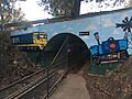
"Henry's Tunnel" on the Willans Hill Miniature Railway
-
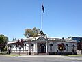
The former Council Chambers
-
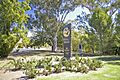
The Wagga Rotary Peace Monument

.jpg)

Wagga Wagga in Books and Songs
Wagga Wagga has appeared in many books and songs. The city's connection to the Tichborne Case even brought Mark Twain to visit in the 1890s. Famous Australian writers like Frank Moorhouse and poets Mary Gilmore and Barcroft Boake have lived here.
Humourist Spike Milligan liked Australian towns with double names. He had a show called "Australia: From Woy Woy to Wagga Wagga."
The song Don't call Wagga Wagga Wagga by Greg Champion and Jim Haynes was a small hit. It makes fun of how Australians shorten double-barrelled town names. In the Harry Potter books, Gilderoy Lockhart claimed to have beaten the "Wagga Wagga Werewolf." The book The Power of One mentions a character from Wagga Wagga. The book Jessica also has parts set in the city.
News and Media
.jpg)
As a regional centre, Wagga Wagga has many local media outlets.
You can watch Australia's national TV channels here: ABC TV, ABC TV Plus, ABC Kids, ABC Me, and ABC News. You can also watch SBS channels: SBS TV, SBS Viceland, SBS Food, SBS World Movies, SBS WorldWatch, and NITV.
The main commercial TV networks are Seven Network (from Seven Regional), Nine Network (from WIN Television), and Network 10 (from Network 10). They also have extra channels like 7two, 7mate, 7Bravo, 7flix, 9Go!, 9Gem, 9Life, Sky News Regional, 10 Bold, 10 Peach, and 10 Shake.

Seven News produces a local news bulletin for the Riverina. It airs every weekday evening. It is made in Wagga Wagga and broadcast from Canberra. Network 10 shows short local news updates throughout the day. WIN Television also has local news stories in its statewide bulletin.
Local radio stations include ABC Riverina, Triple M Riverina (1152 kHz), Hit93.1 Riverina, and Sky Sports Radio. Other local stations are Christian radio station Life FM and community station 2AAA FM. National ABC radio stations and SBS Radio also broadcast here.
The Daily Advertiser is the local newspaper. It is published Monday to Friday. Its sister paper, the Weekend Advertiser, comes out on weekends. The newspaper started in 1868. The Riverina Leader is a free local community newspaper. It started in 1979.
Famous People from Wagga Wagga

Many notable people come from Wagga Wagga. Here are a few:
- Sharna Burgess (Dancing with the Stars professional dancer)
- Wayne Carey (AFL player)
- Dame Edna Everage (Satirical character)
- Paul Kelly (Former Australian rules footballer and captain of the Sydney Swans)
- Bill Kerr (Australian actor)
- Nina Las Vegas (DJ)
- Geoff Lawson (Cricketer)
- Lex Marinos (Actor)
- Michael McCormack (Former Deputy Prime Minister of Australia)
- Sam Moran (Former member of The Wiggles)
- Alicia Quirk (Australian Women's Rugby sevens player and Olympic gold medallist)
- Tony Roche (1966 French Open tennis champion)
- Michael Slater (Cricketer)
- Peter Sterling (Rugby League player and TV commentator)
- Mark Taylor (Australian cricket captain)
See also
 In Spanish: Wagga Wagga para niños
