Walnut Corners, Indiana facts for kids
Quick facts for kids
Walnut Corners, Indiana
|
|
|---|---|

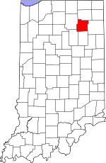
Whitley County's location in Indiana
|
|
| Country | United States |
| State | Indiana |
| County | Whitley |
| Township | Columbia |
| Elevation | 823 ft (251 m) |
| Time zone | UTC-5 (Eastern (EST)) |
| • Summer (DST) | UTC-4 (EDT) |
| ZIP code |
46725
|
| Area code(s) | 260 |
| GNIS feature ID | 445408 |
Walnut Corners is a small, quiet place in Whitley County, Indiana. It's known as an unincorporated community. This means it's a group of homes and people living together, but it doesn't have its own local government like a city or town would. Instead, it's part of a larger area called Columbia Township.
Where is Walnut Corners?
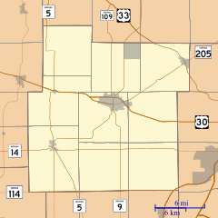
Walnut Corners is located in the northeastern part of the U.S. state of Indiana. You can find it on a map using its special coordinates: 41 degrees, 7 minutes, 57 seconds North latitude and 85 degrees, 29 minutes, 45 seconds West longitude. These numbers help pinpoint its exact spot on Earth.
What is an Unincorporated Community?
An unincorporated community is a place where people live, but it's not officially a city or town. It doesn't have its own mayor or city council. Instead, it's usually governed by the county or township it's located within. For Walnut Corners, this means Whitley County and Columbia Township handle things like roads, police, and other services.
This type of community often has a smaller population and a more rural feel. People living there might rely on nearby cities for bigger stores, schools, and hospitals.
Life in Walnut Corners
Life in an unincorporated community like Walnut Corners is often peaceful. It's a place where neighbors might know each other well. The community is part of the larger Whitley County, which offers a mix of small towns and open spaces.
People in Walnut Corners use the ZIP code 46725 and the 260 area code for their phones. The elevation of Walnut Corners is about 251 meters (or 823 feet) above sea level.


