Warm Springs Creek (California) facts for kids
Quick facts for kids Warm Springs Creek |
|
|---|---|
|
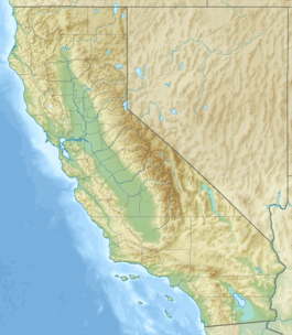
Location of the mouth within California
|
|
| Country | United States |
| State | California |
| Region | Riverside County |
| Physical characteristics | |
| Main source | formerly in Diamond Valley, now in Domenigoni Valley, west of Diamond Valley Lake 1,460 ft (450 m) 33°35′39″N 117°19′05″W / 33.59417°N 117.31806°W |
| River mouth | confluence with Murrieta Creek, tributary of the Santa Margarita River 1,033 ft (315 m) 33°31′37″N 117°11′07″W / 33.52694°N 117.18528°W |
| Length | 18 mi (29 km) |
| Basin features | |
| Tributaries |
|
Warm Springs Creek is a small waterway, like a stream or a dry creek bed called an arroyo. It flows through Riverside County in Southern California. This creek is a tributary, meaning it flows into a larger body of water, which in this case is Murrieta Creek.
Contents
Warm Springs Creek: A Journey Through Riverside County
Warm Springs Creek is an important natural feature in Riverside County. It helps carry water through the landscape, especially during rainy seasons. Understanding where it starts and where it goes helps us learn about the local geography.
Where Does Warm Springs Creek Begin?
The starting point, or source, of Warm Springs Creek has changed over time. It used to begin in an area called Diamond Valley, at about 1,580 feet (480 m) above sea level. However, a large part of that area is now covered by Diamond Valley Lake.
Today, the creek's source is located in Domenigoni Valley. This is west of Diamond Valley Lake and its large West Dam. Here, the creek begins at an elevation of about 1,460 feet (450 m).
The Creek's Path Downstream
From its source, Warm Springs Creek flows southwest through Domenigoni Valley for about 3 miles (4.8 km). Along its path, it passes by the old mining settlement of Leon. You can find the creek near the intersection of Leon Road and Scott Road.
At about 1,400 feet (430 m) in elevation, the creek enters a canyon. It then flows south-southwest, passing to the east of the Murrieta Hogbacks. These are long, narrow ridges of rock. Here, another small creek, an unnamed arroyo from French Valley, joins Warm Springs Creek.
Passing Through Murrieta Hot Springs
The creek continues its journey past the community of Murrieta Hot Springs. This area is now part of the city of Murrieta. The creek flows under Murrieta Hot Springs Road.
Reaching Murrieta Creek
After flowing under Interstate 15, Warm Springs Creek finally meets Murrieta Creek. This meeting point is in the southwestern part of Murrieta, within the Temecula Valley. The elevation at this confluence, or joining point, is about 1,033 feet (315 m). Murrieta Creek then flows into the Santa Margarita River.
 | Emma Amos |
 | Edward Mitchell Bannister |
 | Larry D. Alexander |
 | Ernie Barnes |


